

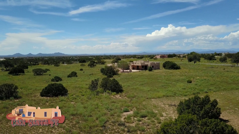


Casa Santa Fe
Welcome to Paulette and Pat's new home on the web.  Where the Coyotes howl and the wind blows free. 6800 MSL

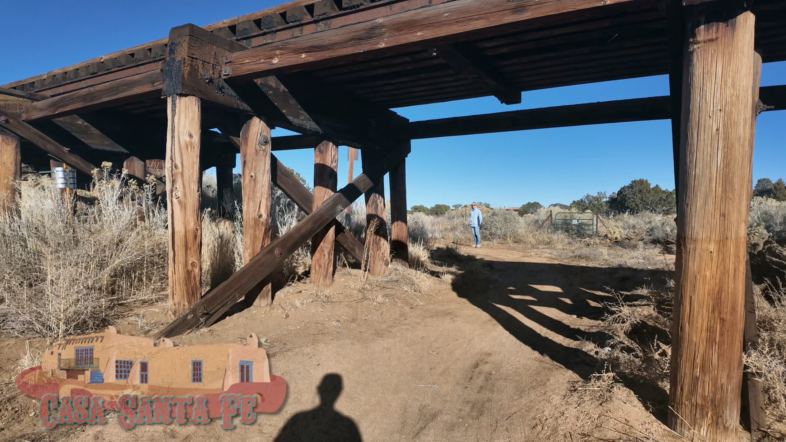
Eldorado at Santa Fe is a census-designated place (CDP) in Santa Fe County, New Mexico, United States. It is part of the Santa Fe, New Mexico Metropolitan Statistical Area. The population was 6,130 at the 2010 census.
This upper middle class community is locally known as Eldorado (occasionally, El Dorado). Eldorado's attractive physical setting, large areas of protected open space, protective covenants, excellent elementary school, and convenience to Santa Fe, have made it a popular place to live in the Santa Fe area.
Archaic Indians lived and hunted in the Eldorado area; archaeologists and others have found Clovis points, but little detailed information is available about these earliest settlers.


Around 600 AD, Ancestral Pueblo (Anasazi) settlers established farms and small pueblos in the area. These settlements endured until about 1325 AD, when a disastrous drought forced abandonment of what became the Eldorado area. Some inhabitants probably moved to the Galisteo, New Mexico area, which itself was abandoned about 1450, as were all of the nearby pueblos except Pecos.
Formal archaeological investigations began about 1914 when Nels C. Nelson of the American Museum of Natural History partially excavated Pueblo Alamo (site LA-8),[3] near the present-day junction of I-25 with US-285. Unfortunately, Pueblo Alamo was almost completely destroyed by the construction of I-25 around 1971, although some salvage archaeology was done.
Another, smaller pueblo, Chamisa Locita or Pueblo Walls (site LA-4) remains largely undisturbed on undeveloped private land, but it has no formal protection.
Eldorado lies entirely within the Canada de los Alamos Grant, a Spanish land grant which dates back to 1785. In 1883, the entire grant was sold for US$2,000. As recorded in 1894, and patented by the US government, the size of the grant was about 12,068 acres (49 km2).

In 1785, Lorenzo Marquez was deeded the grant to land in the Cañada de los Alamos Grant. This grant contained 13,700 acres, including the property now held by Dos Griegos. Although part of this property was lost through an 1892 legal dispute with the adjoining Lamy Land Grant, Dos Griegos lands remained in the Marquez family.
The Los Alamos Grant passed from Marquez to Pablo Delgado and then to his son, Felipe Delgado de Lucero, to his daughter, Margareta Romero and her husband Ireneo de Romero. They continued the tradition of raising sheep on the land.
Note: During this time, many changes were occurring in the area:
- In 1824, New Mexico became part of Mexico, and no longer governed by the Spanish.
- In 1848, New Mexico became a territory of the United States.
- In 1862, the Battle of Glorieta Pass brought the Civil War close to Eldorado.
In 1892, Felipe Delgado sold the Cañada de los Alamos Land Grant to Francisco Manzanares for $100.00.
In 1893 then, Francisco Manzanares and his wife, Antonia "quit-claimed" and "conveyed" the Cañada de los Alamos Land Grant to Lawrence P. Browne for the sum of $2,000. Following the death of Mr. Browne in 1894, the land passed to his widow, Artless.
In 1901, the Onderdonk Land & Cattle company bought both the Canada de los Alamos Grant and the adjacent Bishop John Lamy Grant for $10,000. The Lamy Grant was about 16,546 acres (67 km2) when patented by the USA in 1874.
The Onderdonk Ranch operated both grants as a cattle ranch into the 1950s. The ranch was sold to the Simpson family in 1956, who continued to operate the ranch until 1969, when the Simpsons sold out to the American Realty and Petroleum Corporation (AMREP) for $3.2 million, or about $118.50/acre.

AMREP proceeded to develop about 6,000 acres (24 km2) of their 27,000-acre (109 km2) purchase as Eldorado at Santa Fe, selling the first lots in 1972. For the first ten years, development was slow—only about 200 houses were built. After 1983, when AMREP won a lawsuit over water rights, the pace of development quickened. Many passive solar houses were built, and Eldorado remains the largest solar community in the USA.
AMREP platted about 2700 lots in the original Eldorado subdivisions. As of 2007, the original Eldorado subdivisions are essentially built-out, with only a few vacant lots on the market. There are large areas of vacant private land adjacent.
There are an additional 20 or so newer subdivisions along U.S. Route 285, locally called the 285 Corridor, between Eldorado at Santa Fe and Lamy. Most of these offer larger lots and more expensive houses than Eldorado. Most are served by the Eldorado community water utility. Informally, the adjacent subdivisions, such as Belicia, Dos Griegos and The Ridges, are also called "Eldorado", but they have different covenants and no formal ties to the original AMREP subdivision.
Santa Fe Bandstand
Music On the Hill
Santa Fe Railyard Events
Albuquerque Outpost
Plaza WebCam
Recent Blogs

Linux Runs the Entire World but Everyone Still Uses Windows
Linux Runs the Entire World but Everyone Still Uses Windows
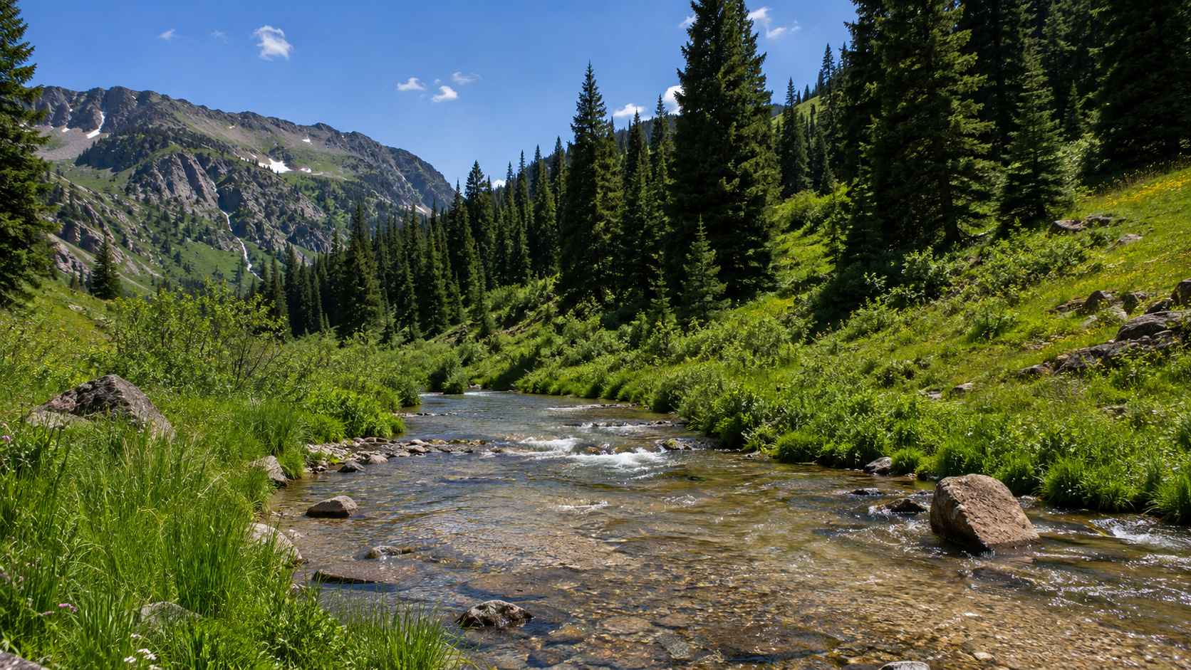
Rio Chama Basin Headwaters Trout Fishing
Rio Chama Basin Headwaters Trout Fishing
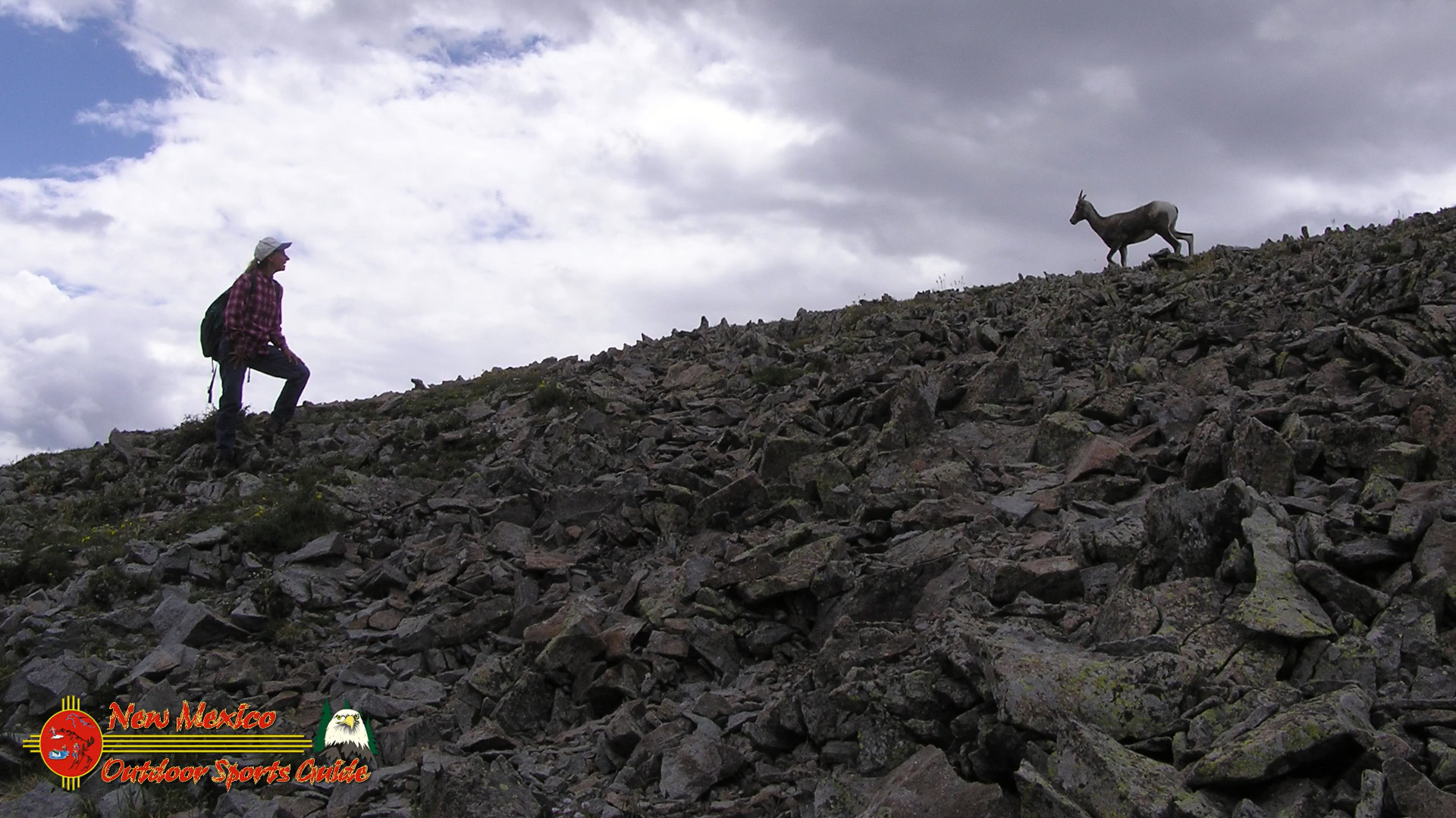
Latir Peak Bighorn Sheep
Latir Peak Bighorn Sheep
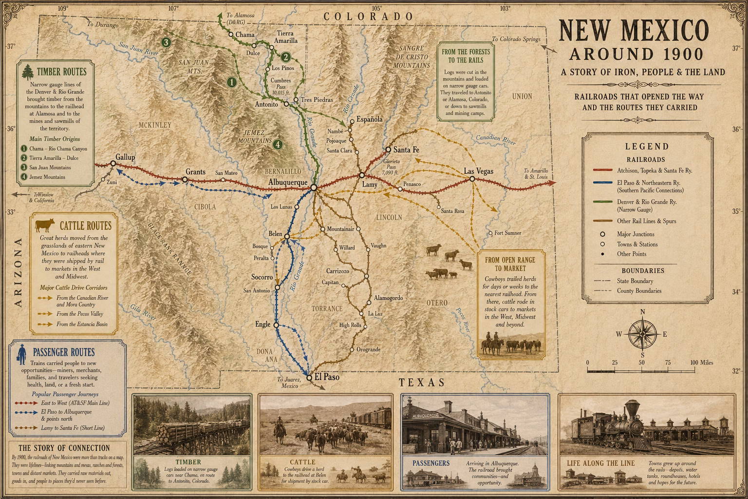
New Mexico Railroads Around 1900
New Mexico Railroads Around 1900
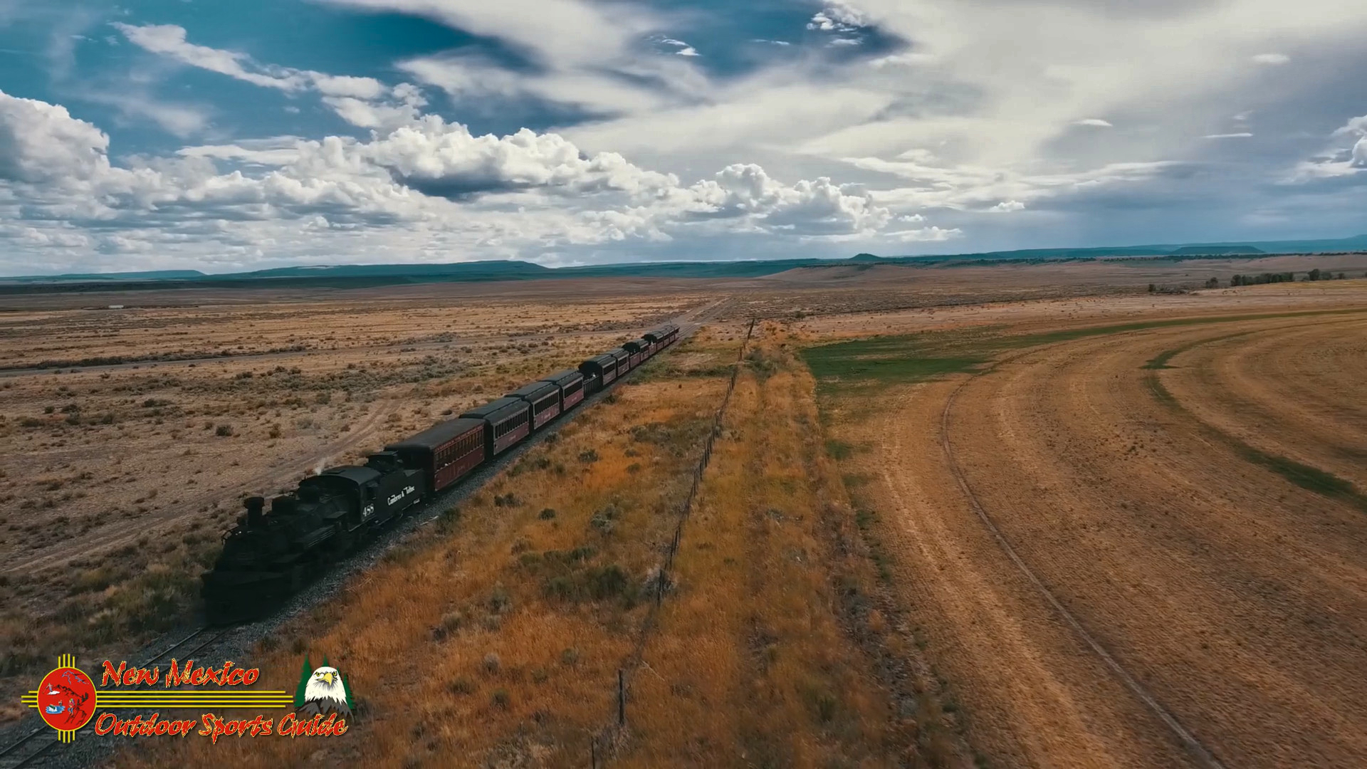
Chasing Steam and Sky: Flying My Drone Over the Cumbres & Toltec Narrow-Gauge Scenic Train Returning to Antonito
Chasing Steam and Sky: Flying My Drone Over the Cumbres & Toltec Narrow-Gauge Scenic Train Returning to Antonito
Santa Fe Rail Trail — April 18, 2026
Santa Fe Rail Trail — April 18, 2026