

Hiking the Arroyo Hondo Trail: A Journey Through Time in Santa Fe's Open Space
"Would you like to try a new trail today?" I asked Paulette over our morning coffee at Casa Santa Fe, watching the first rays of August sunlight paint the Sangre de Cristo Mountains in soft gold. Without hesitation, she replied with that familiar enthusiasm that's made our adventures together so special over all these years. "Sure!" she said, already reaching for her hiking boots.
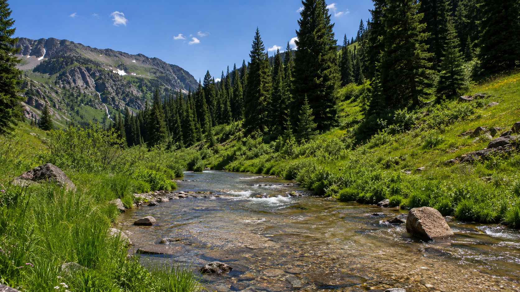
I explained that this particular trail was just a short fifteen-minute drive from our home, about the same length as our regular Santa Fe Rail Trail walk but with a bit more character—around 400 feet of elevation gain that would give us some real views to work with. The trailhead sits at the bottom of the Arroyo Hondo wash, tucked away adjacent to Old Pecos Trail and I-25, a hidden gem that most folks probably drive right past without ever knowing what treasures await just beyond the interstate's constant hum.
Discovering the Arroyo Hondo Open Space
The Arroyo Hondo Trail is part of the Santa Fe County Open Space and Trails program, which manages 6,750 acres of open space, 18 parks, and more than 65 miles of trails throughout our beautiful county. This particular piece of land has quite a story behind it, one that speaks to the power of community conservation. The Arroyo Hondo Open Space Committee was formed to keep the area as an open, public access area, and through private donations that were matched by Santa Fe County, the committee was able to purchase the property, ensuring that future generations could enjoy this special place just as the ancient peoples once did.
As we drove those familiar roads toward the trailhead, I couldn't help but think about how this landscape connects us to centuries of human experience. The Arroyo Hondo area isn't just a pretty place for a hike—it's steeped in the kind of deep history that makes your boots feel lighter and your perspective broader with every step.
Following Ancient Footsteps
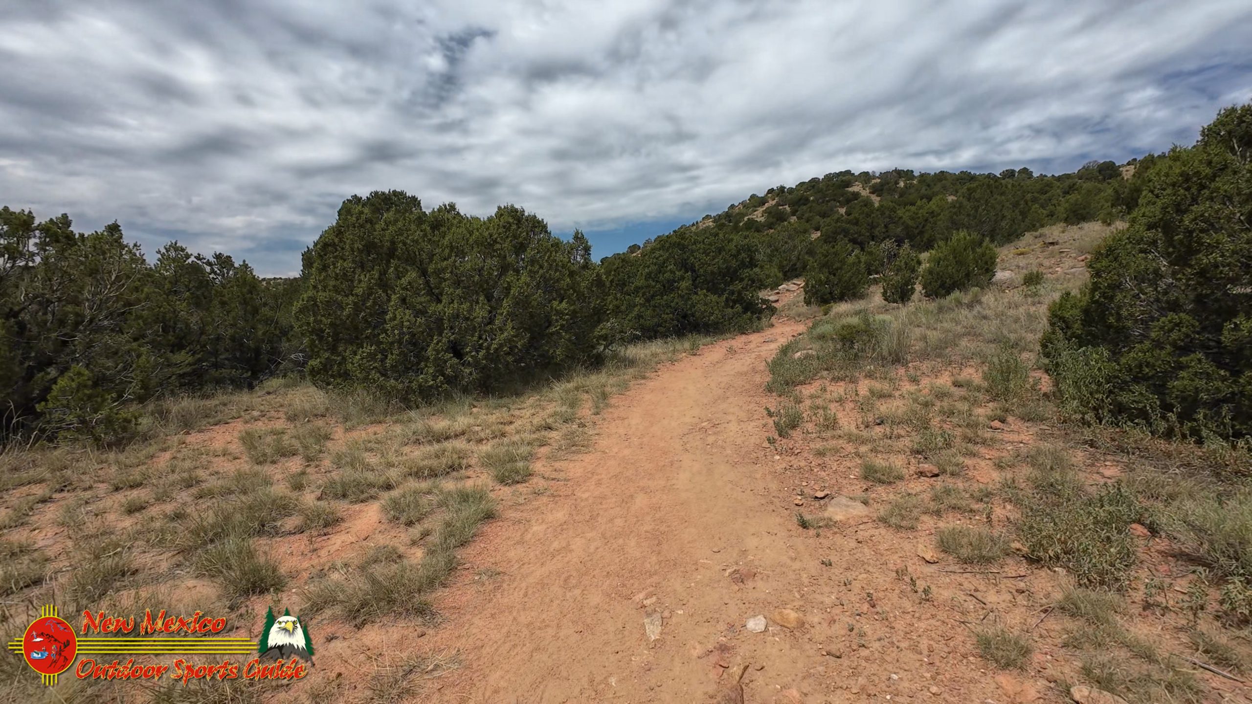
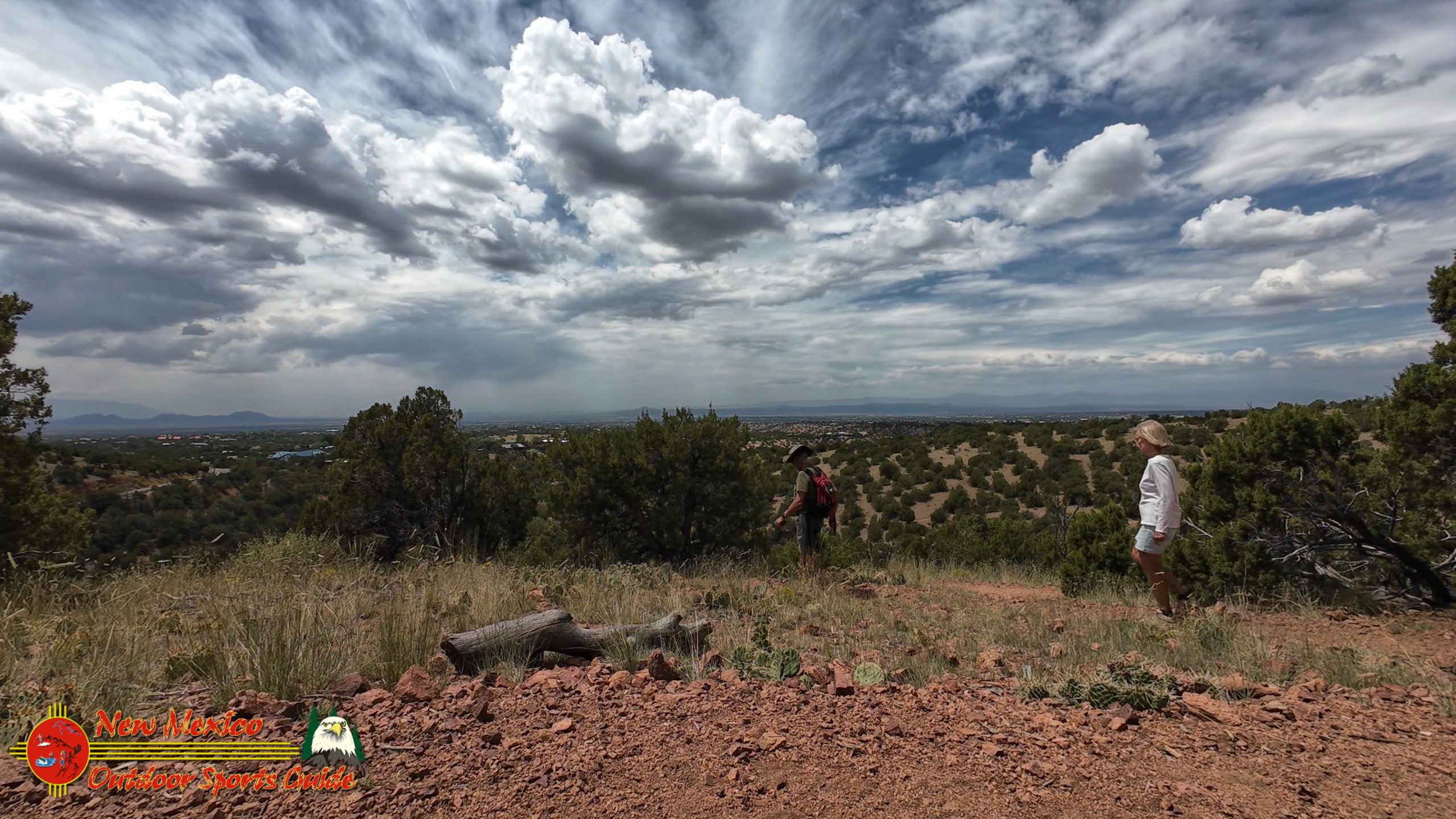
The trail forms a nice loop around a small mountain, and you can park in the lot just after the interstate underpass. We chose to hike the loop counter-clockwise, starting our journey heading south with those magnificent views opening up before us like pages in a living history book. From the very beginning, the trail offers glimpses of the Arroyo Hondo Pueblo ruins site, and I found myself trying to imagine what the ancients might have seen from their settlement all those centuries ago.
The Arroyo Hondo Pueblo has a fascinating archaeological story. The site is associated with the Galisteo Basin, ancestral Tewa, and biscuit ware archaeological areas to the south and north, and Arroyo Hondo Pueblo was listed in the National Register of Historic Places in 2007. Walking this trail, you're literally following in the footsteps of people who called this land home during the Classic Period, roughly from 1325 to 1600 CE.
As we crossed the small footbridge and made our way across the seasonal creek bed, I explained to Paulette how this whole area was part of something much larger—a network of pueblos and communities that stretched throughout the Galisteo Basin. All of the large pueblos are located on major water courses, and it's notable that the largest, longest-occupied pueblos are on drainages that are the most likely to contain water. The ancient peoples knew what they were doing when they chose this spot.
The Galisteo Basin: A Landscape of Stories
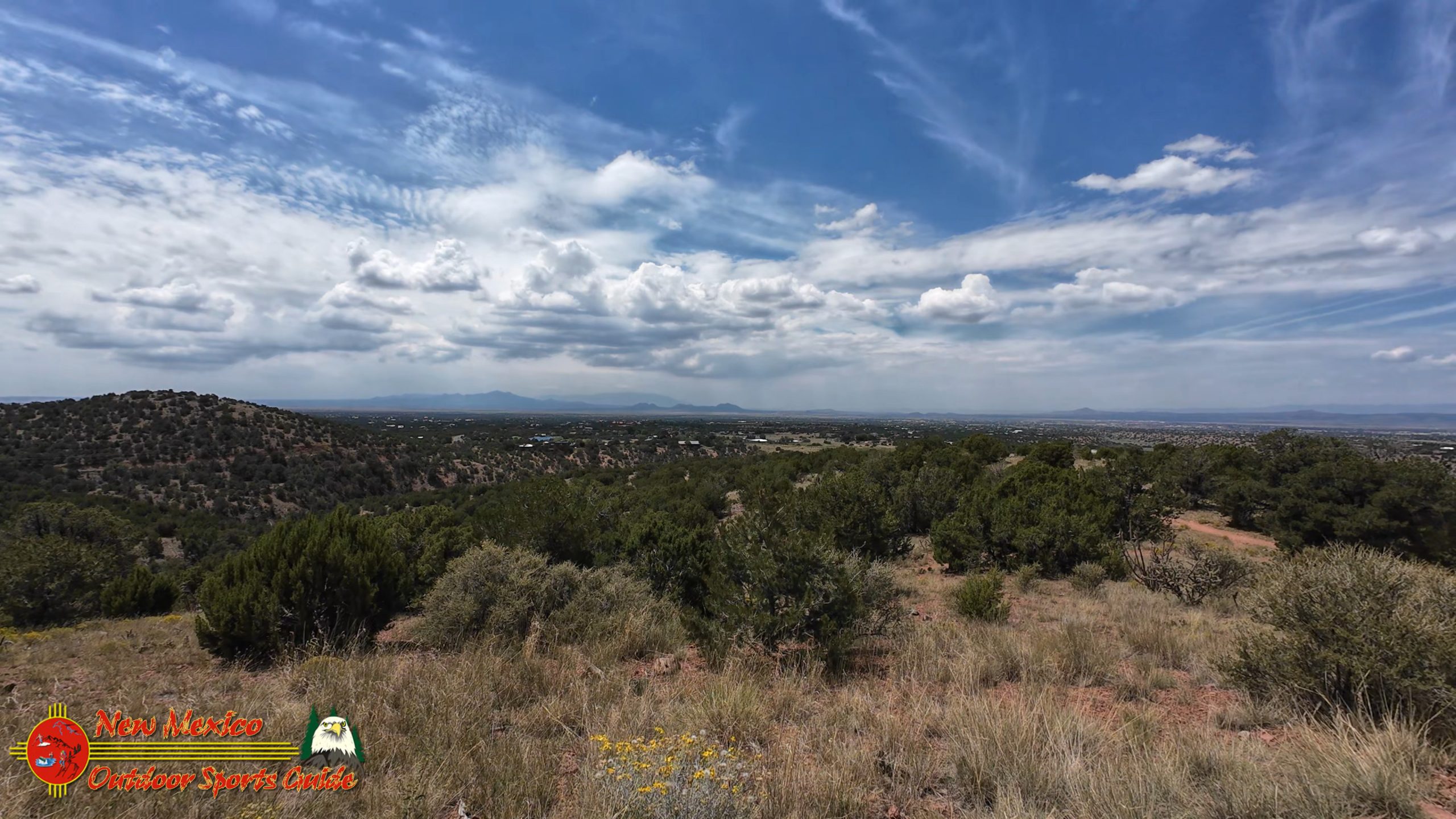
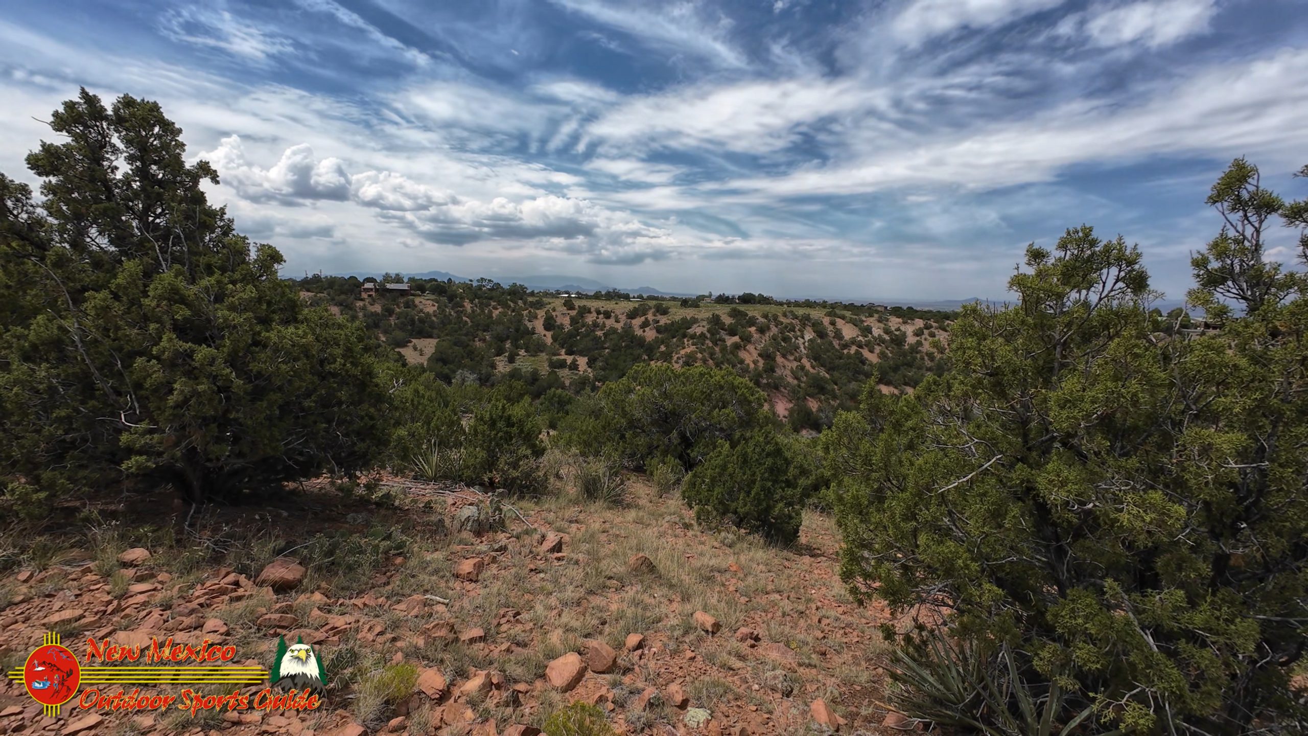
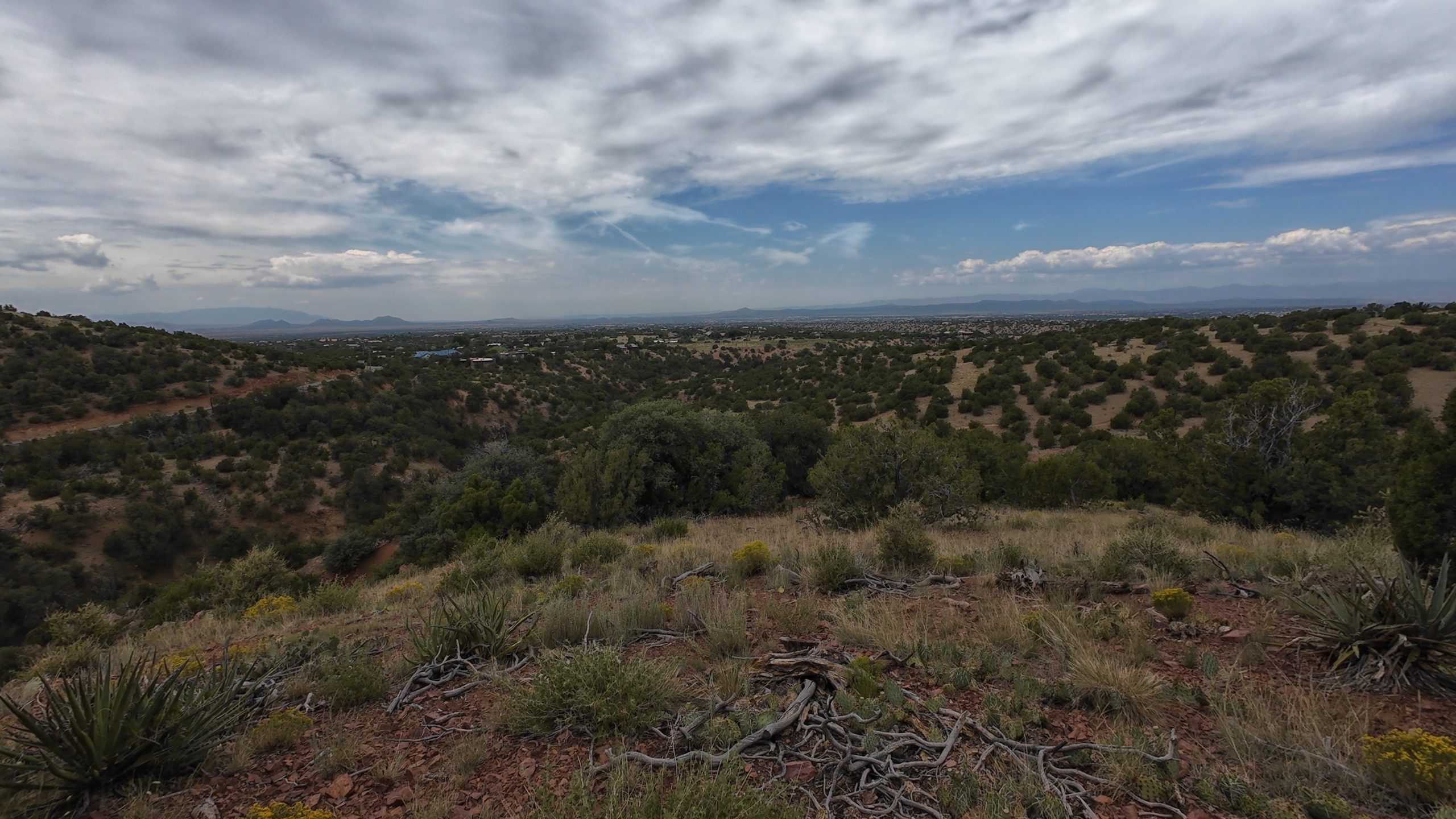
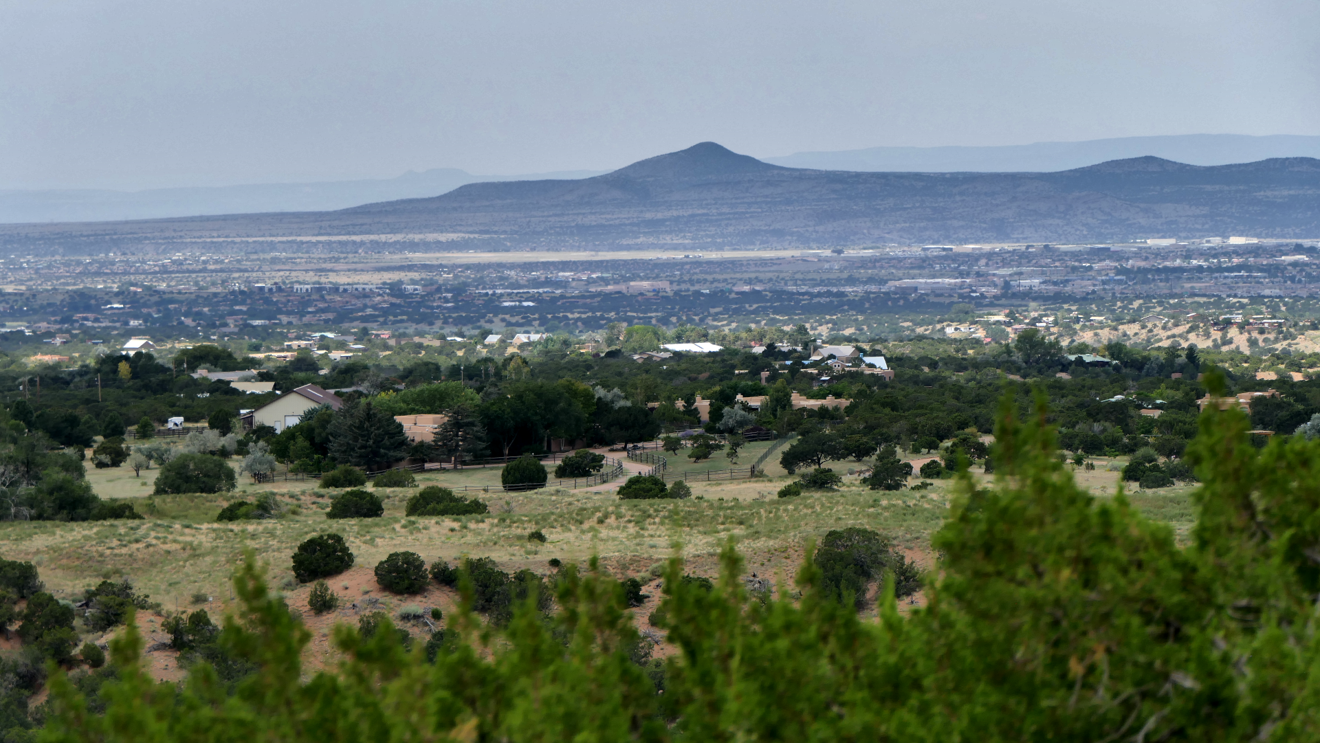
The Galisteo Basin stretches out below the Arroyo Hondo Trail like a vast amphitheater of high desert beauty, and on this particular August afternoon, it was painted in that soft, hazy light that photographers both love and curse. The low 80s temperature made for perfect hiking weather, even if the atmospheric conditions weren't ideal for the crystal-clear photographs I was hoping to capture for my ongoing documentation of Southwest wilderness areas.
This basin has been home to human communities for over a thousand years. The best known of the Basin's pueblo ruins is San Cristobal Pueblo, which contained eight- to nine-room "blocks," several stories in height, organized around five ceremonial plazas. Standing on the Arroyo Hondo Trail and looking out across this landscape, you can almost feel the presence of those ancient communities—the smoke rising from cooking fires, the sounds of daily life, the ceremonies that connected people to this land in ways we're still trying to understand.
Views That Connect Past and Present
As we climbed higher on the counter-clockwise loop, the views began to open up in earnest. To the southeast, the Ortiz Mountains rose like sleeping giants from the high desert floor, their ancient volcanic origins still written in the dramatic lines and shadows that played across their slopes. These mountains have been a landmark for travelers for centuries, serving as a navigation point for everyone from ancient pueblo peoples to Spanish conquistadors to modern-day adventurers like Paulette and me.
The Sandia Mountains, visible in the distance to the south, were barely discernible through the August haze—just ghostly blue suggestions of the massive range that dominates the skyline around Albuquerque. On a clear day, those peaks stand sharp and proud against the sky, but today they seemed to float in and out of visibility like memories half-remembered.
What struck me most powerfully, though, was thinking about how this same view—or something very much like it—might have greeted the residents of the Arroyo Hondo Pueblo when they stepped out of their homes each morning. The mountains haven't changed much in 500 years. The basic geography remains the same. The sun still rises in the east, painting the landscape in those familiar Southwest colors that have inspired artists and photographers for generations.
The Ancient Highway: El Camino Real
One of the most fascinating aspects of hiking the Arroyo Hondo Trail is recognizing how it connects to the historic El Camino Real, the ancient trail that served as the main route from Mexico City to Santa Fe for nearly 300 years. This "Royal Road" passed through the Galisteo Basin, and traders, settlers, missionaries, and military expeditions would have seen many of the same landmarks we were enjoying from our elevated perch on the trail.
Standing there, looking out across the landscape toward where the old trail would have wound its way north toward Santa Fe, I could almost see the dust clouds kicked up by ox-drawn carretas, hear the jingle of mule harnesses, and feel the anticipation of travelers who had been walking for months to reach the northern frontier of New Spain. The Arroyo Hondo area would have been a welcome sight—water, shelter, and perhaps the opportunity to trade with the local pueblo inhabitants.
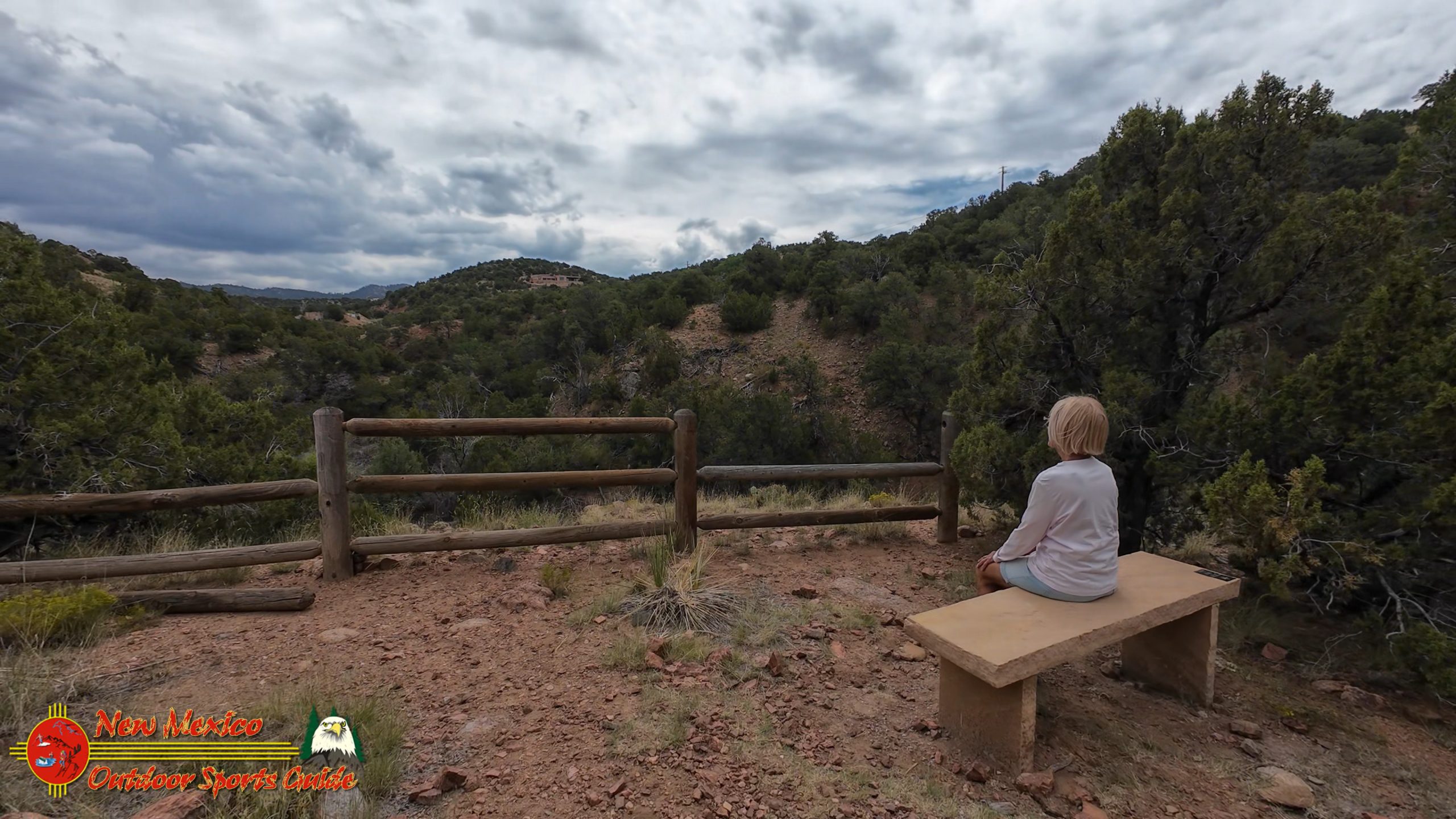
A Trail System Designed for Everyone
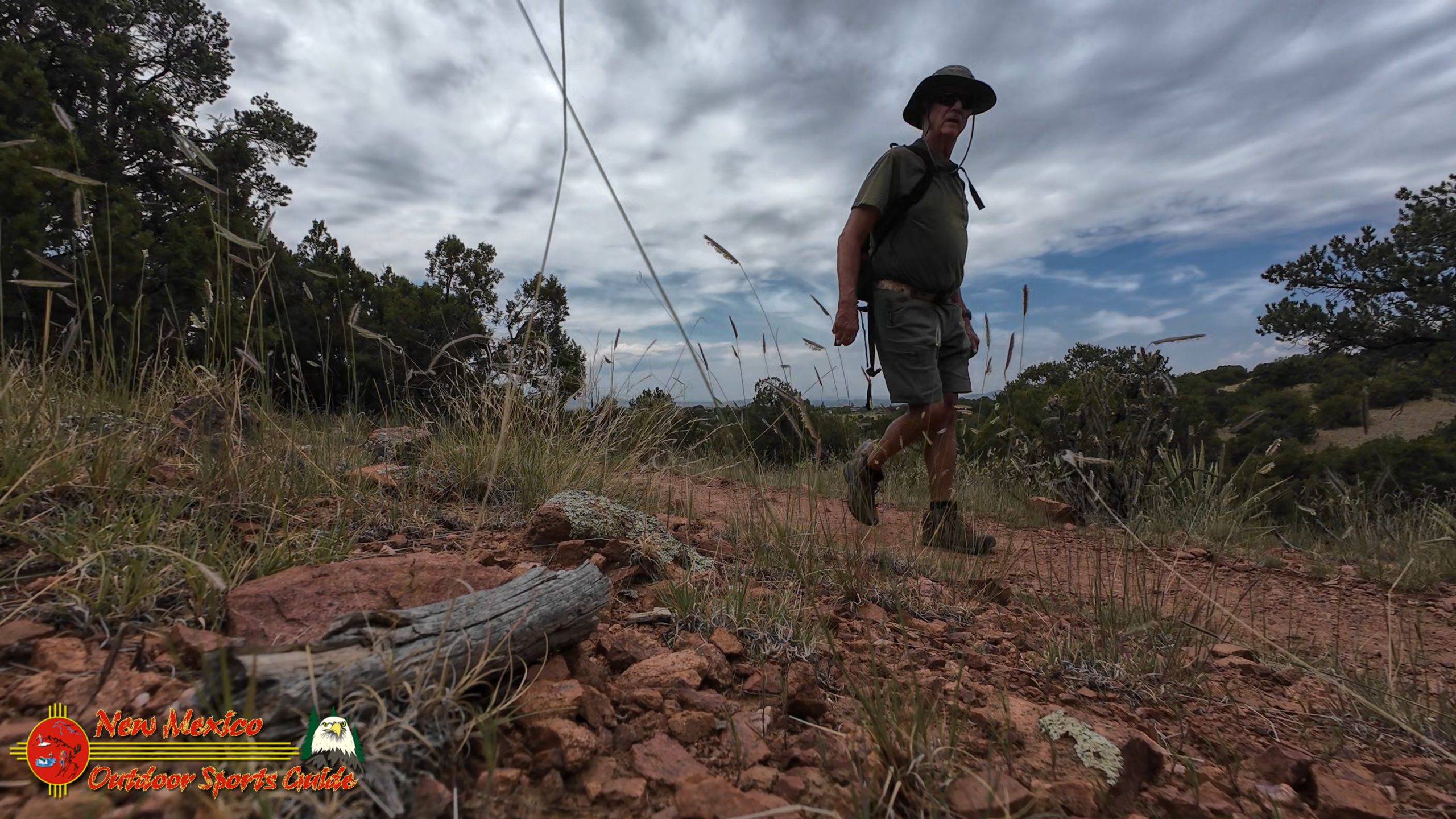
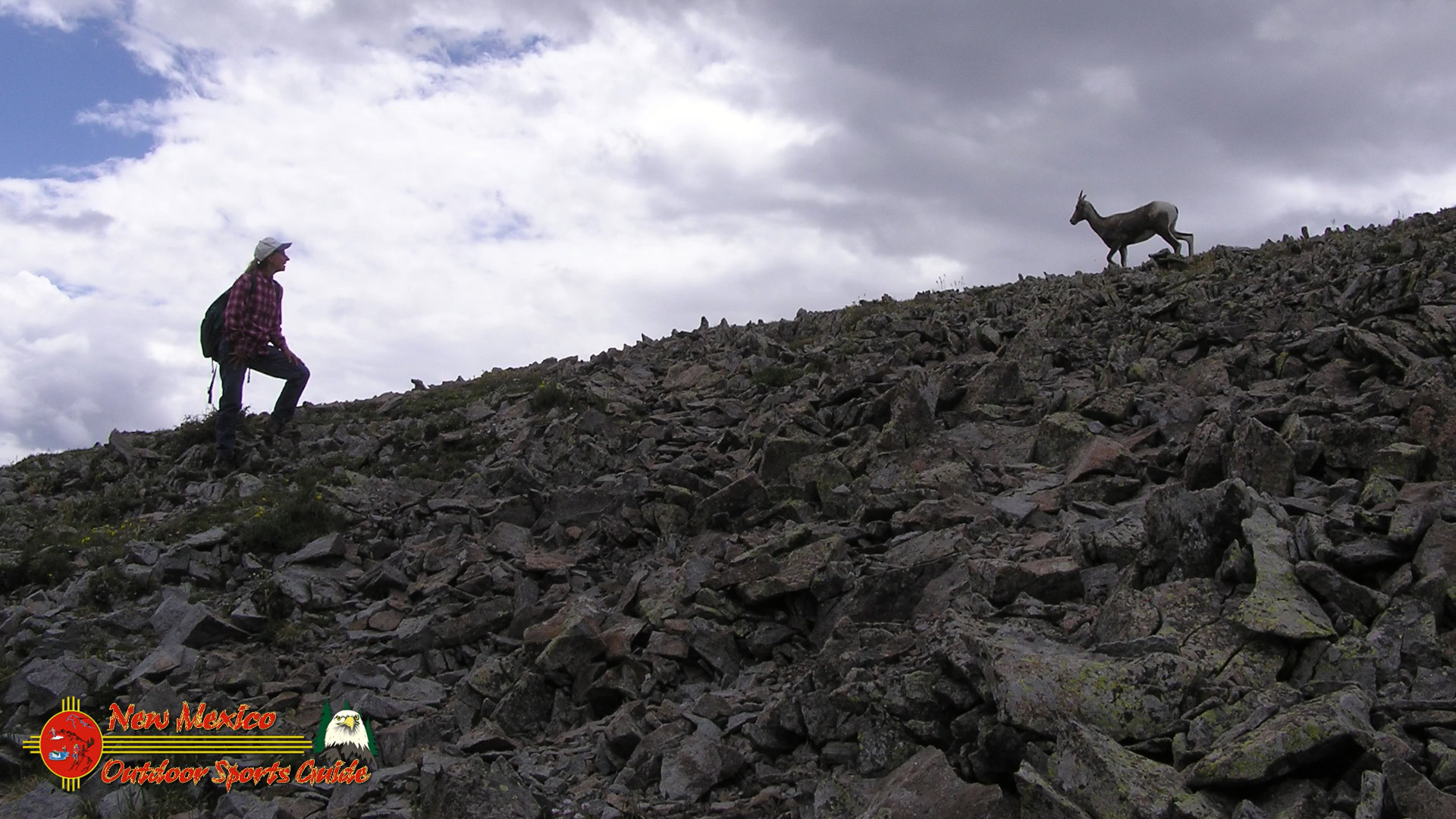
The Arroyo Hondo Open Space Trail is generally considered an easy route, taking an average of 48 minutes to complete, and is popular for hiking, horseback riding, and trail running. What I particularly appreciate about this trail system is how thoughtfully it's been designed. There are well-marked and used trails with a bonus loop in the middle to keep it interesting, and signs with maps at the intersections.
For someone like me, who's spent decades exploring wilderness areas from the Kansas Flint Hills to the mountains of New Mexico, I can appreciate good trail design when I see it. The Santa Fe County Open Space and Trails program has done an excellent job creating a system that's accessible to hikers of all skill levels while still providing enough variety to keep things interesting.
Paulette and I found ourselves stopping frequently—not because the trail was difficult (it certainly wasn't), but because there were so many spots that seemed perfect for photography and videography. Even though the hazy conditions weren't ideal for capturing those crisp, dramatic images I love to share through my New Mexico Outdoor Sports Guide work, we were able to scout out numerous locations that I know will be perfect for future visits when the light is just right.
The Santa Fe County Open Space Legacy
What impresses me most about places like the Arroyo Hondo Open Space is how they represent the best of community-driven conservation. The property is now owned by Santa Fe County and managed by the Santa Fe County Open Space and Trails program, and during public meetings and site visits conducted in 2005-2006, a consensus was reached to leave the site in its natural state, have trails around the property and have the space available for education.
This approach—preserving the natural and cultural integrity of the landscape while making it accessible for education and recreation—reflects a wisdom that comes from understanding how precious these places really are. As someone who's watched development pressure transform landscapes throughout the American West over the past several decades, I have tremendous respect for communities that choose preservation over profit.
Wildlife and Wilderness in the High Desert
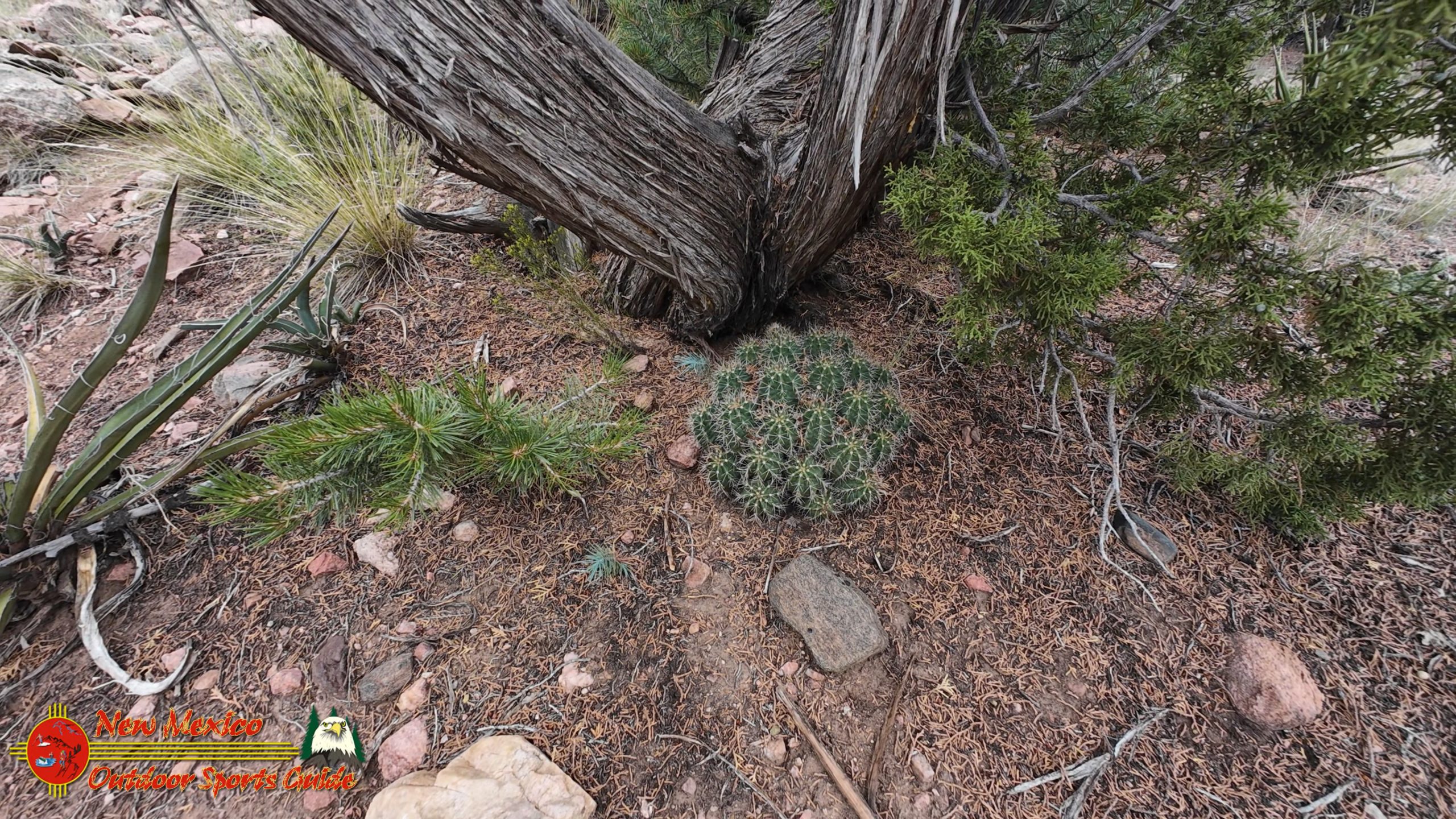
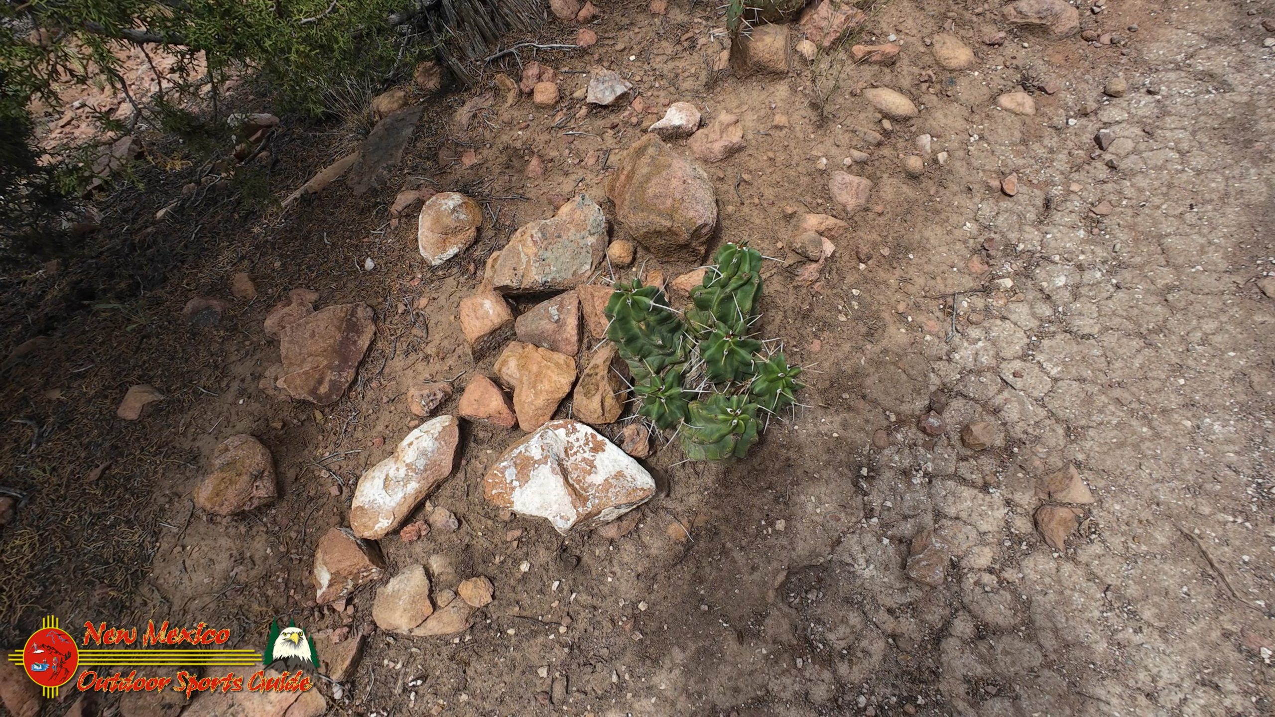
Even on this somewhat hazy August afternoon, the Arroyo Hondo Trail offered plenty of opportunities to observe the subtle beauty of high desert ecosystems. The piñon and juniper woodlands that characterize this elevation provide habitat for an amazing variety of wildlife, from mule deer and elk to smaller creatures like rock squirrels, chipmunks, and an incredible diversity of birds.
As a photographer who's spent years documenting the wilderness and wildlife of the American Southwest, I'm always impressed by how much life thrives in what might initially appear to be harsh, unforgiving landscapes. The high desert has its own rhythm, its own timing, and its own particular kind of beauty that reveals itself to those patient enough to look and listen carefully.
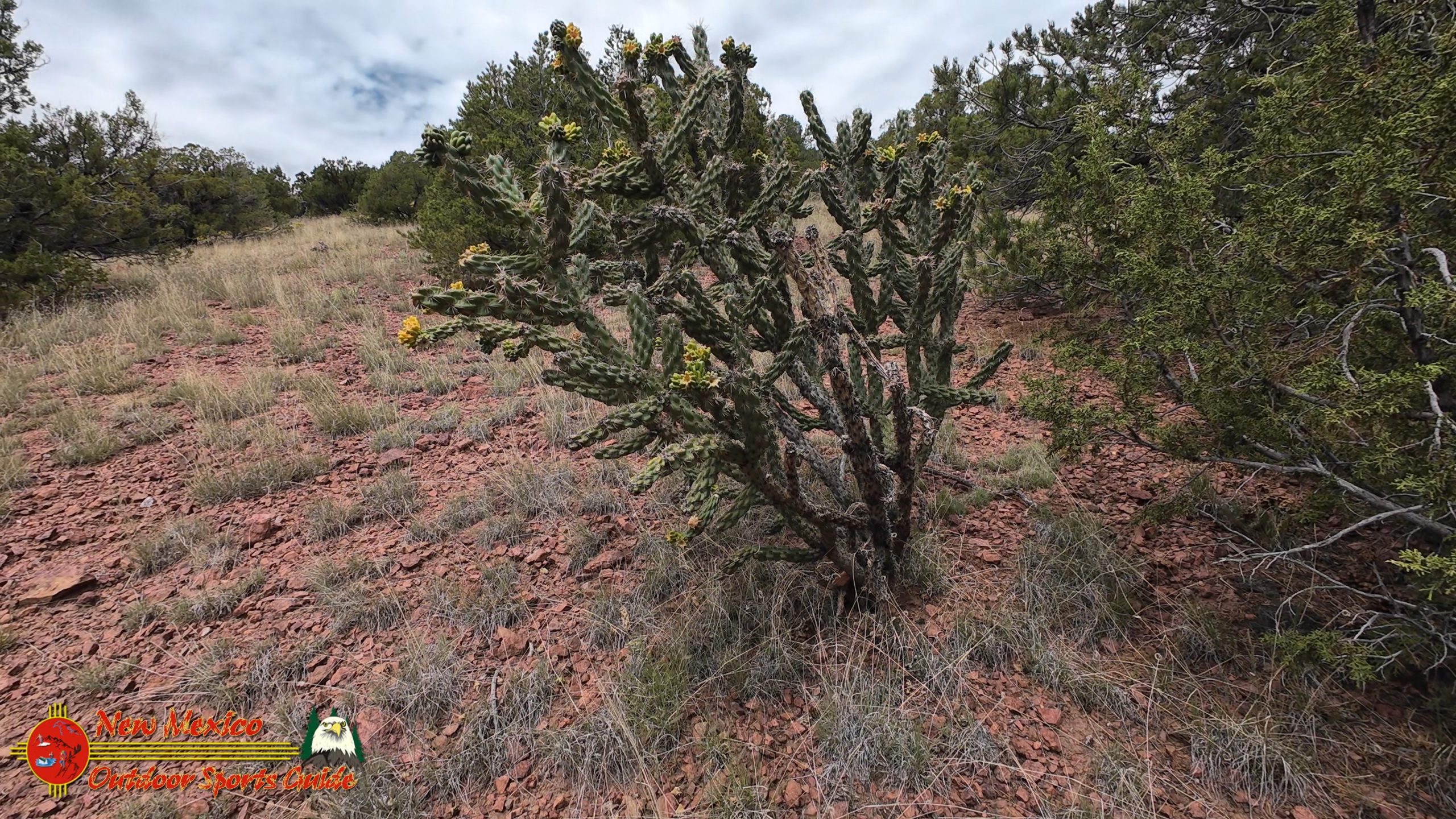
The plant communities along the trail tell their own stories of adaptation and resilience. Four o'clocks bloom in the evening, their bright magenta flowers opening just as the heat of the day begins to fade. Apache plume displays its feathery seed heads like tiny fireworks frozen in time. Chamisa will soon be painting the hillsides gold as we move into autumn.
Connection to Home: Casa Santa Fe
After completing our loop and taking time to explore some of the bonus trail sections, we made our way back to the parking area with that particular kind of satisfaction that comes from discovering a new favorite place. The drive back to Casa Santa Fe gave us time to process what we'd experienced and to start planning future visits when weather conditions might be more favorable for photography.
Back home on our patio, settling in with glasses of refreshing iced tea while Paulette began thinking about dinner preparations, I found myself reflecting on what a privilege it is to live in a place where adventures like this are just fifteen minutes from our front door. The afternoon light was beginning to take on that special golden quality that makes everything in Santa Fe look like it's been touched by magic.
The Photographer's Perspective
From a technical standpoint, the Arroyo Hondo Trail offers numerous opportunities for both photography and videography. The elevation changes provide varied perspectives on the surrounding landscape, while the cultural and historical context adds layers of meaning to any images captured there. While our particular afternoon was a bit too hazy for the dramatic landscape shots I prefer, I was able to identify several key locations that I know will produce excellent results under different lighting conditions.
The trail's position relative to the surrounding mountain ranges means that both sunrise and sunset lighting should offer spectacular opportunities. The Ortiz Mountains to the south and southeast should catch beautiful early morning light, while the western exposure toward the Jemez Mountains would likely provide excellent sunset photography opportunities.
For videographers, the trail offers smooth, walkable surfaces that would work well for handheld shooting or even small stabilizer rigs. The gradual elevation changes and sweeping views would translate beautifully to time-lapse sequences or aerial photography, should regulations permit.
A Living Laboratory
What makes the Arroyo Hondo Trail particularly special is how it functions as a living laboratory where natural and cultural history intersect. The archaeological significance of the area, combined with its ecological importance and its role in the broader Santa Fe County Open Space system, creates opportunities for understanding that go far beyond simple recreation.
Educational groups could easily spend entire days exploring the connections between landscape, climate, human adaptation, and cultural change that are all visible from various points along the trail. The proximity to the interstate and the ease of access make it an ideal location for introducing people to both the natural and cultural heritage of the American Southwest.
Looking Forward
As Paulette and I sat on our patio that evening, watching the light fade across the Sangre de Cristo Mountains and planning our next adventure, I couldn't help but feel grateful for communities that have the wisdom to preserve places like the Arroyo Hondo Open Space. In a world that often seems to prioritize short-term economic gain over long-term cultural and environmental preservation, these protected areas represent a different set of values—one that recognizes the irreplaceable value of connection to place, to history, and to the natural world.
The Arroyo Hondo Trail isn't just a hiking trail—it's a pathway through time, a connection to the deep history of human habitation in the American Southwest, and a reminder that the landscape itself is perhaps our most important teacher. Whether you're a serious hiker looking for your next challenge, a photographer seeking new perspectives, a history buff interested in archaeological sites, or simply someone who appreciates the opportunity to step away from the busy pace of modern life for an hour or two, this trail has something to offer.
The Tough Life in Paradise
As I often joke with friends and fellow outdoor enthusiasts, it's a tough life living in such a beautiful place with such rich history, but somebody has to do it! The truth is, places like the Arroyo Hondo Trail remind us daily of how fortunate we are to call Santa Fe County home. The combination of natural beauty, cultural significance, and thoughtful conservation creates opportunities for connection and understanding that simply don't exist everywhere.
The Arroyo Hondo Trail represents the best of what the Santa Fe County Open Space and Trails program has to offer—accessible recreation, environmental preservation, cultural education, and community engagement all wrapped up in a relatively short, family-friendly hiking experience. Whether you're a longtime resident or a visitor to our area, this trail deserves a spot on your list of must-experience destinations.
For those of us lucky enough to live here, trails like this serve as regular reminders of the incredible privilege of calling this landscape home. And for visitors, they offer a chance to experience the deep history and natural beauty that make northern New Mexico one of the most special places on Earth.
The next time you're looking for a quick escape from the hustle and bustle of daily life, consider spending an hour or two on the Arroyo Hondo Trail. Walk in the footsteps of ancient peoples, enjoy views that have inspired travelers for centuries, and experience firsthand the wisdom of communities that choose preservation over development. You'll come away with a deeper appreciation for the landscape, the history, and the ongoing commitment to conservation that makes places like this possible.

The Rise and Fall of Arroyo Hondo Pueblo: A Window into Ancient New Mexico
When the Spanish first entered the northern Southwest in 1540 under Francisco Vázquez de Coronado, they encountered something they never expected: thriving citadel-like settlements of adobe, rising from the rugged land like earthen fortresses. These pueblos, home to hundreds of families, were not crude shelters scattered in the wilderness, but sophisticated towns built from stone and mud, sustained by farming, and alive with artistry, ceremony, and culture.
Among the pueblos that predated Spanish arrival was Arroyo Hondo Pueblo, located just five miles southeast of present-day Santa Fe, New Mexico. Though long abandoned by the time Coronado’s men marched through, its ruins told a story of resilience, hardship, and adaptation to one of the most unforgiving climates on earth.
Thanks to decades of archaeological work, Arroyo Hondo has become one of the best-studied ancestral pueblos in the Southwest, offering insights into not only how these communities were built and sustained, but also how climate, conflict, and resource depletion could bring even the greatest settlements to ruin.
This is the story of Arroyo Hondo Pueblo—a story written in stone, wood, ash, and earth.
Life in the Northern Rio Grande Valley Before Arroyo Hondo
Before the rise of large pueblos like Arroyo Hondo, the northern Rio Grande Valley during the 1200s was dotted with small, loosely organized settlements. Each pueblo contained between 50 and 100 rooms, housing families that farmed maize, beans, and squash near precious water sources. These people also hunted game, gathered wild plants, and produced pottery and tools that connected them to a wide trade network stretching across the Southwest.
The climate during this period was relatively favorable. Rainfall supported agriculture, harvests were stable, and life was relatively peaceful. Because of this stability, early pueblos were not fortified. They were designed more for communal living and farming efficiency than for defense.
But this period of peace would not last.
The Great Drought and the Birth of Fortified Pueblos
Around 1295 CE, a catastrophic change swept the Southwest. A “Great Drought” struck, lasting decades and causing widespread famine. Modern climatologists have found evidence of severe aridity across the northern hemisphere during this time, possibly linked to the eruption of several massive tropical volcanoes between 1250 and 1300.
In the San Juan Basin and the Mesa Verde region, entire populations vanished as food production collapsed. In the northern Rio Grande, food shortages created desperation. Starvation was compounded by conflict: neighbors raided each other’s food stores, and small, undefended pueblos were left vulnerable to attack. Some hamlets were burned by rival groups; others were abandoned voluntarily as survival became impossible.
The solution was consolidation. Families and entire villages came together to build large, fortified pueblos, designed to offer strength in numbers and safety against raiders. One of the most successful examples of this survival strategy was Arroyo Hondo Pueblo.
The First Arroyo Hondo Settlement (1300–1340)
Founding and Growth
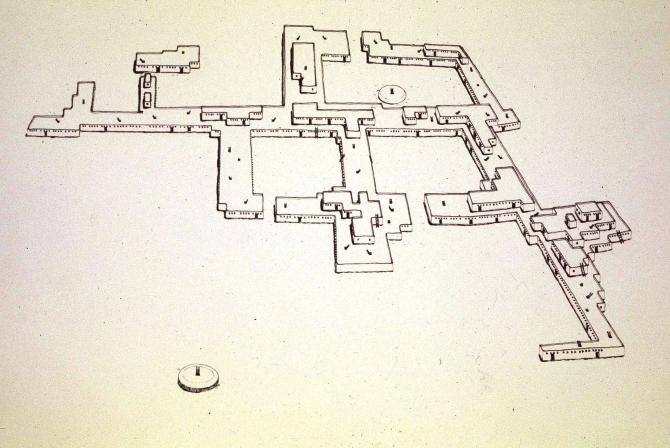
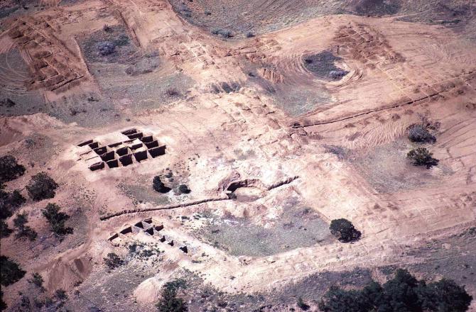
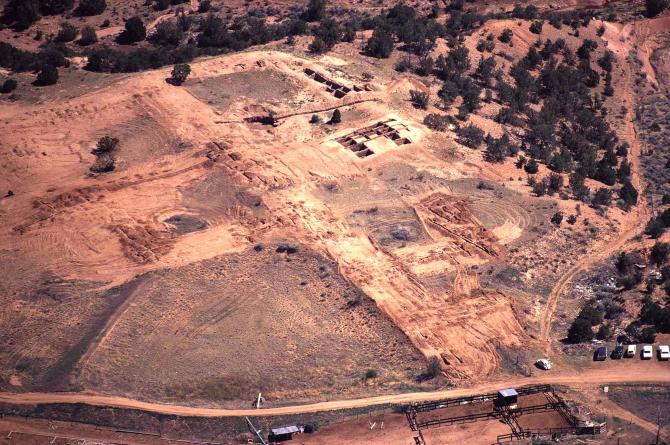
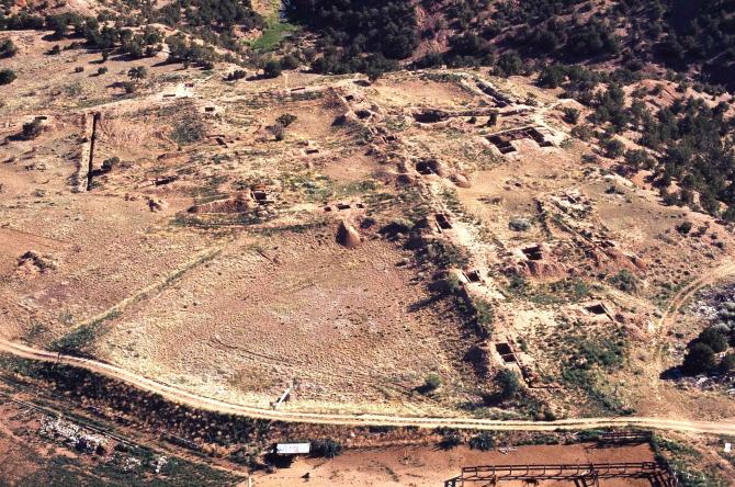
Arroyo Hondo Pueblo began around 1300 CE as a modest 100-room settlement. Its location was ideal: near a spring, positioned on the edge of a deep canyon, and surrounded by farmland. These features provided water, natural defense, and fertile ground for crops.
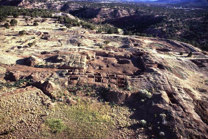
Within just three decades, Arroyo Hondo experienced explosive growth. Families from nine smaller pueblos relocated to the site, swelling its population and transforming the settlement into a massive citadel. By 1330, Arroyo Hondo had expanded tenfold into a 1,000-room town, complete with ten plazas.
This sudden growth was not just a matter of size. The pueblo’s architecture, social organization, political leadership, and religious life all evolved to meet the challenges of larger-scale living. The pueblo became a cultural center, buzzing with economic activity, spiritual ceremonies, and the daily rhythm of farming and hunting.
Daily Life
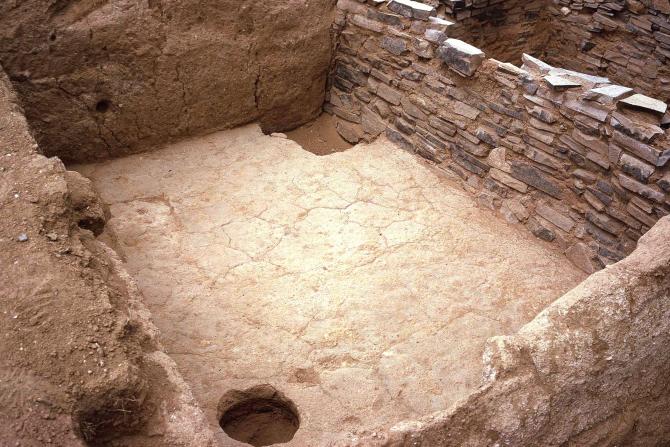
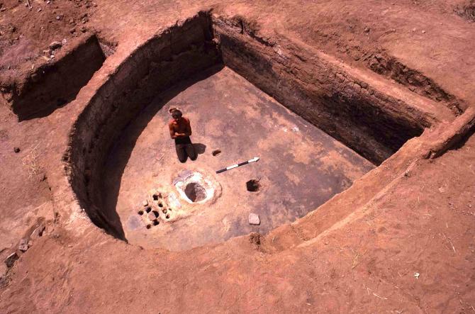
Excavations reveal a remarkably detailed picture of life at Arroyo Hondo during its first occupation. Residents farmed corn, beans, and squash, supplementing their diets with wild plants and animals. Pottery was abundant and highly decorated, reflecting both utility and artistry. Ceremonial life centered around kivas—subterranean chambers used for religious rituals.
Yet beneath this prosperity lay vulnerabilities. The population boom placed enormous pressure on the surrounding environment. Trees were cut down for building and firewood, game was hunted extensively, and farmland was worked heavily. When the climate turned against them, these pressures would prove devastating.
Collapse
Around 1330, another drought struck. Harvests declined, famine spread, and malnutrition weakened the population. Archaeological evidence reveals that several residents died violently during this period, suggesting conflict either from within or from outside raiders.
Within a decade, the once-great pueblo had been abandoned. By 1340, Arroyo Hondo stood empty, its plazas silent, its rooms deserted.
A Pause, Then a Return (1370–1425)
For nearly 30 years, Arroyo Hondo lay abandoned. The land was left scarred by overuse, and the climate remained harsh. But by the 1370s, conditions had improved. Rainfall increased, and the land seemed ready to sustain life again. Encouraged, settlers returned to Arroyo Hondo and built a second pueblo directly atop the ruins of the first.
The Second Settlement
This second occupation was much smaller than the first. Instead of 1,000 rooms, the pueblo contained about 200 rooms, arranged around one fully enclosed plaza and two partially open plazas. The reduced size reflected both the diminished environment and the more cautious ambitions of its builders.
Though smaller, the community was still vibrant. Families farmed, crafted pottery, and participated in ceremonies. Yet the second settlement could never recapture the Eden-like abundance of the first. Centuries of farming, tree cutting, and hunting had already depleted the land.
Final Decline
Around 1410, another devastating drought descended on the Rio Grande Valley. This time, climatologists believe it was the worst drought in over 1,000 years. Food shortages returned, followed by famine.
To make matters worse, a catastrophic fire swept through the pueblo. Archaeologists are unsure whether the fire was accidental or the result of an attack by raiders seeking food. Whatever the cause, it devastated the already struggling community.
By 1425, Arroyo Hondo was completely abandoned for the second and final time. Unlike other pueblos that would continue into the Spanish colonial period, Arroyo Hondo never recovered. Its ruins were left to the wind, sun, and silence of the New Mexico high desert.
Archaeology and Rediscovery
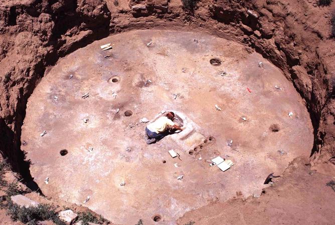
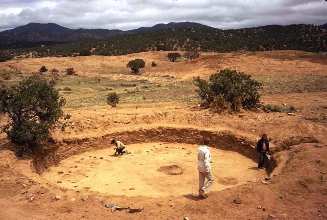
For centuries, Arroyo Hondo remained little more than crumbling ruins in the foothills southeast of Santa Fe. But in the early 1970s, archaeologist Douglas W. Schwartz of the School for Advanced Research (SAR) launched an ambitious project to study the site.
Over five field seasons, archaeologists excavated vast portions of the pueblo, uncovering tens of thousands of artifacts, charred timbers, skeletal remains, and architectural features. Their work provided one of the most complete pictures of pueblo life ever recorded.
The project was supported by grants from the National Science Foundation, the National Geographic Society, and SAR. Multidisciplinary teams studied everything from climate patterns and farming practices to dietary habits and social organization. The result was a groundbreaking body of knowledge that transformed understanding of ancestral Puebloan history.
Lessons from Arroyo Hondo
The story of Arroyo Hondo Pueblo is not merely one of rise and fall—it is a window into how ancient peoples responded to the challenges of climate, environment, and social upheaval.
- Climate shaped destiny. Both occupations of Arroyo Hondo rose during favorable wet periods and collapsed during severe droughts. The pueblo’s history is a stark reminder of how dependent agriculture-based societies are on rainfall.
- Resource management mattered. Intensive farming, deforestation, and hunting depleted the land around Arroyo Hondo, making recovery nearly impossible. Environmental strain was a key factor in the pueblo’s inability to sustain itself long-term.
- Community and conflict intertwined. Arroyo Hondo’s size offered strength, but it also brought vulnerability. Large populations required large food stores, making the pueblo a target for raids during hard times.
- Adaptation was essential—but not always enough. The second settlement demonstrated resilience and adaptability, but even careful planning could not withstand the combination of drought, famine, and disaster.
Visiting Arroyo Hondo Today
Today, Arroyo Hondo Pueblo lies in quiet ruins on private land southeast of Santa Fe. While the site itself is not open for general public visitation, its story is preserved through research publications, museum exhibits, and interpretive displays. The School for Advanced Research in Santa Fe houses many of the artifacts and records from the excavation, offering scholars and the public a way to engage with the pueblo’s history.
For travelers exploring the Santa Fe area, Arroyo Hondo provides context for the living pueblos nearby—such as Taos Pueblo or Ohkay Owingeh—that continue to thrive despite centuries of hardship. Standing in Santa Fe’s Plaza or walking along the Santa Fe River, one can reflect that long before Spanish colonists or Anglo settlers arrived, vibrant towns like Arroyo Hondo already rose, flourished, and fell on this same land.
Conclusion: A Silent Witness of Time
The ruins of Arroyo Hondo Pueblo stand as silent testimony to human resilience and fragility. Here, in the shadow of the Sangre de Cristo Mountains, generations built homes, raised families, created art, and held ceremonies under the same sky we see today. Twice they rose, twice they fell—brought down by forces both natural and human.
Yet in their story lies a lesson as relevant now as it was 700 years ago: that societies depend on the delicate balance of environment, climate, and community. Arroyo Hondo Pueblo may be abandoned, but its story still speaks—a reminder of both the power and the vulnerability of human endeavor in the face of nature’s unyielding cycles.
0 Comments