
There’s something about the Pecos that gets under your skin, especially if you've lived here as long as Paulette and I have. Nearly 50 years of marriage has taught us that sometimes, the best way to celebrate a lifetime together is by getting away from it all—heading into the mountains, where the air is clean, the rivers run cold, and time slows down.
This September, we decided to take on one of our favorite New Mexico hiking trails: the Hamilton Mesa Trail #249, which follows the ridge above Jack’s Creek and the Pecos River. It’s a hike we’ve done a few times over the years, but each time feels new—different seasons bring different colors, and our memories of past hikes blend with the excitement of the present. This time, we packed a simple camp lunch and headed out to enjoy a quiet afternoon in the wilderness.
The Village of Pecos, NM: Starting the Day Right
Our day began with a slow drive through the village of Pecos, New Mexico, the kind of place where you can still catch locals sipping coffee on their front porches. It's about a half-hour from Santa Fe, and the village serves as the gateway to the Pecos Wilderness. We’ve always enjoyed making a pit stop here before heading up into the mountains. There’s something comforting about the way the adobe homes sit nestled into the landscape, as if they’ve always been part of the scenery. The old mission church and a few small stores are worth exploring if you’ve got the time.
We picked up some fresh tortillas and green chile jerky—perfect for a trailside snack—and made our way toward Jack’s Creek Campground, where the trailhead for Hamilton Mesa Trail #249 begins. The road climbs as you leave Pecos, weaving through stands of pine and aspen until you arrive at the campground, sitting at around 8,000 feet in the foothills of the Sangre de Cristo Mountains.
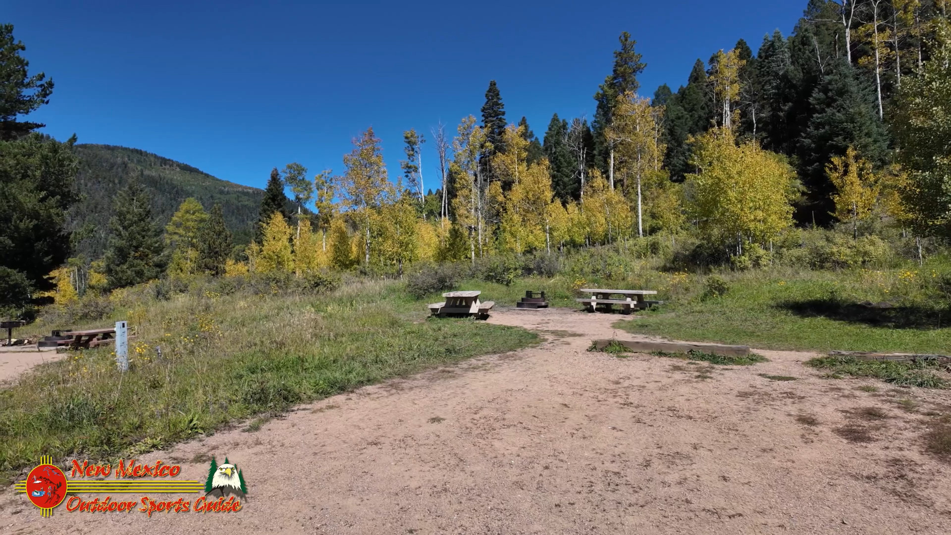
Jack’s Creek Campground: A Scenic Base
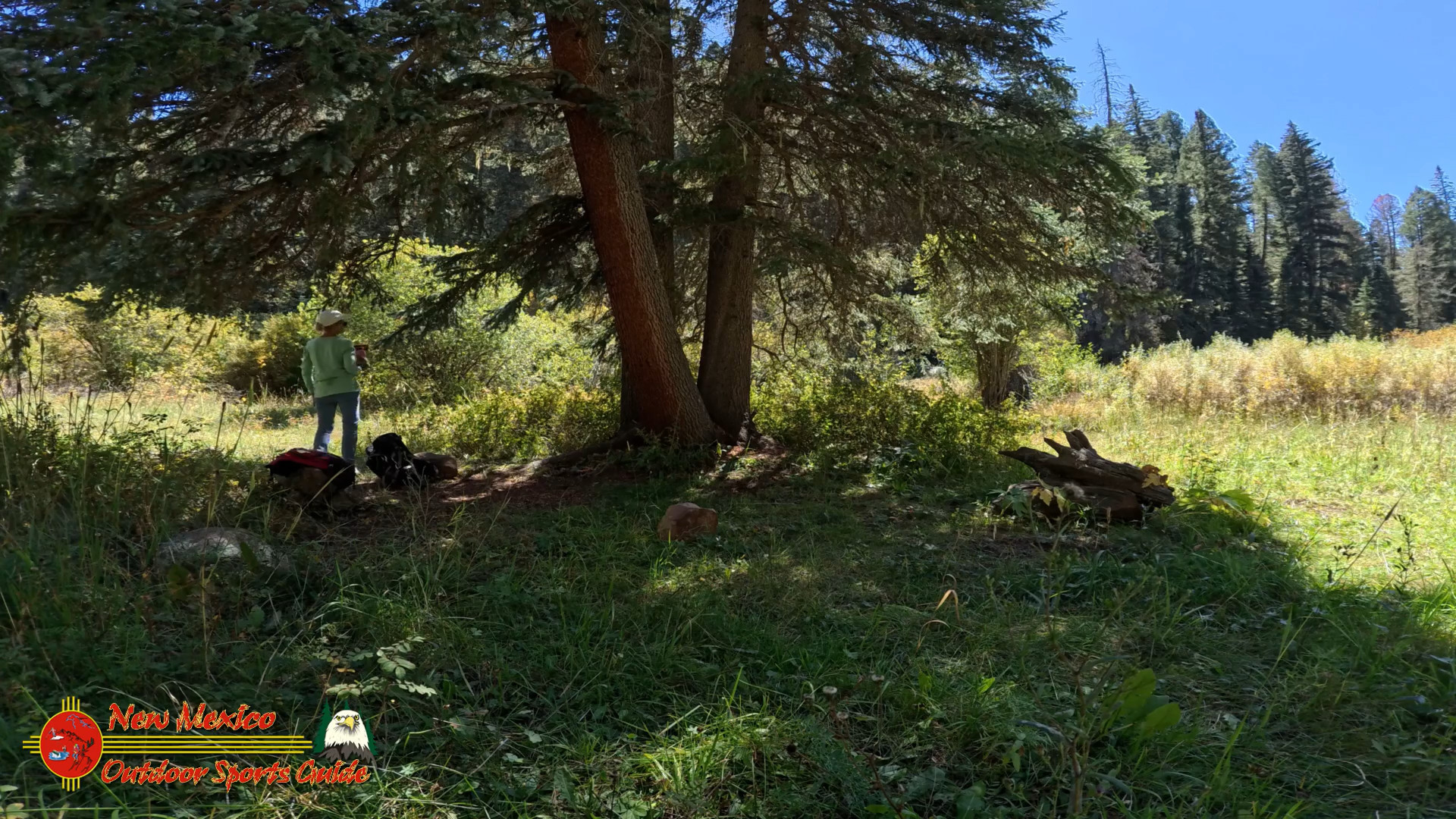
Parking at Jack’s Creek Campground is easy, and even in September, when the tourists start to thin out, there were a few cars in the lot. This is a popular spot for camping and hiking, but by fall, the crowds have moved on, leaving a peaceful silence behind. I always appreciate the quiet of this area—it's as if the mountains themselves are inviting you in, asking you to take your time and enjoy the land.
We double-checked our GPS coordinates before starting out (35.8920° N, 105.6591° W) to make sure we were on the right path. Even though Paulette and I are pretty familiar with this trail, it's always a good idea to have technology as a backup. You never know when the mountains will throw a curveball—fog rolling in or an unexpected rain shower—but that’s part of the adventure, right?
What to Wear for a September Hike
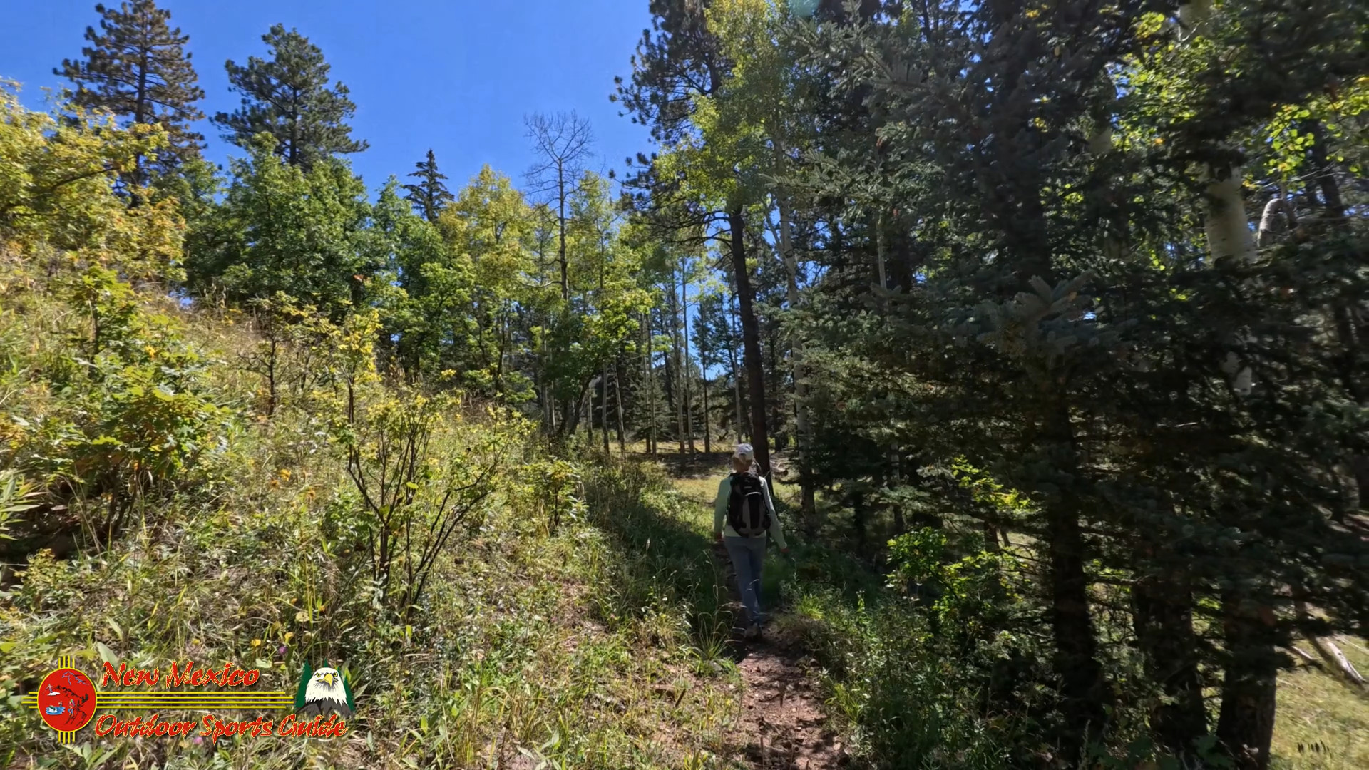
September is a great time to hike in the Pecos Wilderness, but the weather can be unpredictable. Paulette and I layered up—she wore her trusty fleece jacket and a bandana she’s had for years, while I stuck with my favorite plaid flannel and a light rain jacket tied around my waist. The mornings up here are cool, but the sun can warm things up quickly, so layers are key. We’ve learned to always carry a rain shell because mountain weather doesn’t follow the rules—one minute, it’s sunny, and the next, you’re caught in a downpour.
And don’t forget the hiking boots. I can’t tell you how many times a good pair of boots has saved my ankles on the rocky trails of New Mexico. Hamilton Mesa Trail is well-maintained, but there are still plenty of roots and rocks to watch out for.
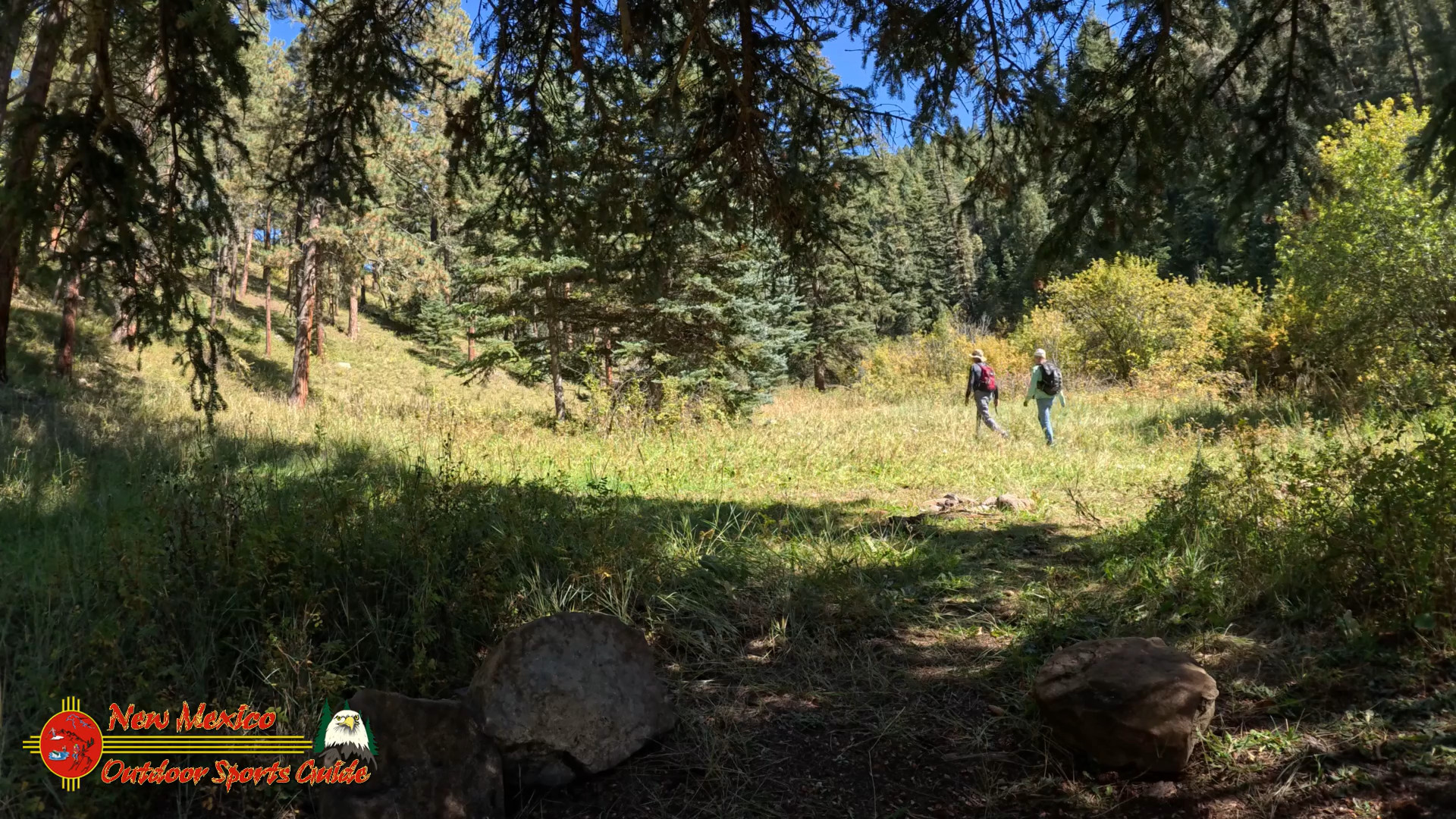
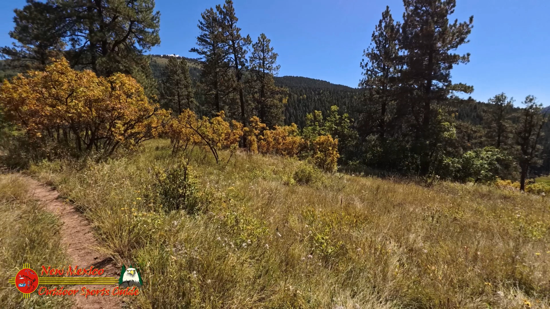
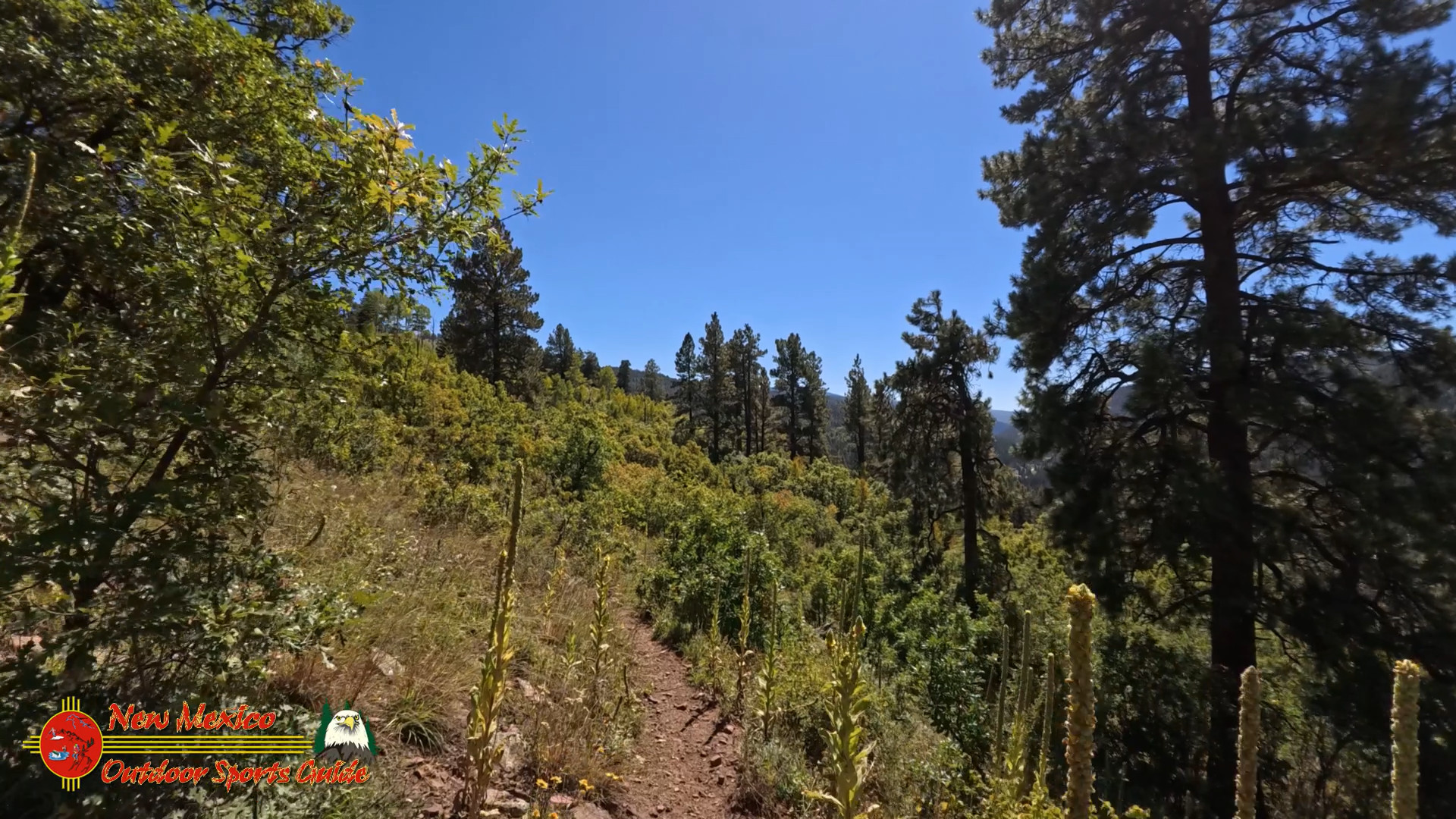
Hitting the Hamilton Mesa Trail #249
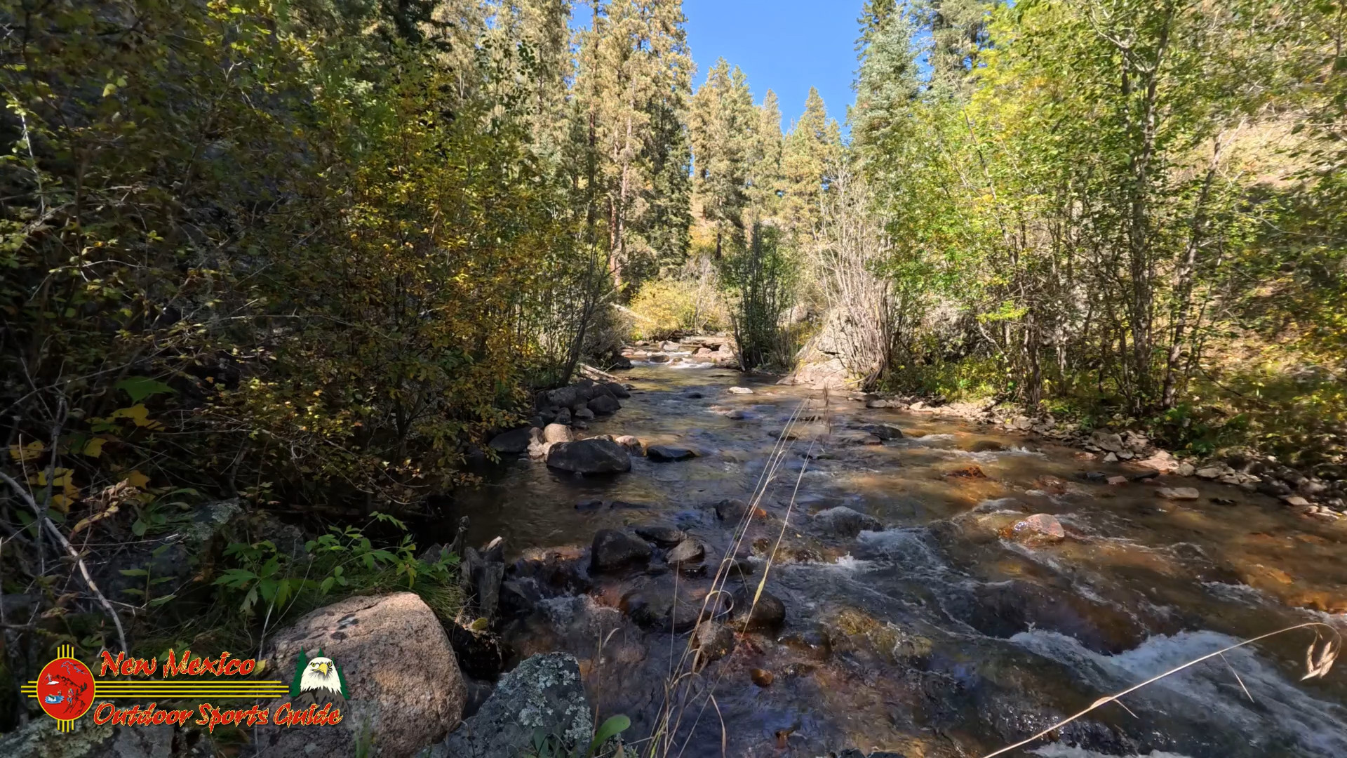
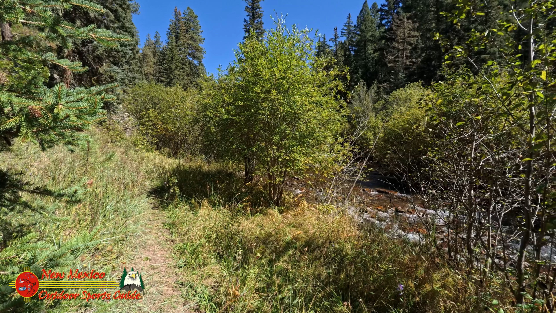
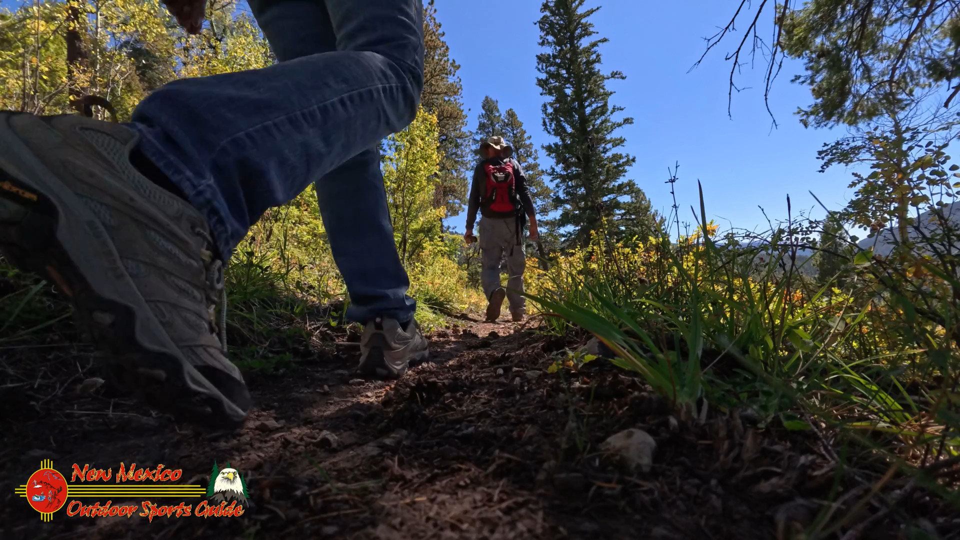
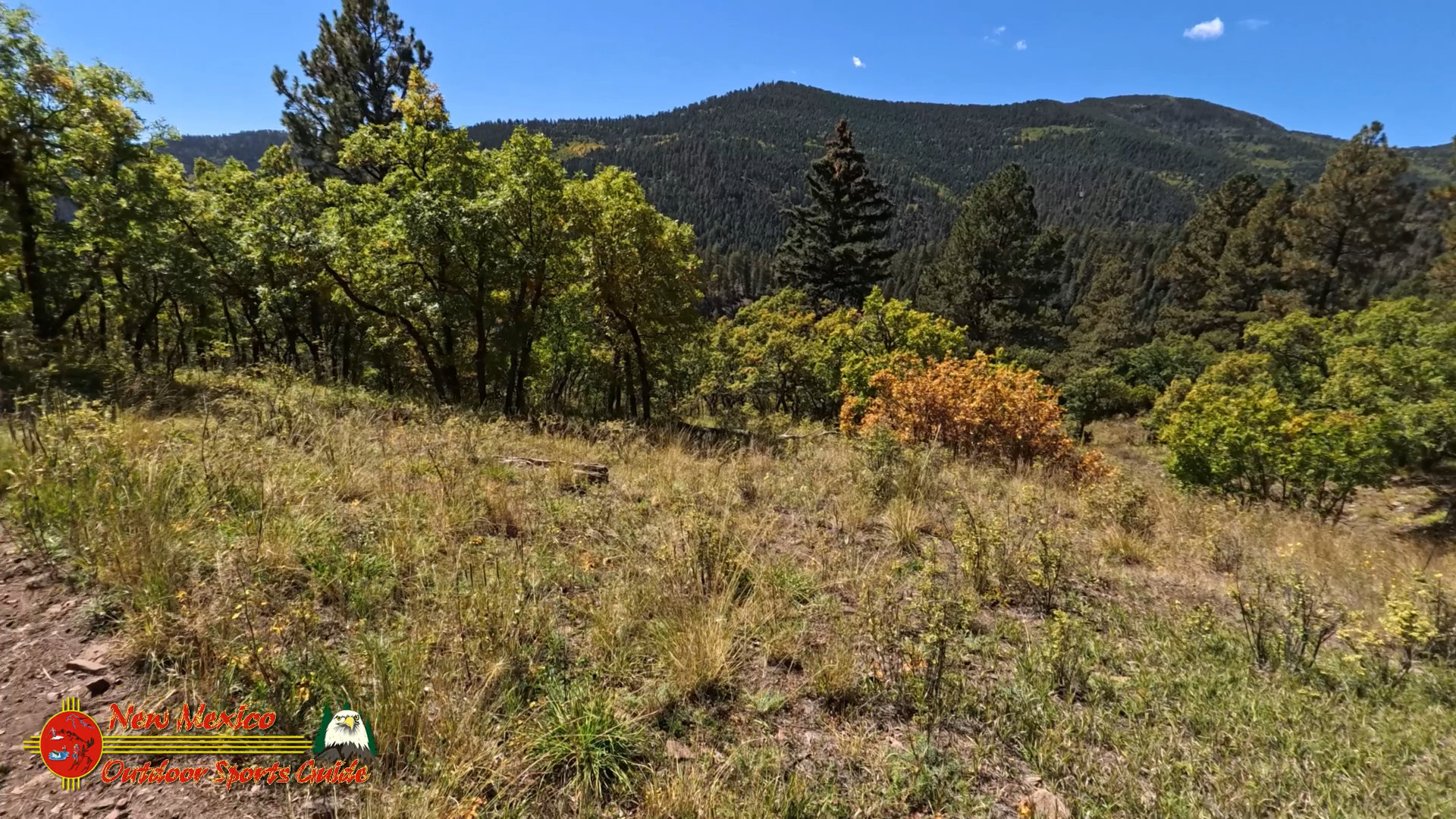
We set out on Hamilton Mesa Trail #249 just as the morning mist was lifting off the trees. The trail runs for about 5.5 miles one way, starting at the campground and climbing steadily along a ridge with views of the Pecos River far below. It’s not a strenuous hike, but it keeps you on your toes with a mix of gentle ascents and rolling terrain. Paulette and I like this trail because it’s not about racing to the end—it’s about enjoying the journey, walking side by side with nothing but the sound of the wind through the trees and the crunch of our boots on the dirt.
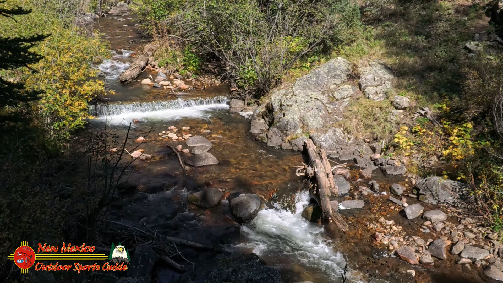
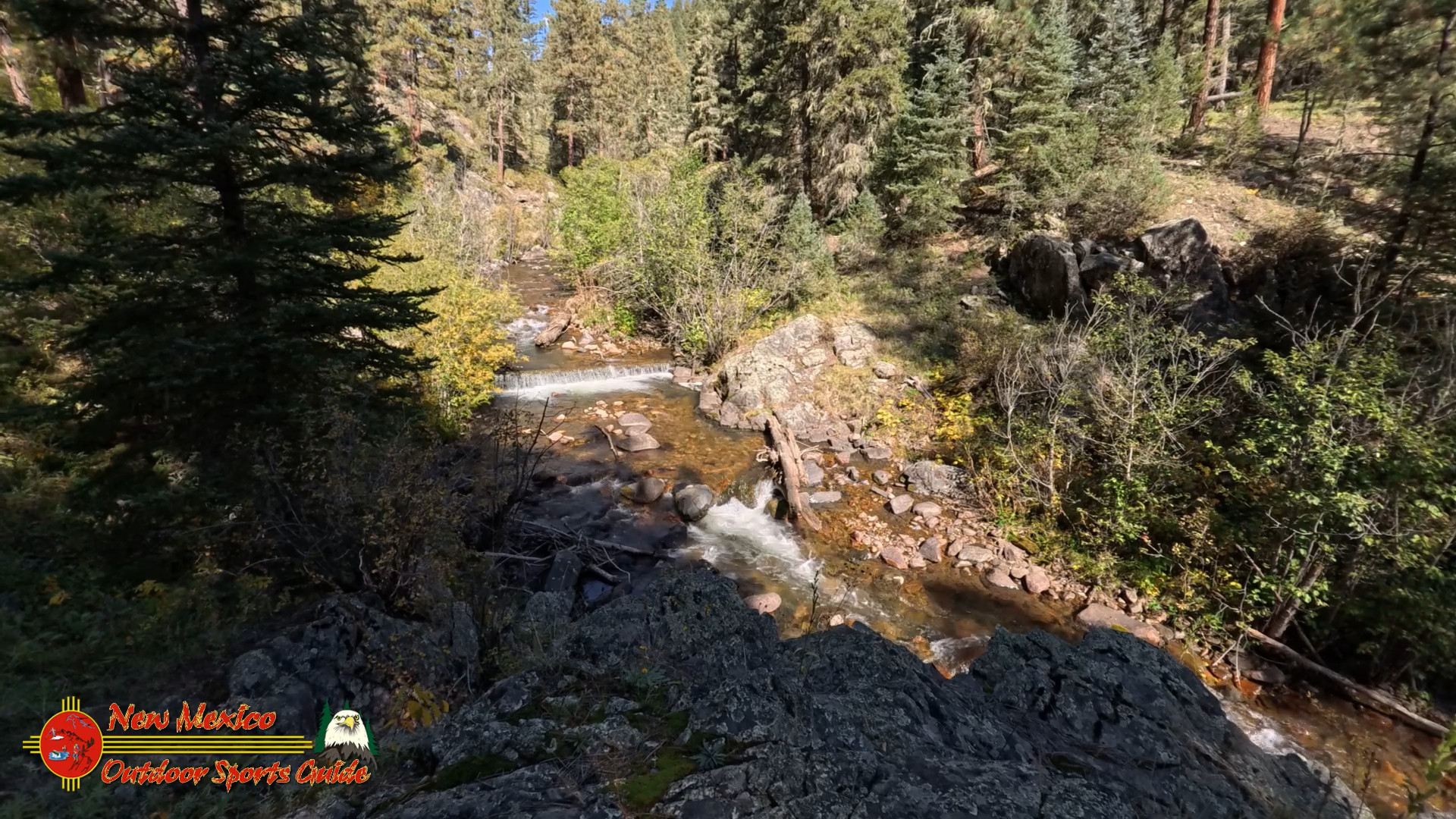
As we walked, we could see the river winding through the valley below, glistening in the morning light. It’s humbling to think that this water starts right here, in the Pecos Wilderness, and makes its way across hundreds of miles, through New Mexico, and eventually meets the Rio Grande at Lake Amistad in Texas. From its snow-fed headwaters to the deserts of the Southwest, the Pecos River is the lifeblood of the land.
Camp Lunch Along the Pecos River
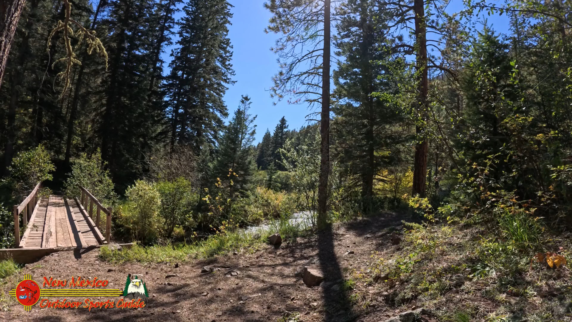
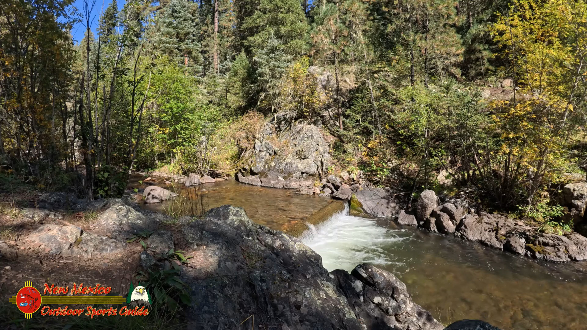
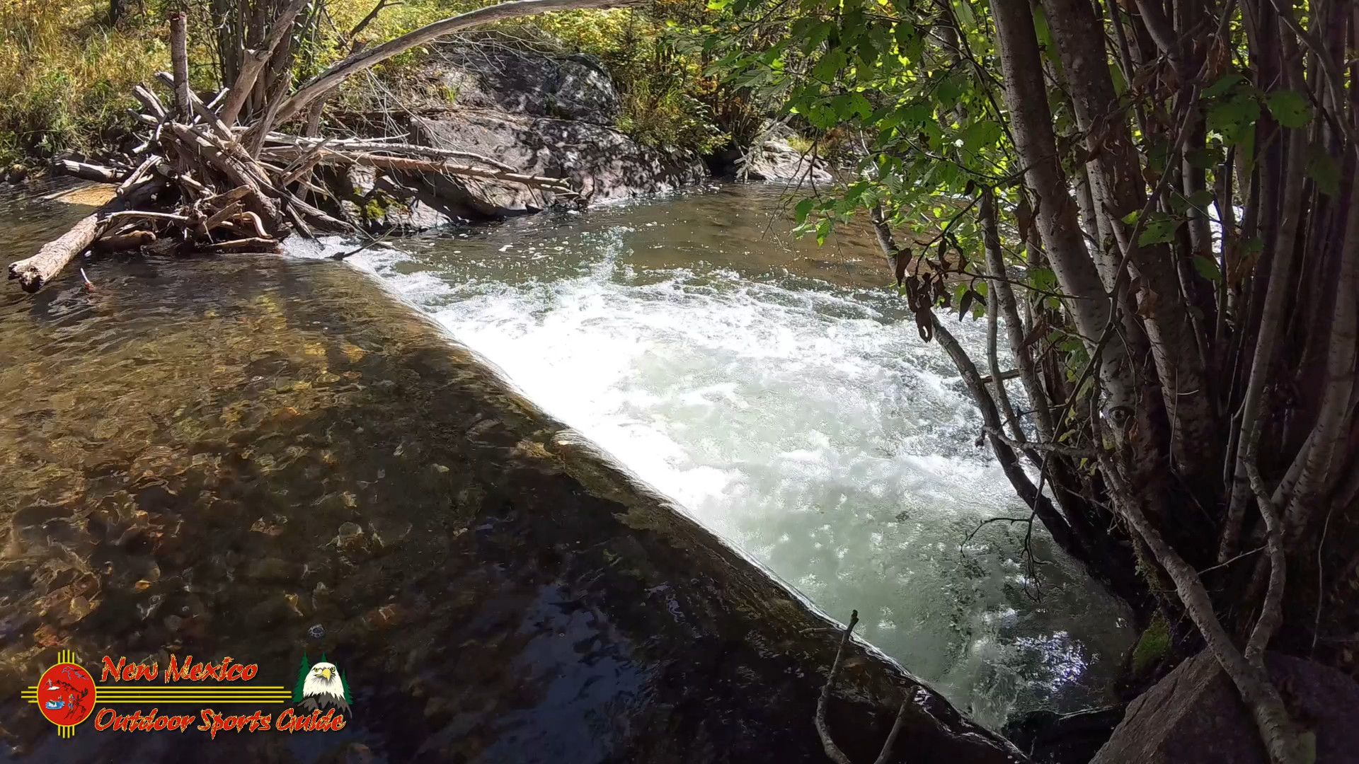
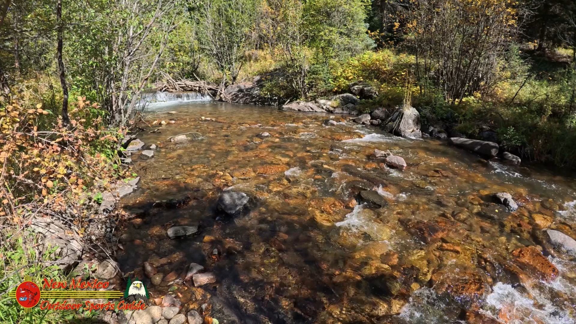
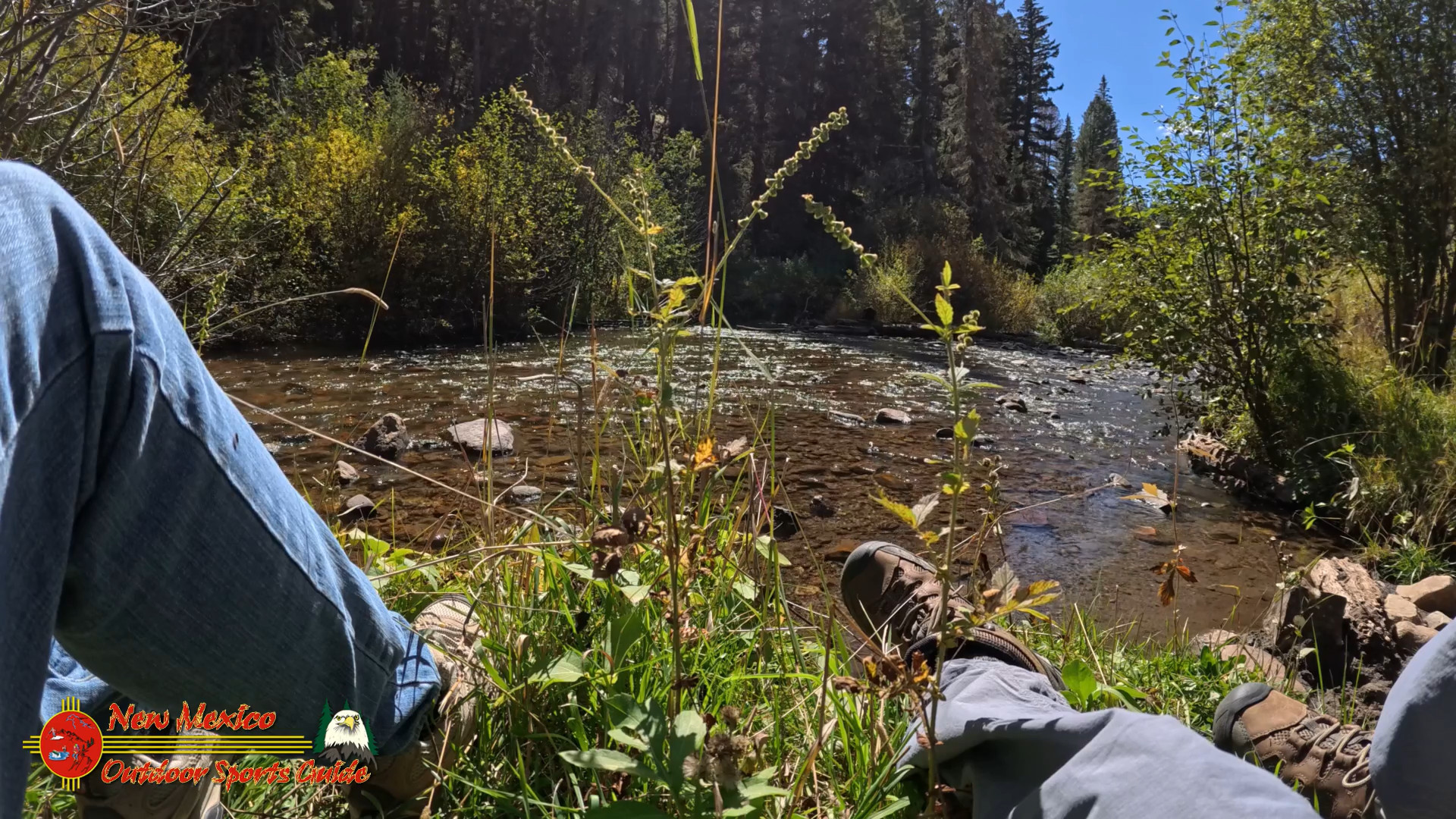
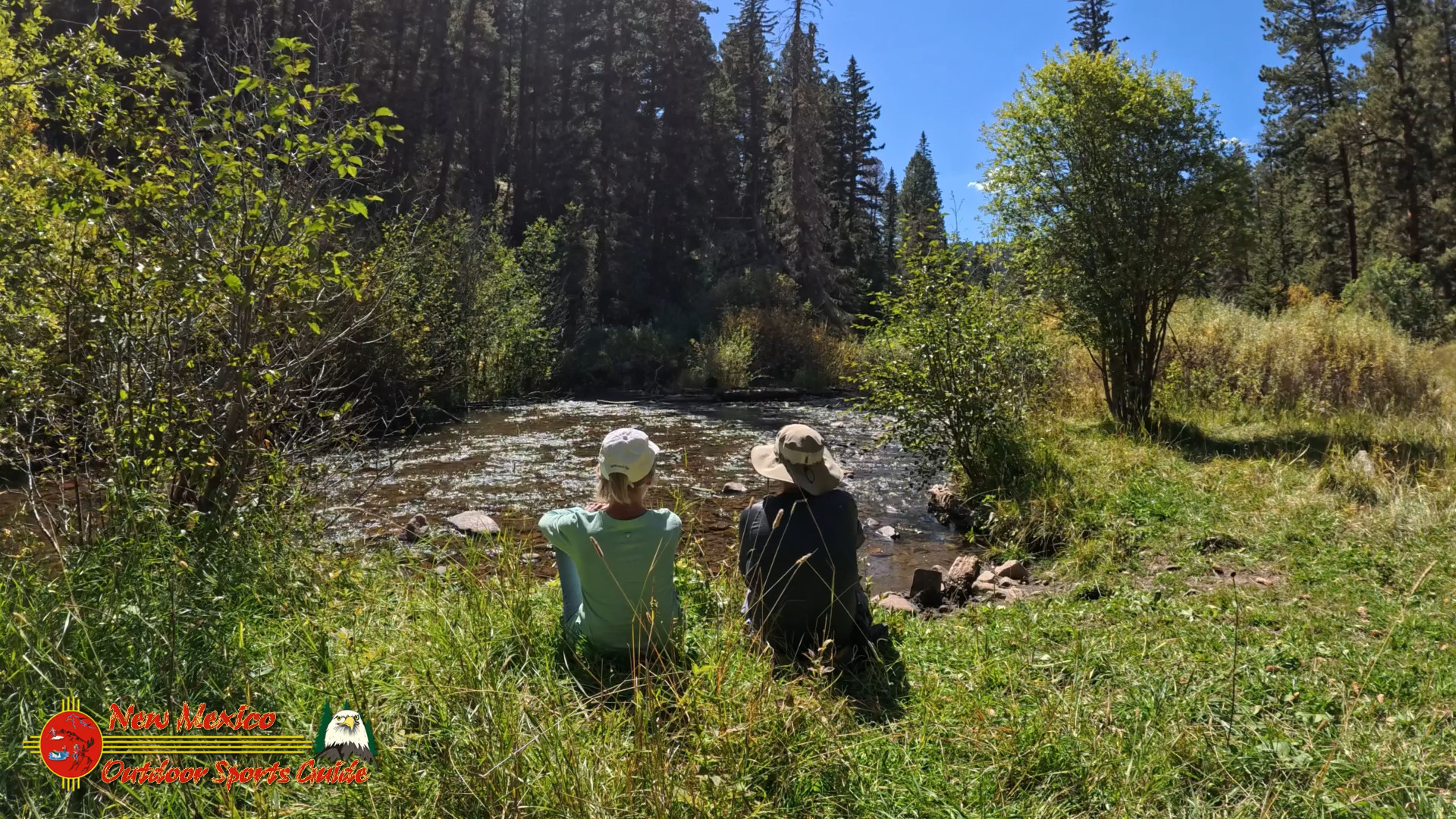
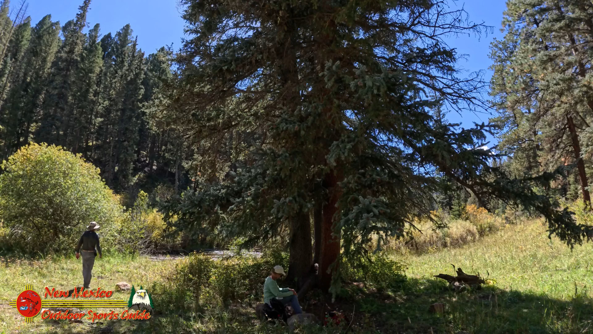
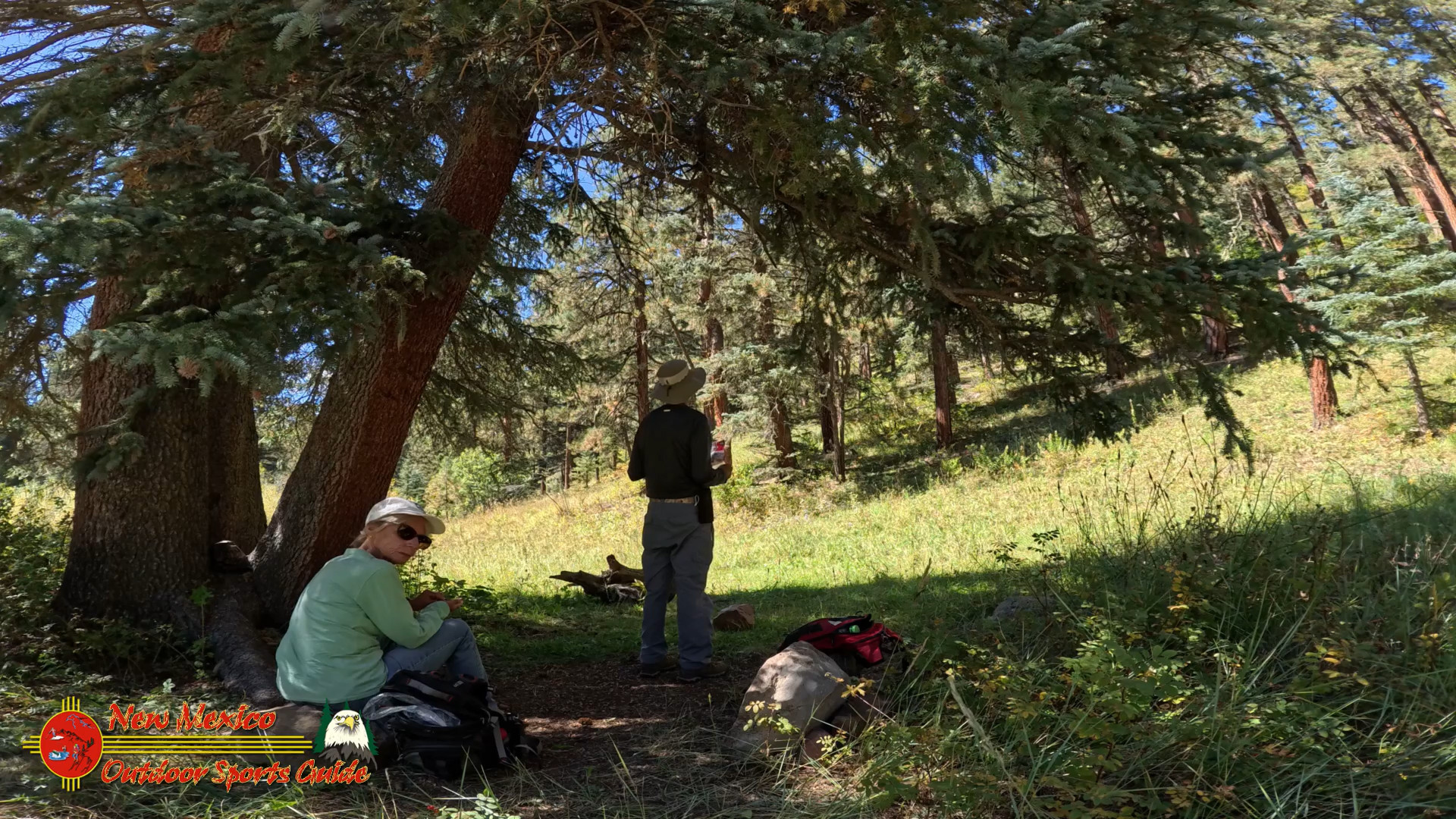
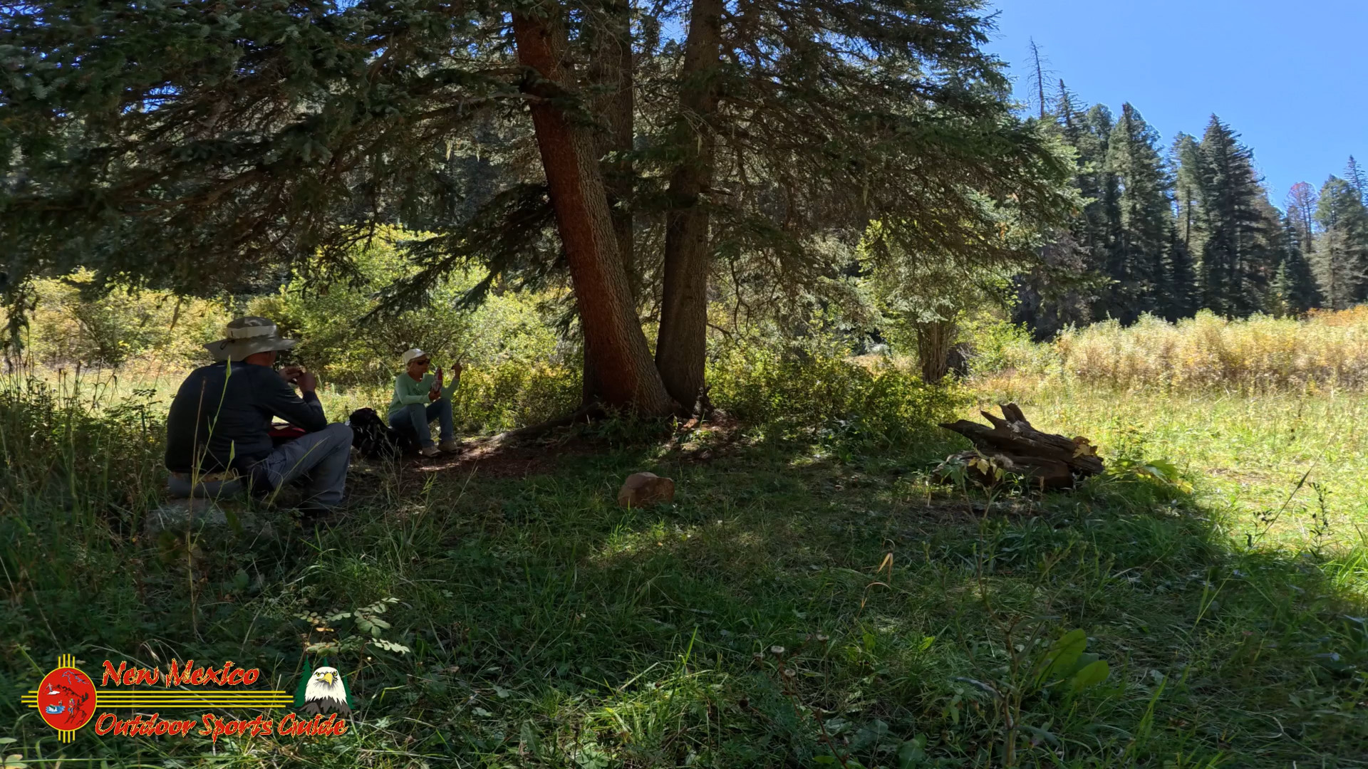
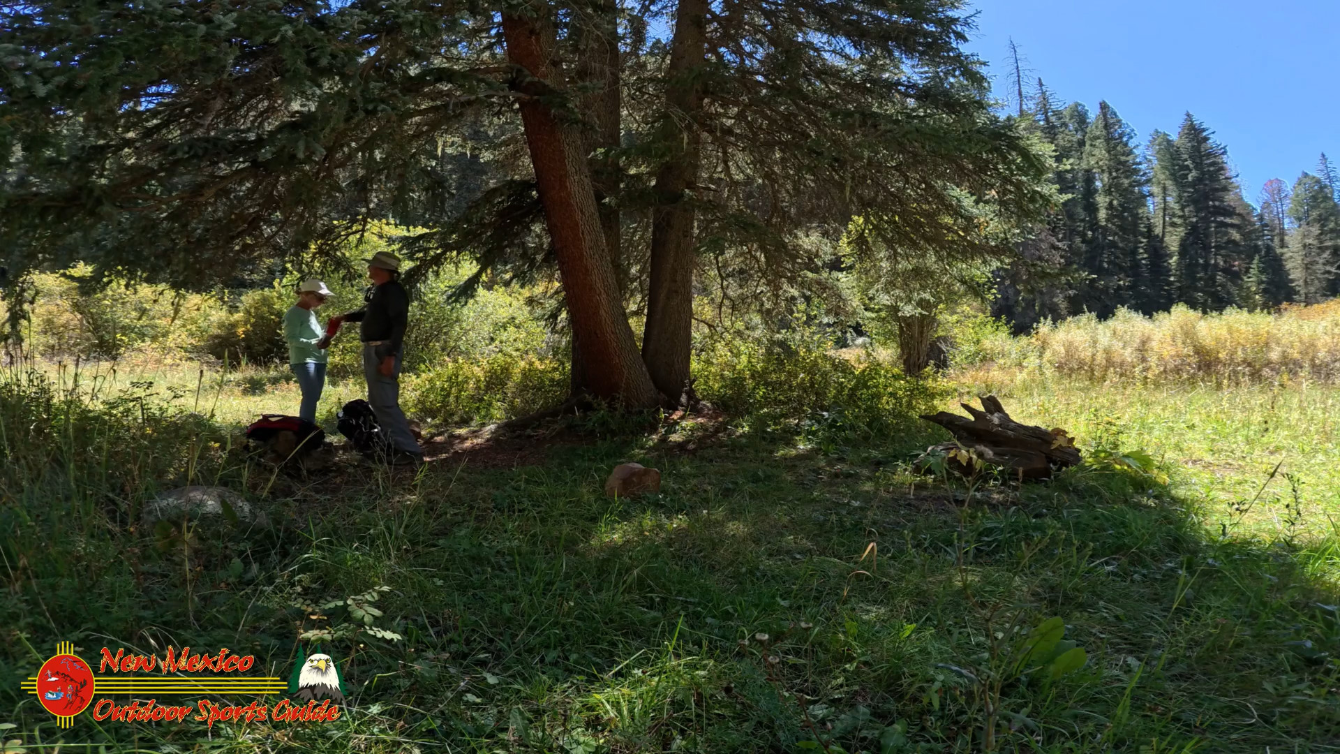
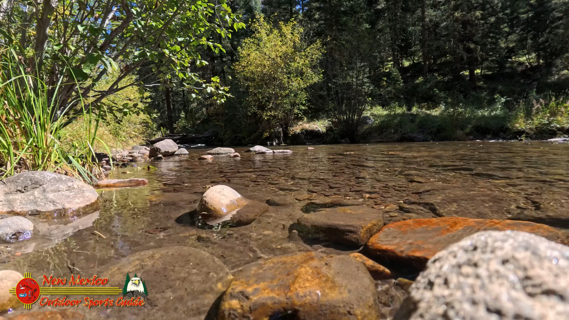
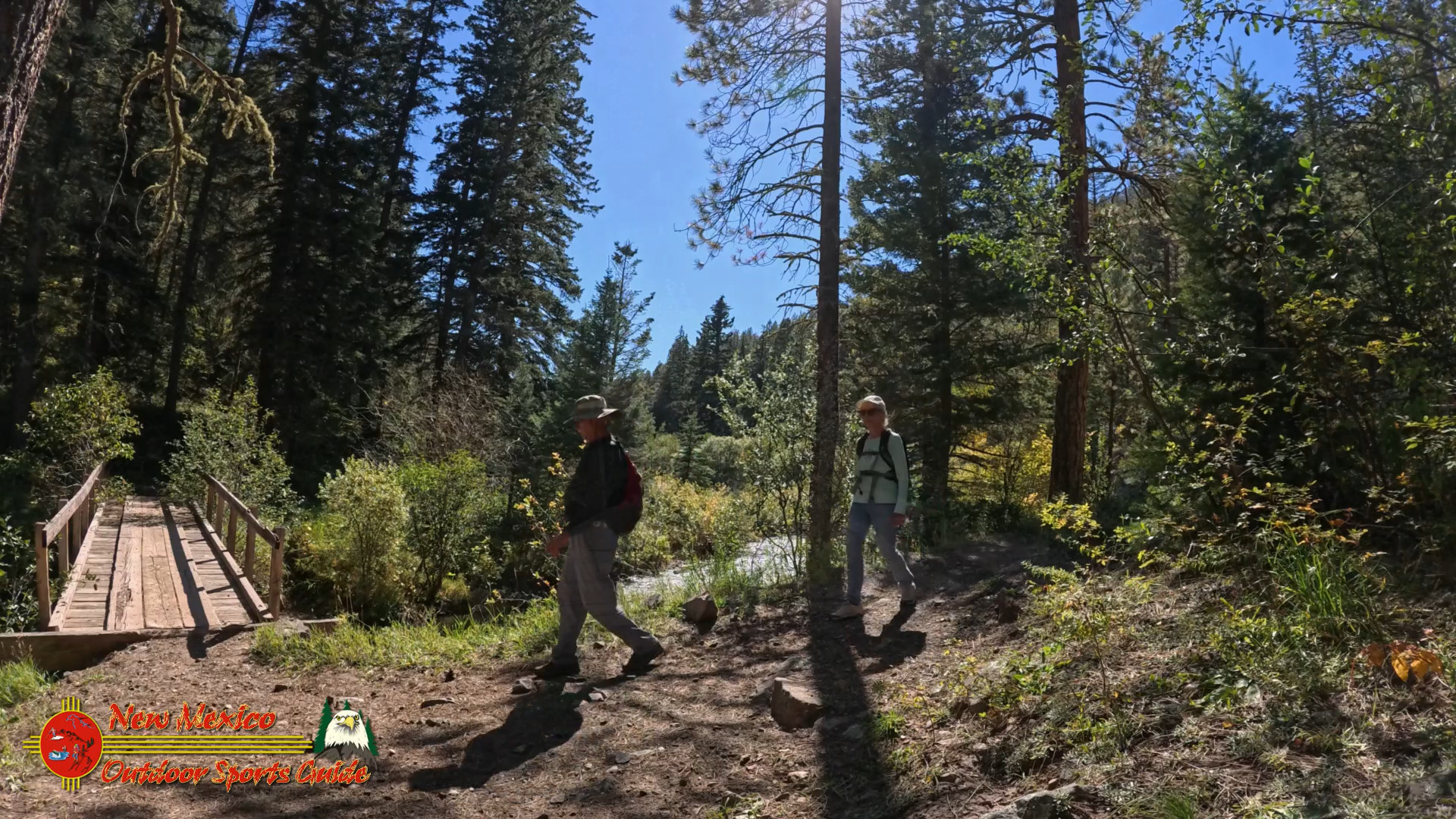
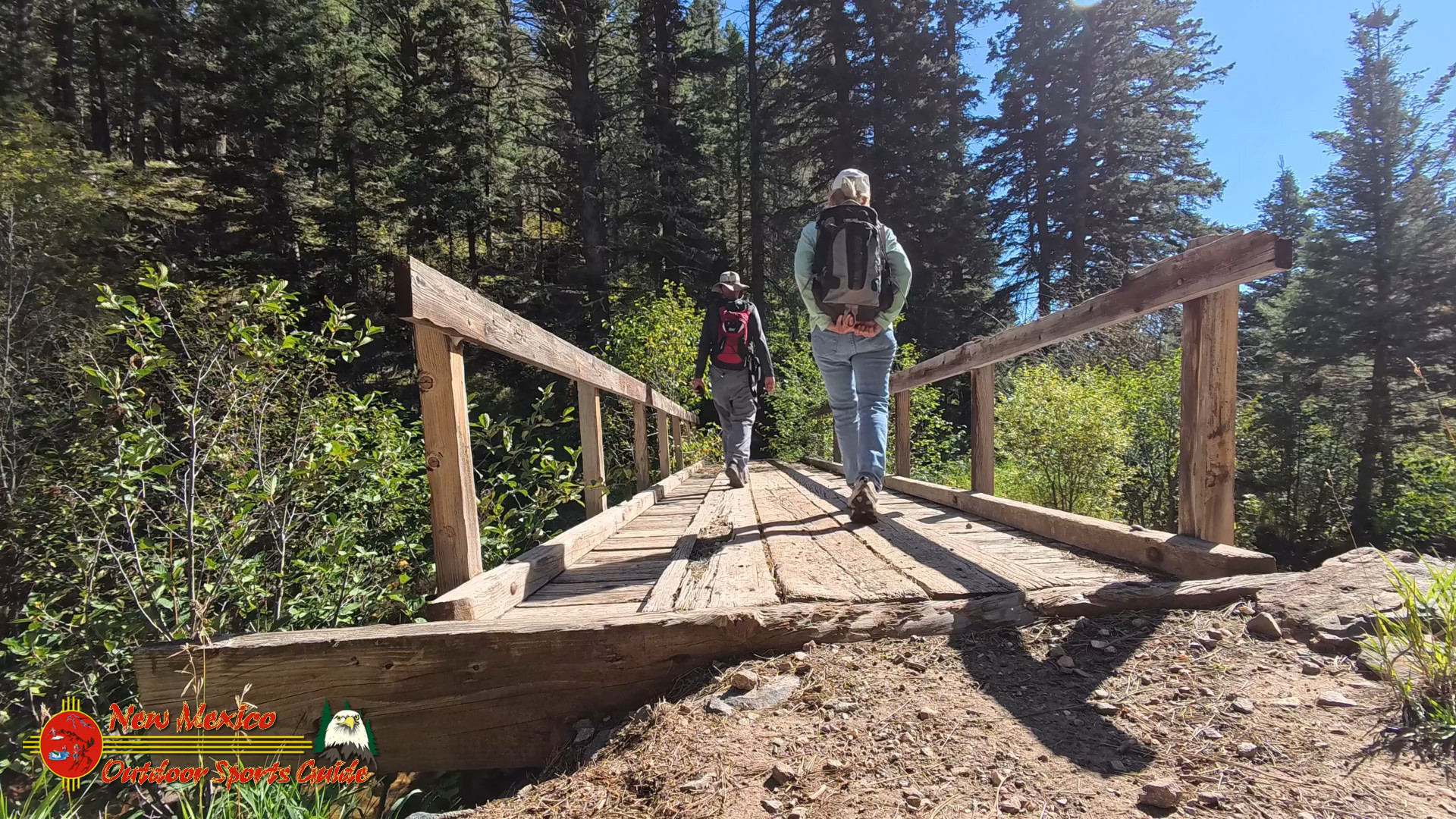
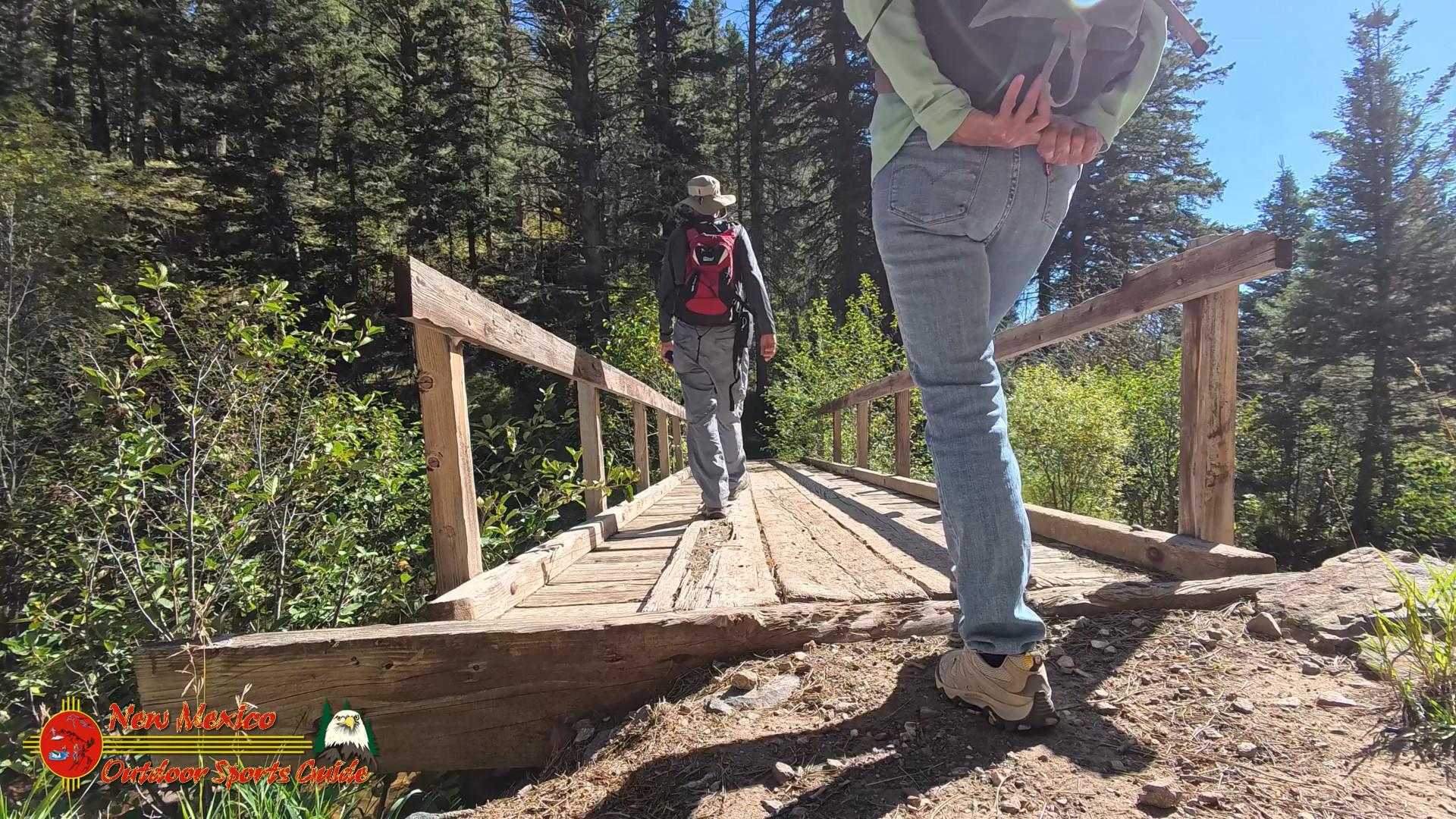
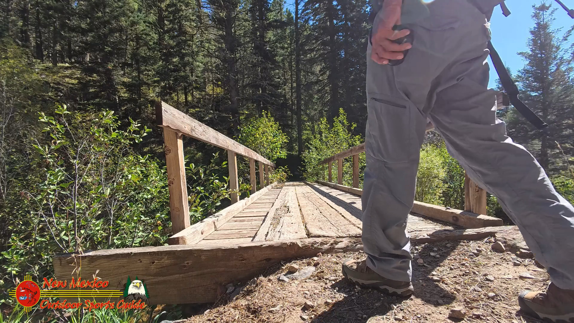
After about 30 minutes of hiking, the trail dipped down toward the Pecos River, and we found the perfect spot to take a break. There’s a footbridge that crosses the river—a simple wooden structure that gives you a front-row seat to the rushing water below. Paulette and I have always loved finding a good spot to sit, listen to the river, and share a meal together. We spread out our tortillas and jerky, adding some cheese and green chile we’d packed from home. Nothing tastes better than a simple meal after a good hike—especially when you're surrounded by towering trees and the sound of the river.
As we sat there, the sun filtering through the leaves, we couldn’t help but reflect on the years we’ve spent exploring the outdoors together. Nearly five decades of marriage, and here we were, still finding new trails to walk, still enjoying the quiet moments in nature. It’s amazing how a place like this can make you feel young again, like you're just starting out on your journey.
The Pecos River: Connecting the Wilderness to the Desert
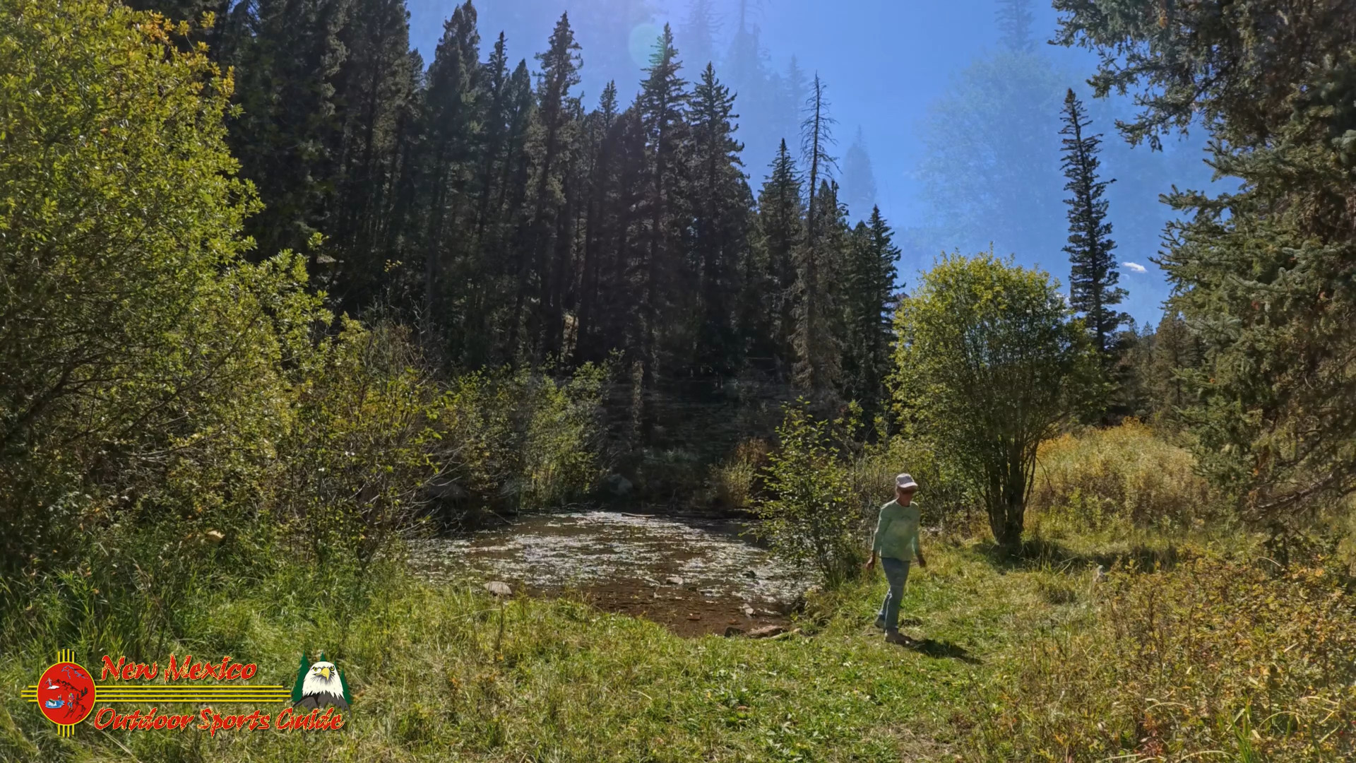
Looking at the river, I thought about how far it had to travel. From its headwaters here in the mountains, the Pecos River flows for over 900 miles, cutting through canyons and plains before finally joining the Rio Grande. It’s a reminder that everything in nature is connected, from the alpine meadows of the Pecos Wilderness to the arid borderlands of Texas. And standing on that footbridge, watching the water rush by, I felt grateful to be part of that connection, however briefly. I wondered if Ady would remeber my wish that my ashes get poured into the Pecos from this bridge for my final return to Texas.
Back to Jack’s Creek and Santa Fe
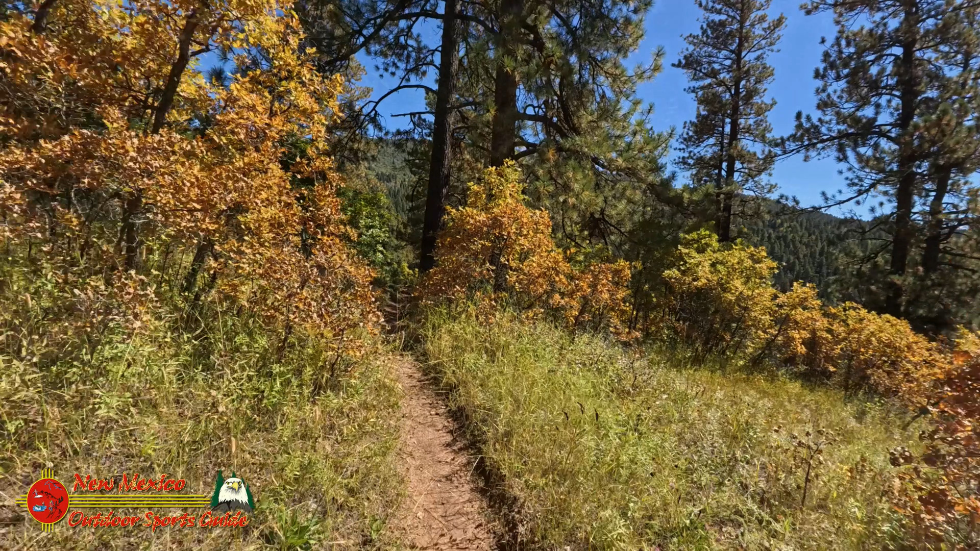
After lunch, we crossed the footbridge and continued a little farther down the trail before turning back. The 1.5 mile hike back was just long enough to leave us feeling content, but not completely exhausted. By the time we made it back to Jack’s Creek Campground, the sun was dipping low in the sky, casting a golden glow over the mountains. We lingered for a few minutes, taking in the stillness before loading up the car and heading back toward Santa Fe.
On the drive home, we talked about the things we’ve seen together over the years—places we’ve explored, trails we’ve hiked, and all the moments in between. The Hamilton Mesa Trail #249 might be just one of many trails we’ve walked, but it holds a special place in our hearts. Maybe it’s the views of the Pecos River, or maybe it’s just that time spent in nature with someone you love has a way of making even the simplest moments feel profound.
Quick Tips for Finding Hamilton Mesa Trail #249
-
Location: Pecos Wilderness, near Jack’s Creek Campground
-
GPS Coordinates: 35.8920° N, 105.6591° W
-
Trail Length: 1.5 miles one way to the Pecos Footbridge
-
Elevation: 8,000 to 10,000 feet
-
Best Time to Hike: September (cool weather, fewer crowds)
-
Parking: Jack’s Creek Campground
-
Village of Pecos: A charming stop for supplies and local culture
- Clothing: Dress in layers, wear sturdy boots, and bring a rain jacket
Hamilton Mesa Trail 249 Map


0 Comments