

Comb Ridge Overview
Butler Wash - Day 1
Restroom 15 minutes or less from Butler Wash Ruins Lot
Mule Canyon Kiva House on Fire Ruins - South Fork Mule Canyon Ruins
Cave Canyon or Mule Canyon Towers
Round Trip Distance: 1.6 miles
Difficulty: Easy
Elevation: 5947 - 6036 feet
Cellphone: 0-3 bars
Time: 1 hr. 30 mins.
Trailhead: Cave Canyon
Fee: none
Attractions: Ancestral Puebloan ruins, cliff dwellings
Lower Mule Canyon
Rating:

Round Trip Distance: 1 mile
Difficulty: Moderate
Elevation: 4780 - 4902 feet
Cellphone: 0 bars
Time: 1 hr.
Trailhead: Lower Mule Canyon
Fee: none
Attractions: Anasazi cliff dwellings
https://www.gjhikes.com/2016/11/lower-mule-canyon-ruins.html#more
The Lower Mule Canyon Ruins are located in the Comb Wash area west of Blanding, Utah. The ruins consist of 2 cliff dwellings and a separate granary that are spread out along a southwest facing cliff all within about a quarter mile of each other. The location of the ruins is in the lower end of Mule Canyon a short distance from where the mouth of the canyon meets Comb Wash.
Mule Canyon Day 2
Rating:

Round Trip Distance: 2-8 miles
Difficulty: Easy
Elevation: 5910 - 6194 feet
Cellphone: 0 bars
Time: 2-6 hrs.
Trailhead: Texas Flat Road MM 0.3
Fee: $2/person
Attractions: Cliff dwellings
https://www.gjhikes.com/2013/06/cave-towers.html#more
Rating:

Like most of the sites in the area there isn't a sign. You will find the turnoff on the south side of Highway 95 about halfway between mile markers 102 and 103. The turnoff to the House on Fire ruins on CR 275 is a little further west on the right side of the highway and the Mule Canyon Ruins are past that also on the right side. If you get to either of those turnoffs then you have gone too far.
North Mule Canyon ? worth an all day hike
Rating:
Round Trip Distance: 5.3 miles
Difficulty: Moderate
Elevation: 5942 - 6102 feet
Cellphone: 0 bars
Time: 4 hrs. 45 mins.
Trailhead: North Fork Mule Canyon
Fee: $2/person
Attractions: cliff dwellings, rock art
All total we saw about 11 minor ruins, some of which were as small as a few stacked rocks, and 4 ruins that were much more substantial. Besides that there were the various rock art sites and the well preserved granary at the turnaround point.
Bluff Combs Wash Rd - Day 3
Combs Ridge Photos 95 and 235 Combs Wash Rd
Photos and videos where hiway cuts through Combs Ridge
Lower Fish Creek
https://www.gjhikes.com/2019/11/lower-fish-creek.html#more
ating:
Round Trip Distance: 9+ miles
Difficulty: Moderate
Elevation: 4521 - 4727 feet
Cellphone: 0-1 bars
Time: 7 hrs. 30 mins.
Trailhead: Lower Cabin Trail
Fee: $2/person
Attractions: Cliff dwellings, granaries
River House Ruin
https://www.gjhikes.com/search?q=river+house+ruins
Rating:
Round Trip Distance: 0.2 - 0.6 miles
Difficulty: Easy
Elevation: 4241 - 4310 feet
Cellphone: 0 bars
Time: 45 mins.
Trailhead: River House Ruin
Fee: none
Attractions: Cliff dwelling, rock art
37°13'21.63"N, 109°41'18.28"W
https://www.gjhikes.com/2017/07/river-house-ruin.html
To get to the ruins from Bluff drive west on Highway 191 for about 4 miles to its junction with Highway 163. Continue straight on Highway 163 for another 3.14 miles. The highway will cross Comb Ridge and descend down the west side. Turn left onto San Juan County Road 235 and enter Comb Wash. A high clearance 4-wheel drive vehicle is recommended at this point due to sandy washes and rocky sections. Follow the wash for about 3.8 miles where the road turns sharply to the left and climbs a steep rocky hill. The road will briefly level off at the top of the hill where you can stay to the right. The first road to the left leads to San Juan Hill while the next left fork leads elsewhere as shown on our map. From this point it is about another half mile to the ruin. Enroute the road will pass the Rincone Trading Post where it continues east around the point of a small cliff and down a section of uneven slickrock. From there the road gets much easier for the rest of the way to the ruin.
Butler Wash/Kachina Panel ?
Rating:
Round Trip Distance: 0.2 - 1.8 miles
Difficulty: Easy
Elevation: 4220 - 4235 feet
Cellphone: 0 bars
Time: 2 hrs.
Trailhead: Butler Wash Panel
Fee: none
Attractions: Numerous petroglyphs
The Butler Wash Panel is located west of Bluff, Utah near where Butler Wash meets up with the San Juan River. The panel has multiple large images that have been identified to represent various kachina so it is also sometimes referred to as the Kachina Panel. There are hundreds of other images besides the kachina as well as the rubble pile ruins of a pueblo. Getting to the site requires a high clearance 4-wheel drive or other off road vehicle or a round trip hike of around 12.5 miles. For that reason most of the visitors to the Butler Wash Panel and the nearby River House Ruins are river rats that are floating by on the San Juan.
https://www.gjhikes.com/2019/10/butler-wash-panel.html
Lower Butler Wash Rd - 262 to Monarch Cave Ruins Day 4
Cold Spring Cave
Rating:
Round Trip Distance: 2 miles
Difficulty: Moderate
Elevation: 4657 - 4842 feet
Cellphone: 0-3 bars
Time: 1 hr. 45 mins.
Trailhead: Cold Springs
Fee: none
Attractions: Cliff dwellings, rock art, pottery sherds
https://www.gjhikes.com/2013/06/cold-spring-cave.html
The unmarked trailhead for the Cold Spring Cave trail is located about 2 tenths of a mile north of the Monarch Cave trailhead. We have created our own map of the area that you might like to print and take along that shows the distances from Highway 163 to each of the most popular trailheads.
From the parking area the trail crosses a shallow wash and continues along an old jeep road. The road passes right over an archaeological site a short distance from the trailhead where there was possibly a pueblo and/or kiva at one time. Watch for a well worn trail that leaves the road about a quarter mile from the parking area and heads toward the wash.
After crossing the main Butler Wash stay above the side wash as you head toward the mouth of the canyon. The wash is choked with brush in places making it more difficult to hike. There are trails that split off of the main route that look like they might lead to something interesting if you have extra time.
As you hike up the canyon you will come to a fork. The trail to Cold Spring Cave heads up the side canyon on the right. The turnoff into the side canyon is about 8 tenths of a mile from the trailhead. From here the trail climbs up the left side of a small spillover and enters the almost hidden canyon.
Monarch Cave Ruins
37°21'28.55"N, 109°38'33.14"W
Rating:
Round Trip Distance: 2 miles
Difficulty: Moderate
Elevation: 4656 - 4791 feet
Cellphone: 0-3 bars
Time: 1 hr. 30 mins.
Trailhead: Monarch Cave
Fee: none
Attractions: Cliff dwellings, petroglyphs, artifacts
Monarch Cave is located in Butler Wash on the east side of Comb Ridge near Bluff, Utah. A short trail leads from the trailhead up a narrow canyon to a cave that contains the remains of an Ancestral Puebloan cliff dwelling. The cave and surrounding area makeup a nice outdoor museum with many traces of the daily activities of its ancient inhabitants. Besides the ruins visitors are treated to some petroglyphs and artifacts that include pottery sherds, corn cobs, sharpening grooves and metates.
Unnamed Butler Wash Ruins Ruins 1 mile north of Hwy 163
37°16'29.16"N, 109°38'48.18"W
Wolfman Panel Trail
https://www.gjhikes.com/2013/06/wolfman-panel.html#more
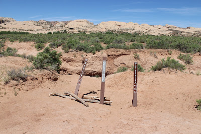
No Trailhead sign, but there is an unmarked parking area down a two track along the boundary fence, and a somewhat visible footpath is followed across slickrock using cairns.
Rating:
Round Trip Distance: 1-1.5 miles
Difficulty: Moderate
Elevation: 4368 - 4533 feet
Cellphone: 0-3 bars
Time: 1 hr. 30 mins.
Trailhead: Wolfman Panel
Fee: none
Attractions: Great petroglyphs, unique cliff dwelling, pottery sherds
The Wolfman Panel is a petroglyph site located near the south end of the Butler Wash Road near Bluff, Utah. The panel consists of multiple images that were precisely inscribed into the dark patina of the cliff. There are also a few remaining walls of a cliff dwelling across the wash that are passed on the hike in to the Wolfman Panel that we took the time to hike over to for this post.
The Butler Wash Road starts out as gravel but after a short distance it leaves the gravel road and becomes dirt and slickrock. The slickrock has had a pavement grinder taken to it to smooth out the humps. Follow the road until you measure almost 1 mile from the highway and you will come to a fence and cattle guard. On the other side of the fence is a BLM information kiosk but before crossing the cattle guard you will want to turn left and follow the road along the fence to a parking area that serves as the trailhead for the Wolfman Panel. The trail begins at the 3 brown mylar trail markers and heads towards the wash across the slickrock.
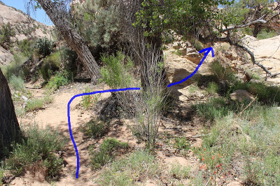
You will notice a few cairns as you come near to the wash. At this point the trail turns to the south along the rim. Before continuing along the trail you can hike closer to the rim and see a cliff dwelling across the wash.
The petroglyphs are located on the far side of an alcove beneath the rim. Getting down to the bench area below the alcove requires squeezing between a large boulder and the cliff followed by a little minor scrambling.
A good ledge serves as the path after you get past the boulder. The petroglyphs are best viewed from the area about 30-40 feet beneath them. Most of the petroglyphs are large and very distinct and show up very well. There are a few images like the Wolfman that are in the lighter rock that you may want to get closer to view.
After coming this close to the cliff dwelling on the other side of the wash it seems a shame not to venture over and take a look at it. By far the best route to take is to follow the trail along the base of the cliff that you came down on.
Un-named Ruins in Lower Butler Wash
37°16'54.30"N, 109°38'30.01"W
Caves in Lower Butler Wash
37°19'11.22"N, 109°38'21.63"W
Bluff & San Juan - Day 5
Sand Island Petroglyph Panel
Fly Over Bluff
37°17'24.00"N, 109°33'25.63"W
https://www.climb-utah.com/signup.htm
https://bearsearsmonument.org/wp-content/uploads/2019/02/Bears-Ears-National-Monument-Map.pdf
Over & Under Ruins ?
37°38'49.15"N, 109°40'10.67"W
Hwy 092 - 37.65134451545817, -109.6711611989025


0 Comments