
You know, after eight decades of wandering this beautiful earth, I've learned that the best adventures often come from the simplest of wrong turns. Four days after our July 4th mishap—if you can call discovering something wonderful a mishap—Paulette and I found ourselves lacing up our hiking boots once again, determined to properly explore that trail near Apache Canyon that had gotten the better of my navigation skills earlier in the week.
The Call of the Trail
Living here in Santa Fe, we're blessed with an embarrassment of riches when it comes to hiking near Santa Fe. The southern foothills of the Sangre de Cristo range spread out before us like a weathered tapestry, each trail offering its own unique story written in stone, sage, and sky. But there's something particularly alluring about the trail system near Apache Canyon—perhaps it's the way the morning light catches the red rocks, or how the distant views of the Galisteo Basin seem to stretch endlessly toward the horizon.
On that warm July 8th morning, we packed our usual gear: plenty of water (you don't mess around with hydration in this high desert country), our trusty hiking poles, and of course, my camera. After forty-plus years of marriage, Paulette knows that any hike with me is as much about capturing the light and landscape as it is about the walking itself. It's a passion that's only grown stronger since we moved to Santa Fe in 2017, trading our summer escapes to Lake Mohave for the cooler mountain air and endless photographic opportunities of northern New Mexico.
Setting Out on the Hidden Canyon Trail
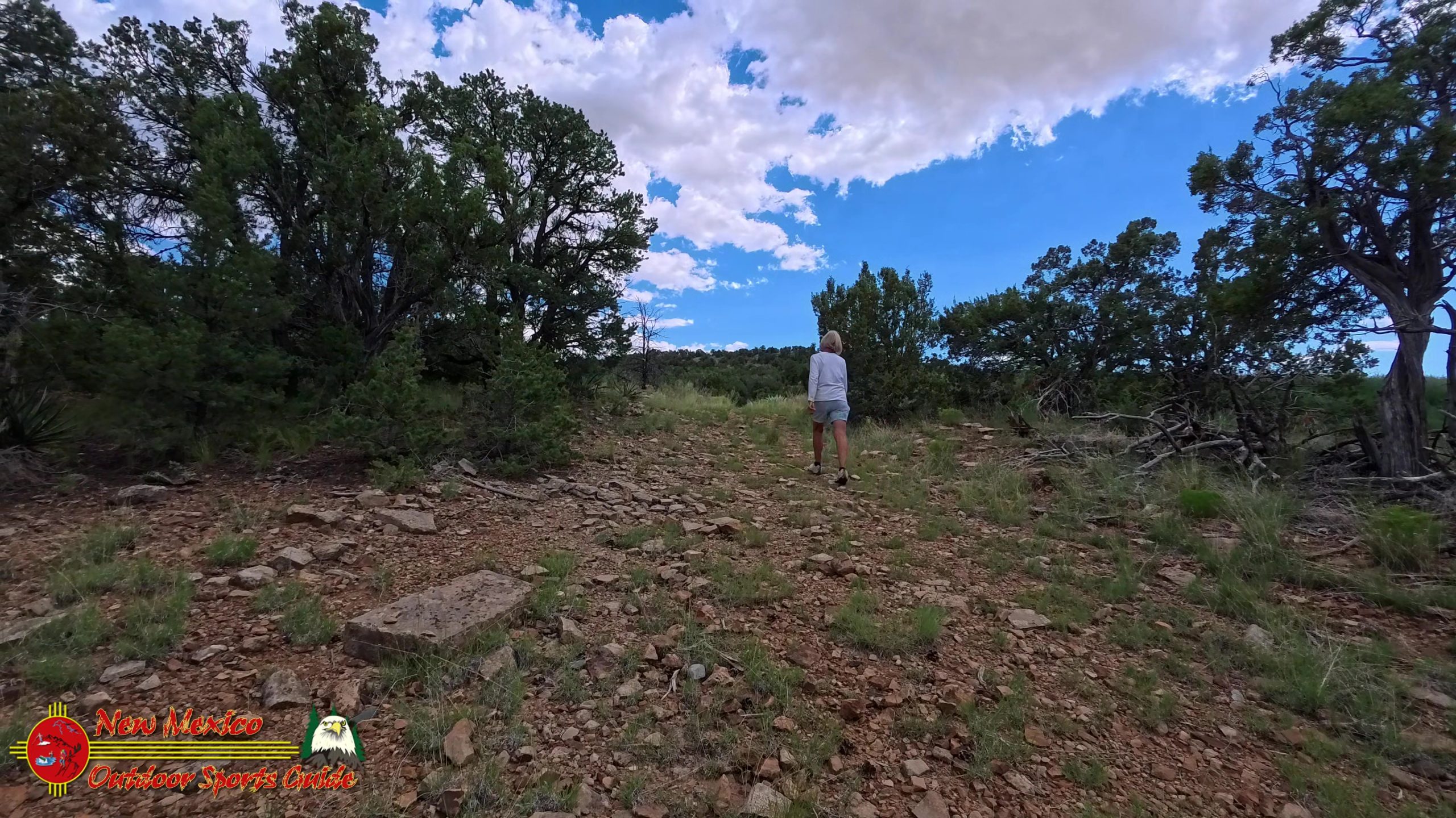
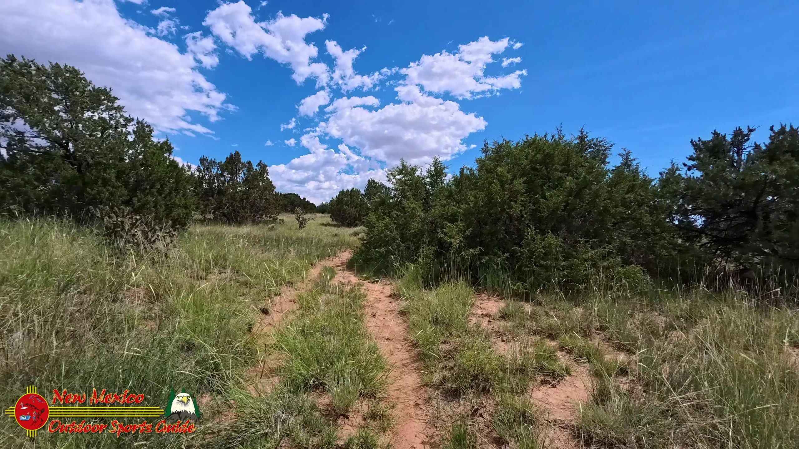
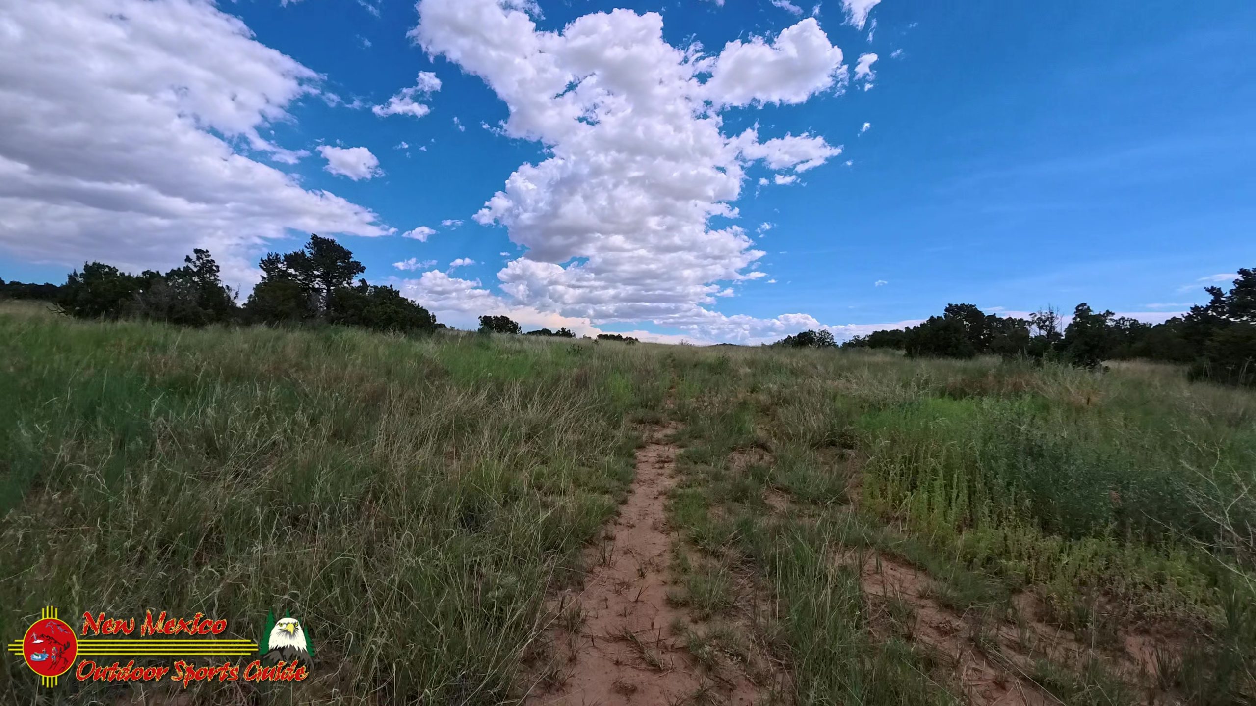
The drive from our Santa Fe home to the trailhead is mercifully short—one of the many advantages of hiking near Santa Fe. Within minutes, we're parked and shouldering our packs, the familiar weight of water bottles and camera gear settling comfortably against our backs. The plan was simple: a 4.5-mile out-and-back on what we'd discovered was called the Hidden Canyon Trail. It would match our normal daily distance on the Santa Fe Rail Trail, but with considerably more elevation gain and infinitely better views.
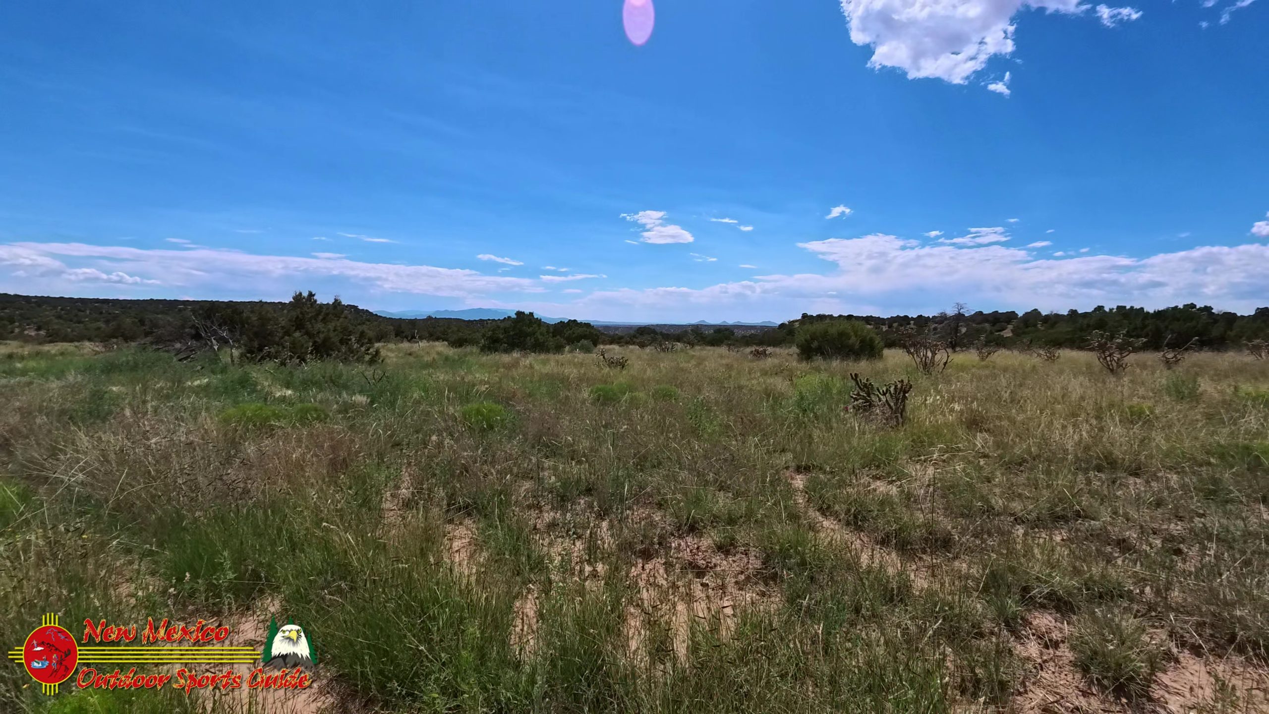
The trail begins innocuously enough, winding through typical high desert terrain punctuated by piñon pines and juniper trees. But as we gained elevation, the landscape began to reveal its secrets. The Galisteo Basin stretched out below us, a vast expanse of rolling hills and mesas that have witnessed thousands of years of human history. From this vantage point, it's easy to understand why ancient peoples chose to make their homes in this region.
The Galisteo Basin: A Window into Ancient Times
The Galisteo Basin holds a special place in the archaeological record of the American Southwest. Long before Spanish conquistadors or Anglo settlers arrived, this area was home to thriving Ancestral Puebloan communities. The basin's fertile soils and reliable water sources made it an ideal location for the corn, beans, and squash agriculture that sustained these ancient peoples.
Between roughly 1250 and 1400 CE, the Galisteo Basin was dotted with large pueblos, some containing hundreds of rooms. The Ancestral Puebloans, whom we once called the Anasazi, were master architects and engineers, creating sophisticated communities that took advantage of the region's natural resources while adapting to its challenges. They quarried tuff from nearby volcanic deposits, fashioned tools from local chert, and created beautiful pottery from basin clays.
As we hiked higher, I couldn't help but imagine those ancient inhabitants looking out over this same landscape, perhaps from clifftop granaries or watchtowers, keeping an eye on their fields below and the horizon beyond. The more I learn about these people, the more I respect their intimate knowledge of this land—knowledge earned through generations of careful observation and adaptation.
Following the Wrong Turn That Led to Discovery
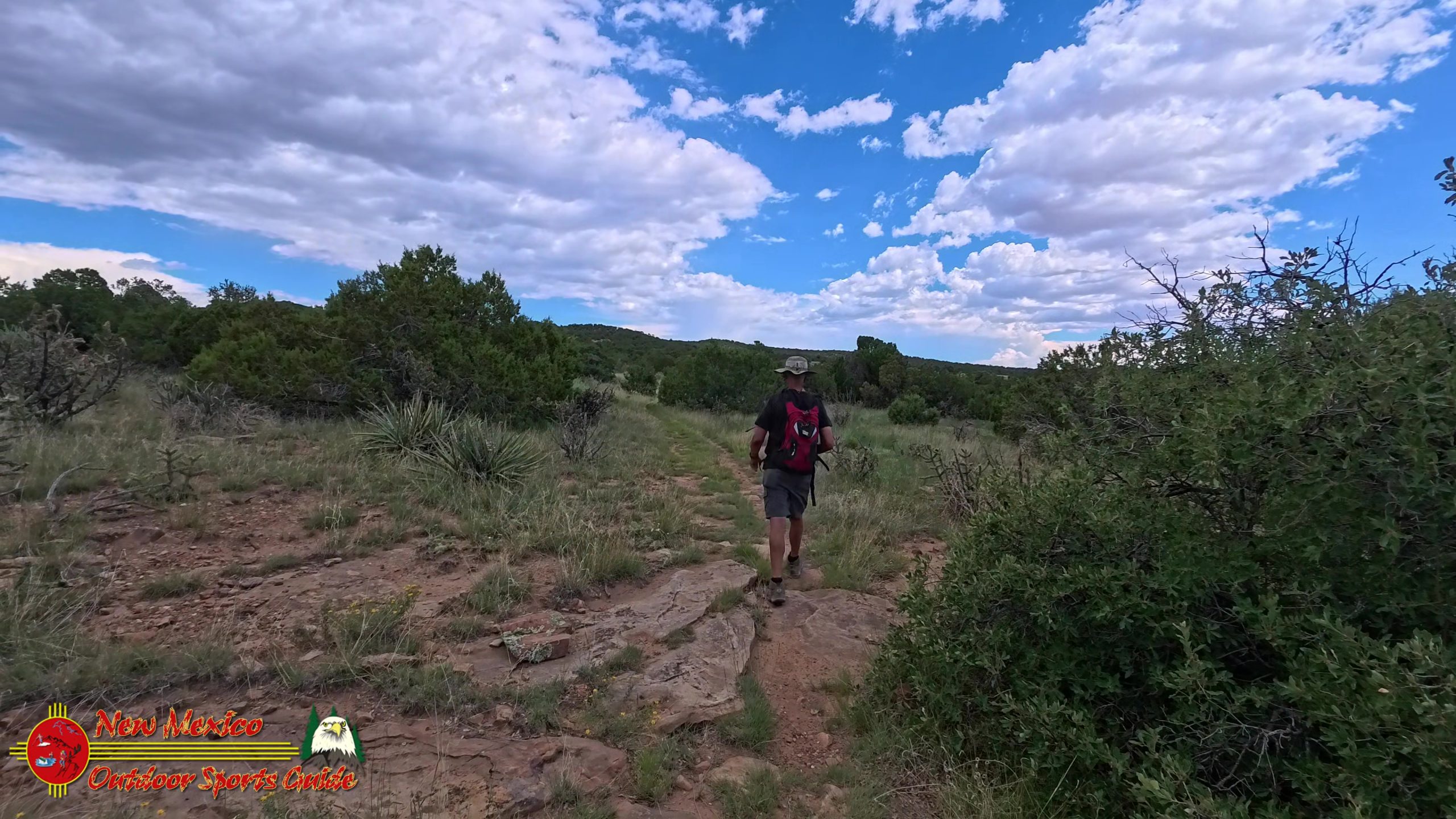
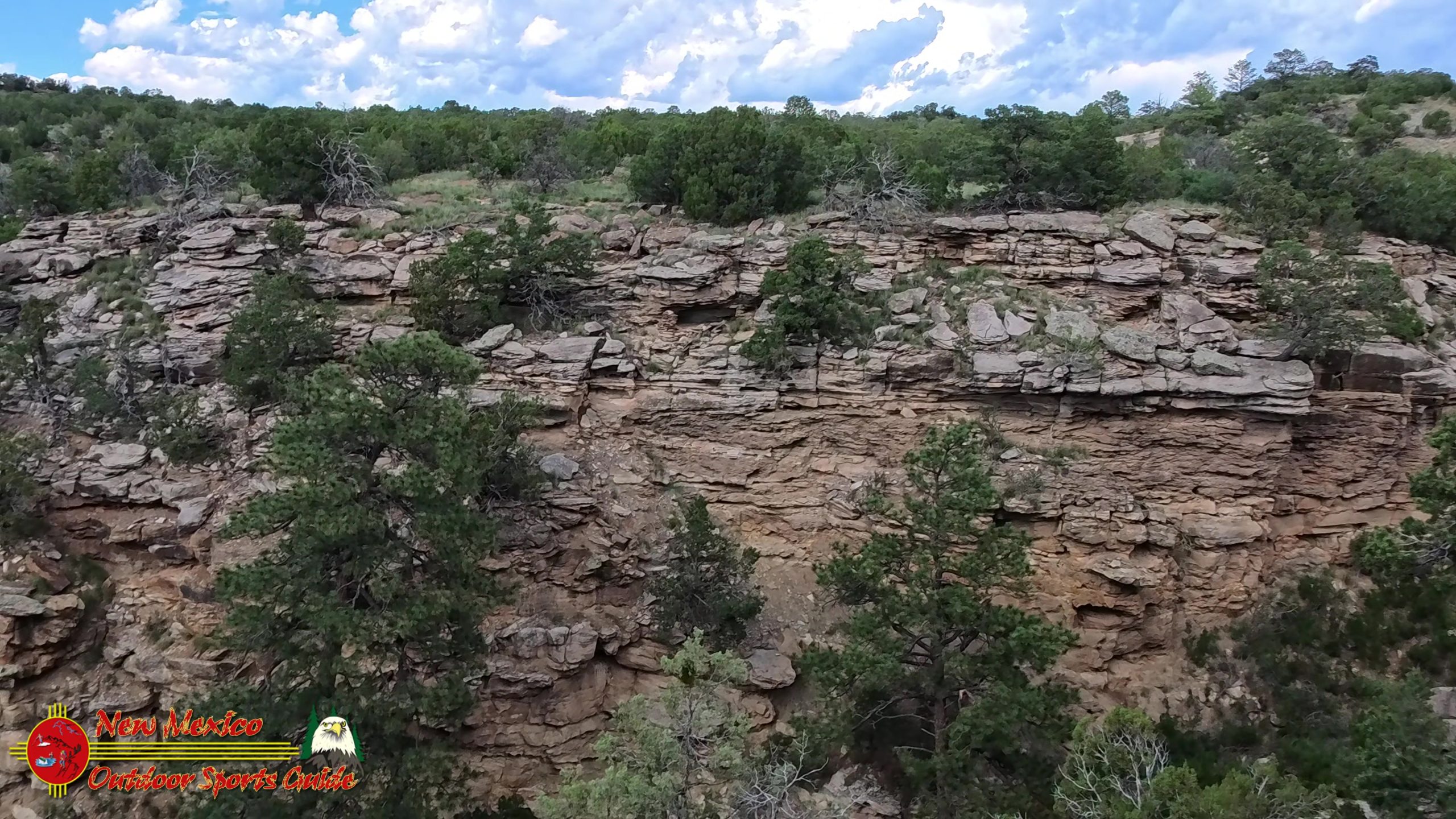
Our July 4th "wrong turn" had actually been a blessing in disguise. What should have been a 4.5-mile hike had stretched to 6 miles, but those extra miles had taken us deeper into country we'd never explored before. The terrain grew more rugged as we followed the Hidden Canyon Trail toward its namesake destination, with the path alternately climbing over rocky outcrops and descending into small arroyos.
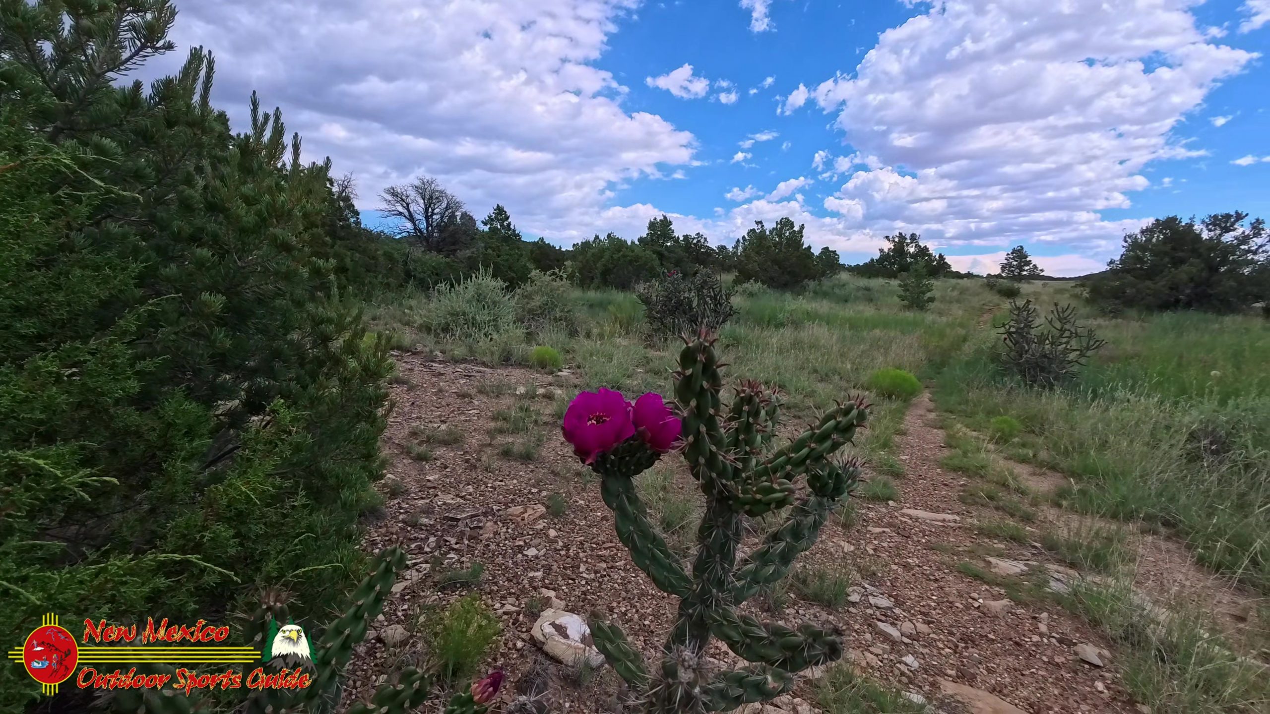
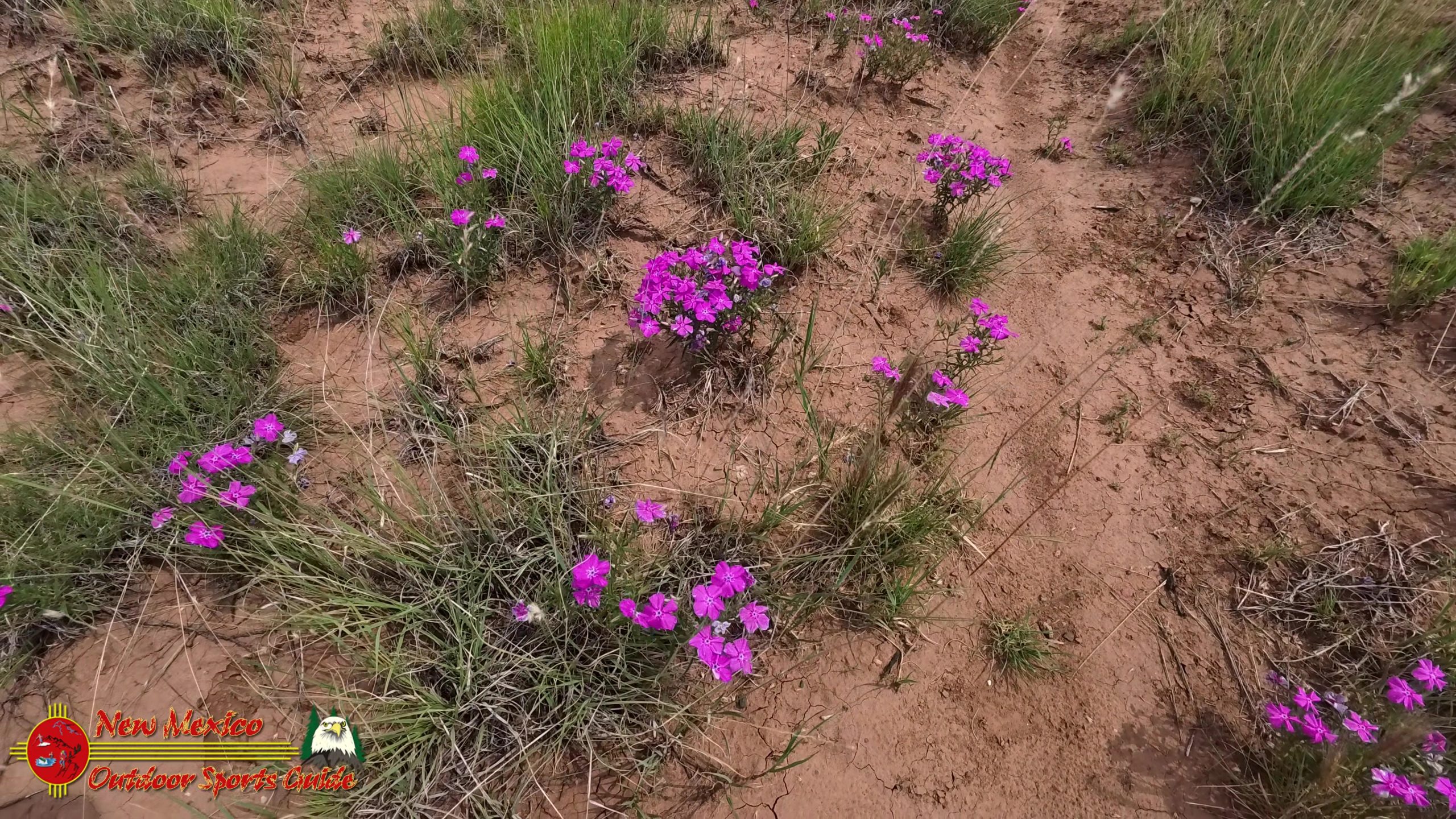
The seasonal wildflowers were putting on quite a show. Bright red cholla cactus blooms dotted the landscape like natural fireworks, their vibrant petals almost glowing in the high altitude sunlight. Indian paintbrush added splashes of orange and red, while purple lupine created stunning contrast against the pale green sage. After growing up on a ranch in the Kansas Flint Hills, where the palette was predominantly green and gold, I never tire of the dramatic color combinations this southwestern landscape serves up.
The Sangre de Cristo Mountains: Our Constant Companions
The Sangre de Cristo range has been our constant companion since we moved to Santa Fe, and on this particular morning, the mountains seemed especially magnificent. These peaks, whose name means "Blood of Christ" in Spanish, earn their moniker from the way they glow red and pink in the alpenglow of sunrise and sunset. Rising to over 13,000 feet in places, they form a dramatic backdrop to virtually every outdoor adventure in this part of New Mexico.
From our vantage point on the Hidden Canyon Trail, we could see how the mountains gradually give way to the high desert country that characterizes so much of the Southwest. It's a transition that never fails to impress me—the way snow-capped peaks can share the same view with cactus-studded mesas, the way alpine meadows exist just a few miles from desert arroyos. This is the kind of landscape that makes hiking near Santa Fe such a privilege.
Discovering the Hidden Canyon
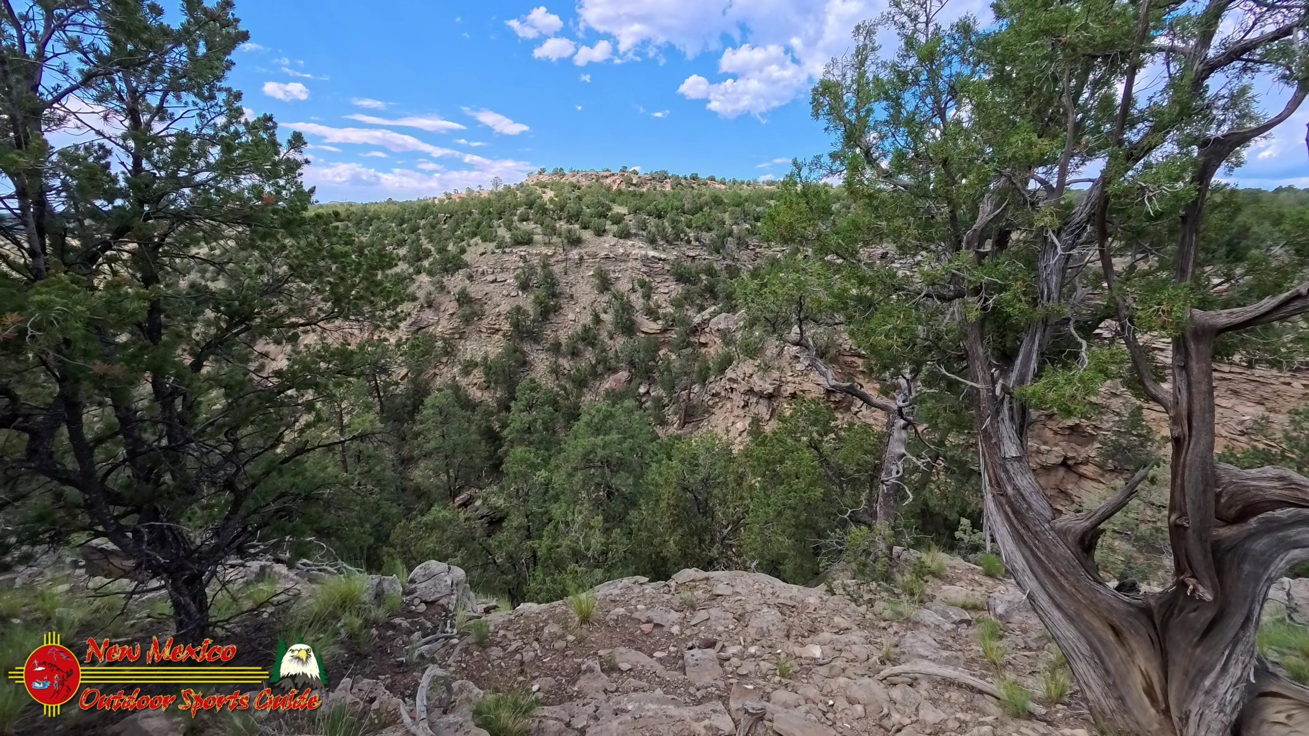
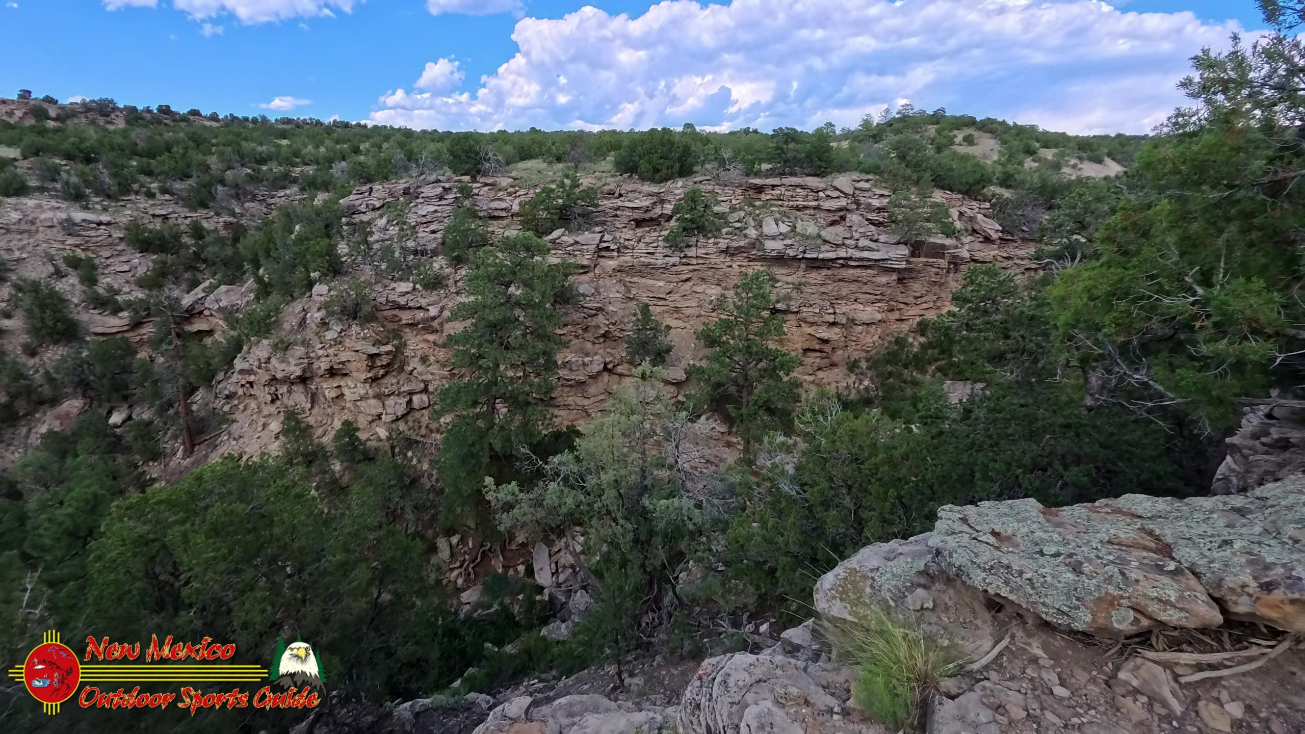
After about an hour of steady climbing, we finally reached the trail's destination: Hidden Canyon itself. The name proved apt—you don't see the canyon until you're practically on top of it, and even then, its depths remain largely concealed from casual observation. We found a comfortable spot on a rocky outcrop overlooking the canyon and settled in for a snack and some serious landscape photography.
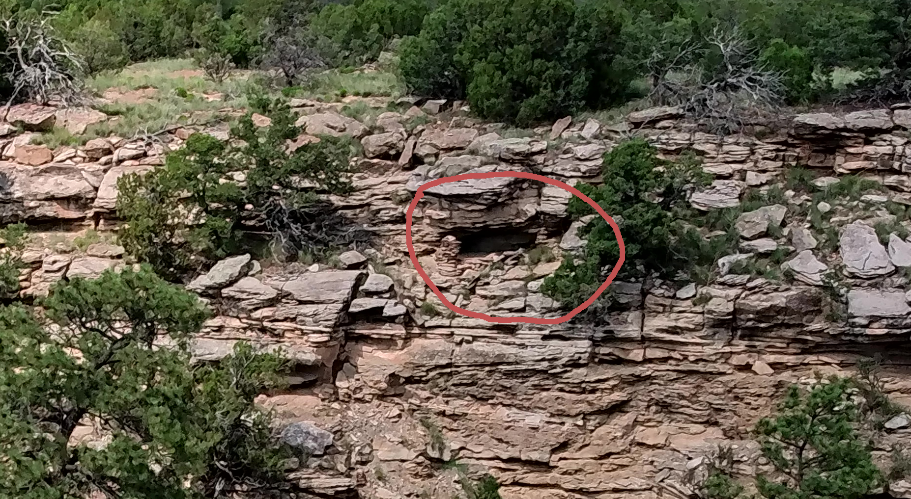
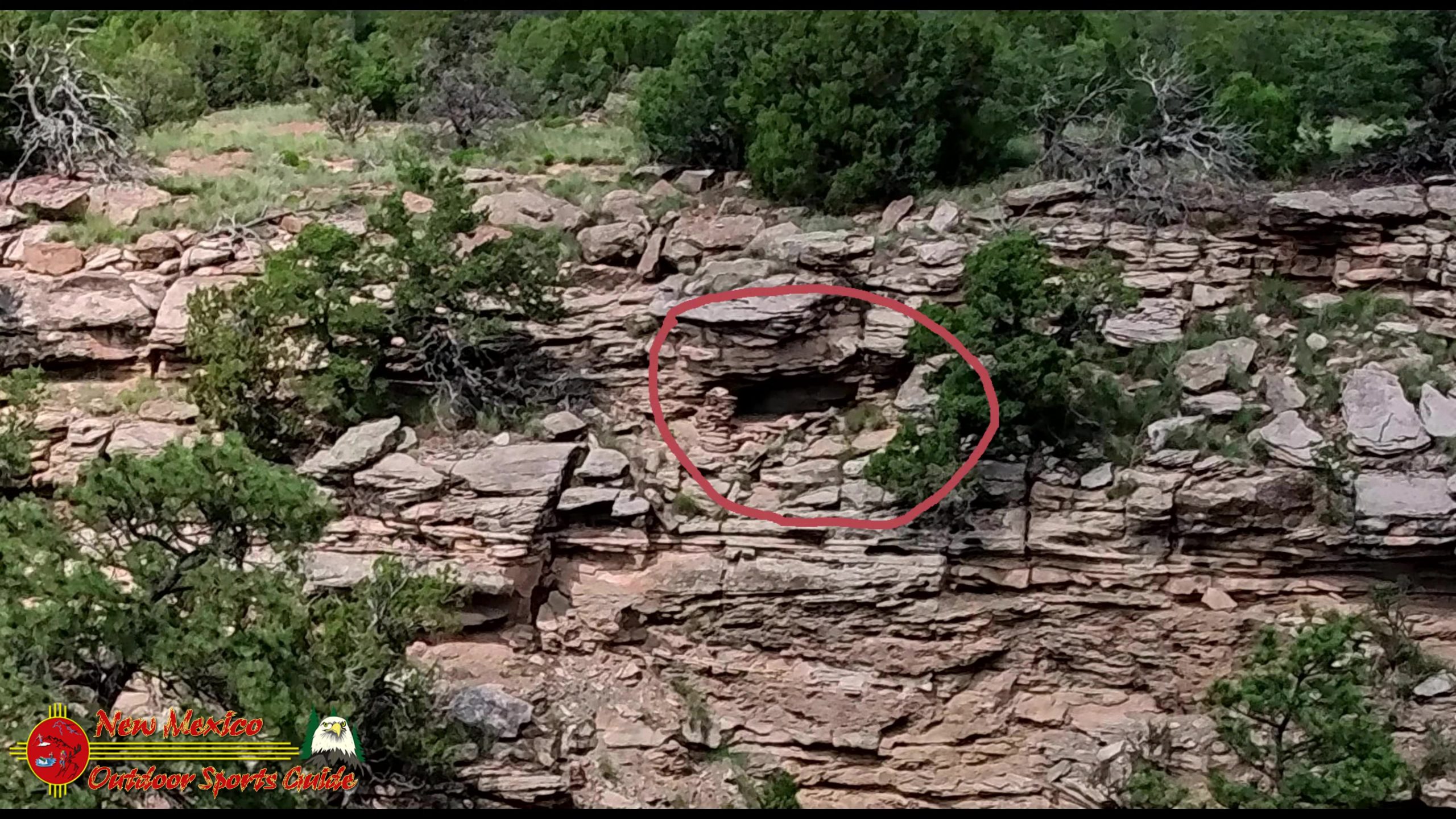
That's when I noticed something unusual on the opposite canyon wall. Through my camera's viewfinder, I was scanning the cliff face when something caught my eye—a symmetry too perfect to be natural. I adjusted my zoom and focused more carefully, and there it was: the unmistakable remains of a stone wall.
An Unexpected Archaeological Discovery
What we were looking at was clearly the remains of an ancient granary, tucked into a small cave about halfway up the opposite canyon wall. The placed stone walls on both sides of the cave opening were still visible, though weathered by centuries of wind and rain. Below the cave, we could make out debris that had tumbled down the cliff face over the years—likely the remains of additional wall construction.
Having spent considerable time exploring the well-preserved ruins in Bears Ears National Monument, we both recognized what we were seeing. The Ancestral Puebloans were master builders who took advantage of natural caves and overhangs to create storage facilities for their precious corn, beans, and squash. These granaries were often built in seemingly inaccessible locations, both to protect the stored food from raiders and to take advantage of the dry conditions that would help preserve the harvest.
When we returned home that evening, I spent time researching what we'd found. Surprisingly, this particular granary doesn't appear to be documented in any of the archaeological literature I could find online. That doesn't mean it's unknown to professionals—the area has been surveyed extensively—but it does suggest that Hidden Canyon still holds secrets waiting to be discovered by careful observers.
The Broader Archaeological Context
Our discovery fits perfectly into what we know about Ancestral Puebloan settlement patterns in the Galisteo Basin. The main villages were typically located on mesa tops or in the basin itself, where water and arable land were readily available. But the inhabitants also made extensive use of the surrounding canyon country, creating specialized sites for storage, defense, and resource procurement.
Granaries like the one we discovered were crucial components of the Ancestral Puebloan survival strategy. The ability to store surplus crops allowed these communities to survive periodic droughts and crop failures. The granaries were often built in locations that were difficult to access, requiring knowledge of specific routes and climbing techniques that would have been passed down through generations.
Views from the High Country
From our perch overlooking Hidden Canyon, the views extended far beyond the immediate canyon system. To the south, the Ortiz Mountains rose like a series of green islands from the desert floor. These mountains, rich in minerals and timber, would have been important resource areas for the ancient inhabitants of the Galisteo Basin. Turquoise was quarried from the Ortiz Mountains, and the distinctive blue-green stone became a trade item that connected the Galisteo Basin to communities throughout the Southwest.
Further south, the Sandia Mountains provided a dramatic backdrop to the basin country. On clear days like this one, the Sandias seem close enough to touch, their peaks etched sharp against the deep blue sky. The interplay of these different mountain ranges creates a landscape of incredible depth and complexity, a vista that changes throughout the day as the light shifts and shadows move across the terrain.
The Journey Back
As much as we would have loved to spend the entire day exploring Hidden Canyon and searching for additional archaeological sites, we knew we needed to allow enough time for the return journey. The hike back to the trailhead would be just over two miles, but in this country, you never know what might slow you down—a particularly photogenic wildflower display, an interesting rock formation, or simply the need to stop and appreciate the view.
The descent offered different perspectives on the landscape we'd climbed through earlier. The Galisteo Basin spread out below us, and from this angle, we could better appreciate the intricate network of arroyos and mesas that characterize this part of New Mexico. The town of Lamy was visible in the distance, a small cluster of buildings that serves as a reminder of the railroad era that brought significant change to this region in the late 1800s.
Reflections on a Lifetime of Hiking
At eighty-something years old, I've been privileged to hike trails across much of the American West. From the rolling grasslands of my Kansas boyhood to the dramatic peaks and valleys around our Angel Fire home, each landscape has taught me something different about the natural world and my place in it. But there's something particularly special about hiking near Santa Fe, where every trail seems to offer a perfect blend of natural beauty and human history.
The discovery of that hidden granary reminded me that this landscape is far from empty or uninhabited. For thousands of years, people have called this country home, developing sophisticated ways of life that were perfectly adapted to the challenges and opportunities of the high desert. Their presence is still written in the landscape, visible to those who know how to look.
The Ongoing Adventure
Our "wrong turn" on July 4th had led to a wonderful discovery, but it also raised new questions. Were there other archaeological sites in Hidden Canyon? What about on the mesa tops and in the side canyons we hadn't explored? The limited time we'd spent in the area suggested that much more remains to be discovered by patient and observant hikers.
This is one of the things I love most about hiking near Santa Fe—the sense that every trail holds the possibility of discovery. Whether it's a new wildflower species, a different view of familiar mountains, or the remains of an ancient granary, this landscape never stops teaching and surprising those who take the time to really look.
As we reached the trailhead and loaded our gear back into the Outback, Paulette and I were already planning our next visit to Hidden Canyon. Next time, we'll bring more water, allow more time, and perhaps invest in some serious binoculars for scanning the canyon walls. The granary we discovered is just the beginning of what this remarkable landscape has to offer.
The Gift of Place
Living in Santa Fe, with easy access to trails like Hidden Canyon, feels like a gift that keeps giving. Every morning, I wake up to views of the Sangre de Cristo Mountains, and every day offers the possibility of new discoveries in the high desert country that surrounds our home. After decades of exploring the American Southwest, I'm still amazed by the depth and complexity of this landscape, by the way it rewards careful observation and patient exploration.
The Hidden Canyon Trail, with its unexpected archaeological treasures and sweeping views of the Galisteo Basin, represents everything I love about hiking near Santa Fe. It's accessible enough for regular exploration but challenging enough to keep things interesting. It offers solitude and natural beauty while connecting us to the deep human history of this remarkable region.
Our July 8th hike might have been planned as a simple redux of our earlier adventure, but it turned into something much more significant—a reminder that the best discoveries often come when we're open to the unexpected and willing to look beyond the obvious. In Hidden Canyon, we found not just an ancient granary, but a deeper connection to the landscape and history that make this corner of New Mexico so special.
As the sun set over the Galisteo Basin that evening, painting the sky in shades of red and orange that would have made those ancient pottery makers proud, I felt grateful for the wrong turn that led us to Hidden Canyon, and for all the adventures that still await us in this magnificent country we're privileged to call home.

0 Comments