

Grand Lake to Long Draw Road and the Trek to the Headwaters
The aroma of fresh-brewed coffee filled our Grand Lake cabin as I stared out the window at a decidedly gray morning. The mountain peaks behind Shadow Mountain Lake had vanished completely into a thick blanket of clouds—the kind of obstinate overcast that makes you wonder if you've made a terrible mistake planning an outdoor adventure. But the weather forecast on my phone told a different story: clearing by midday. After spending a lifetime reading weather patterns from ranch country in the Kansas Flint Hills to the high peaks of New Mexico, I've learned that mountain weather is as fickle as a spooked mustang, but when the forecasters say it'll clear, you roll the dice and trust your luck.
After a hearty breakfast—the kind that sticks to your ribs for a long day ahead—Paulette and I loaded up the Outback with our gear: cameras, GPS, drone equipment, water, snacks, and all the essentials for what promised to be a three-hour drive to the Colorado River Headwaters trailhead at the end of Long Draw Road. The big question mark hanging over the expedition wasn't the distance or the terrain—it was snow. How deep would it be on Long Draw Road? Would we even make it to the trailhead?
The Journey Begins: From Grand Lake to Walden
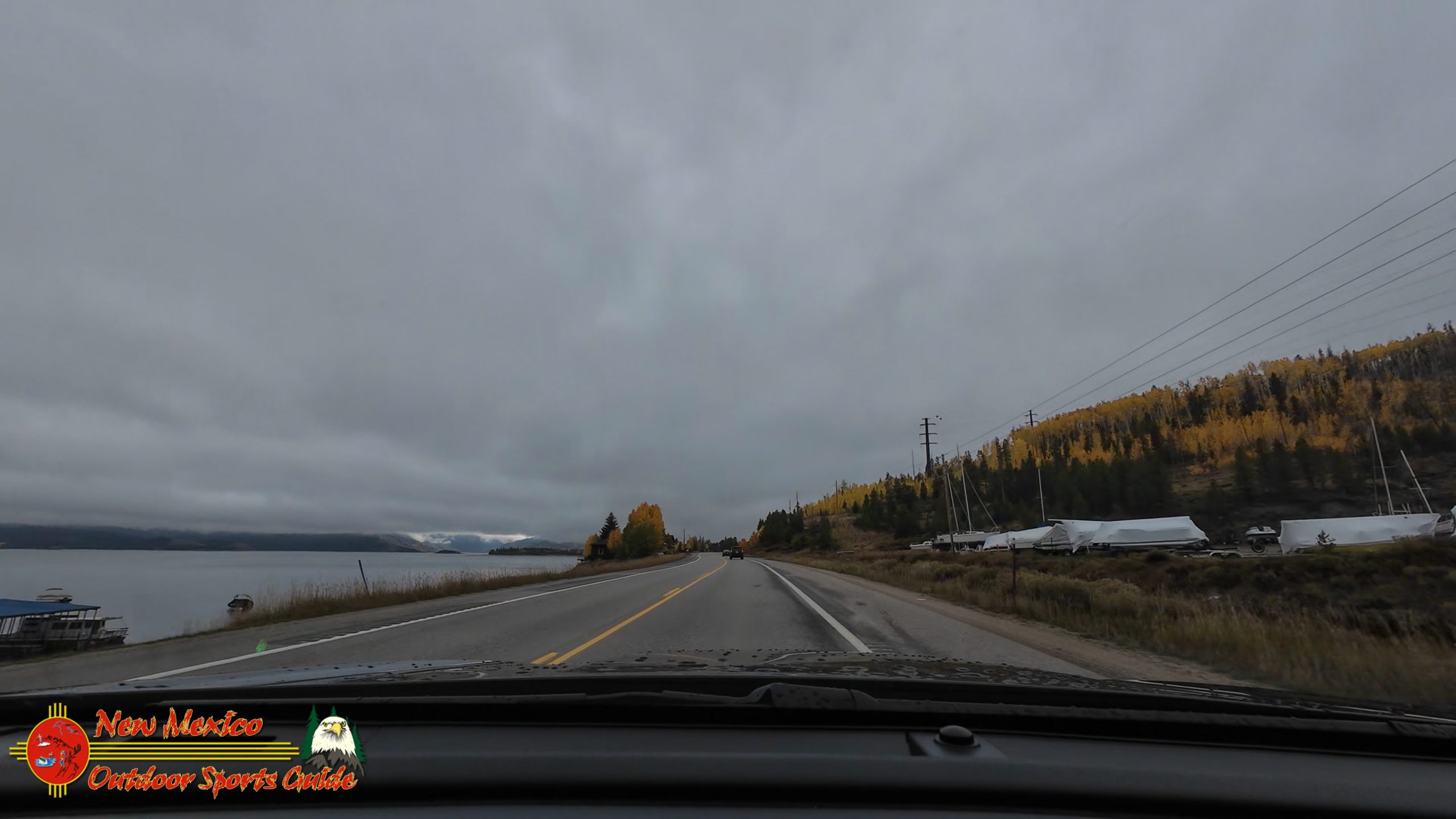
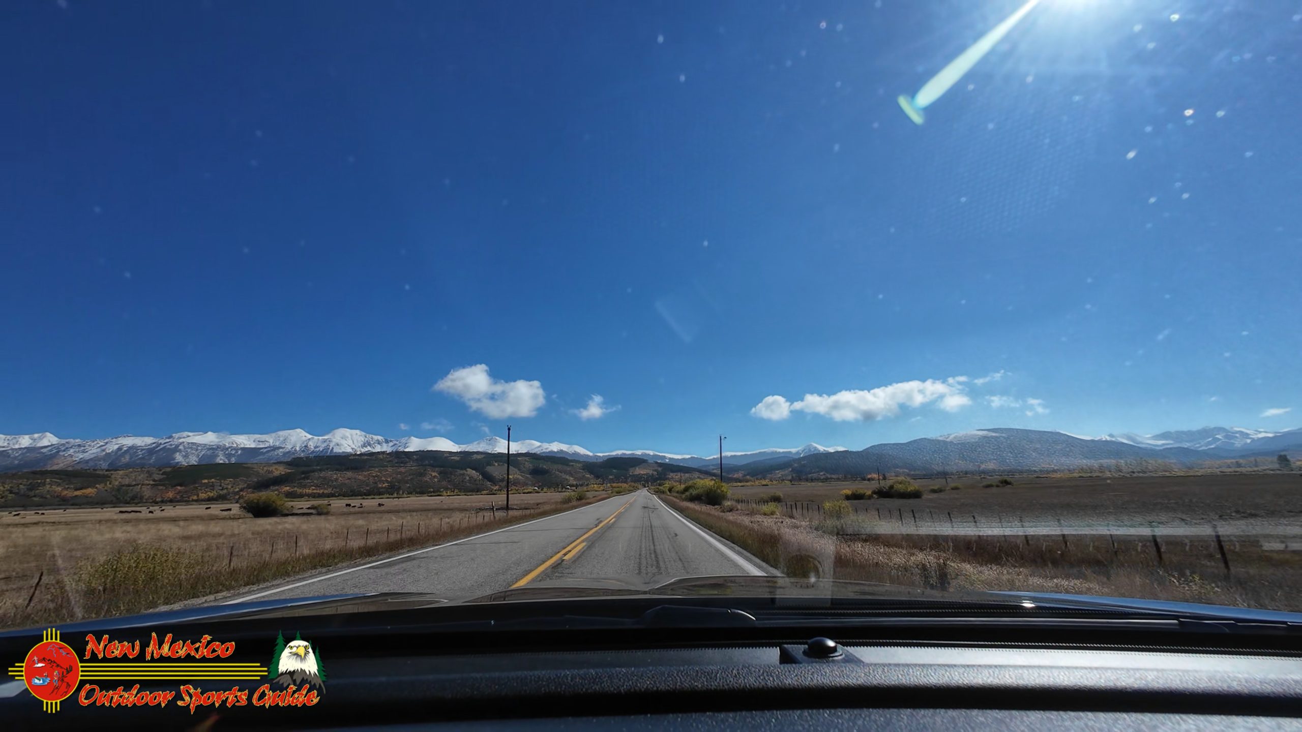
The initial drive past Shadow Mountain Lake and Lake Granby was, to put it mildly, pretty dismal. The overcast skies pressed down on the landscape like a heavy wool blanket, muting everything to shades of steel gray and pewter. The lakes, usually so vibrant and inviting, looked cold and uninviting. For someone who's spent decades photographing and filming the American Southwest, I know the difference good light makes, and this wasn't it.
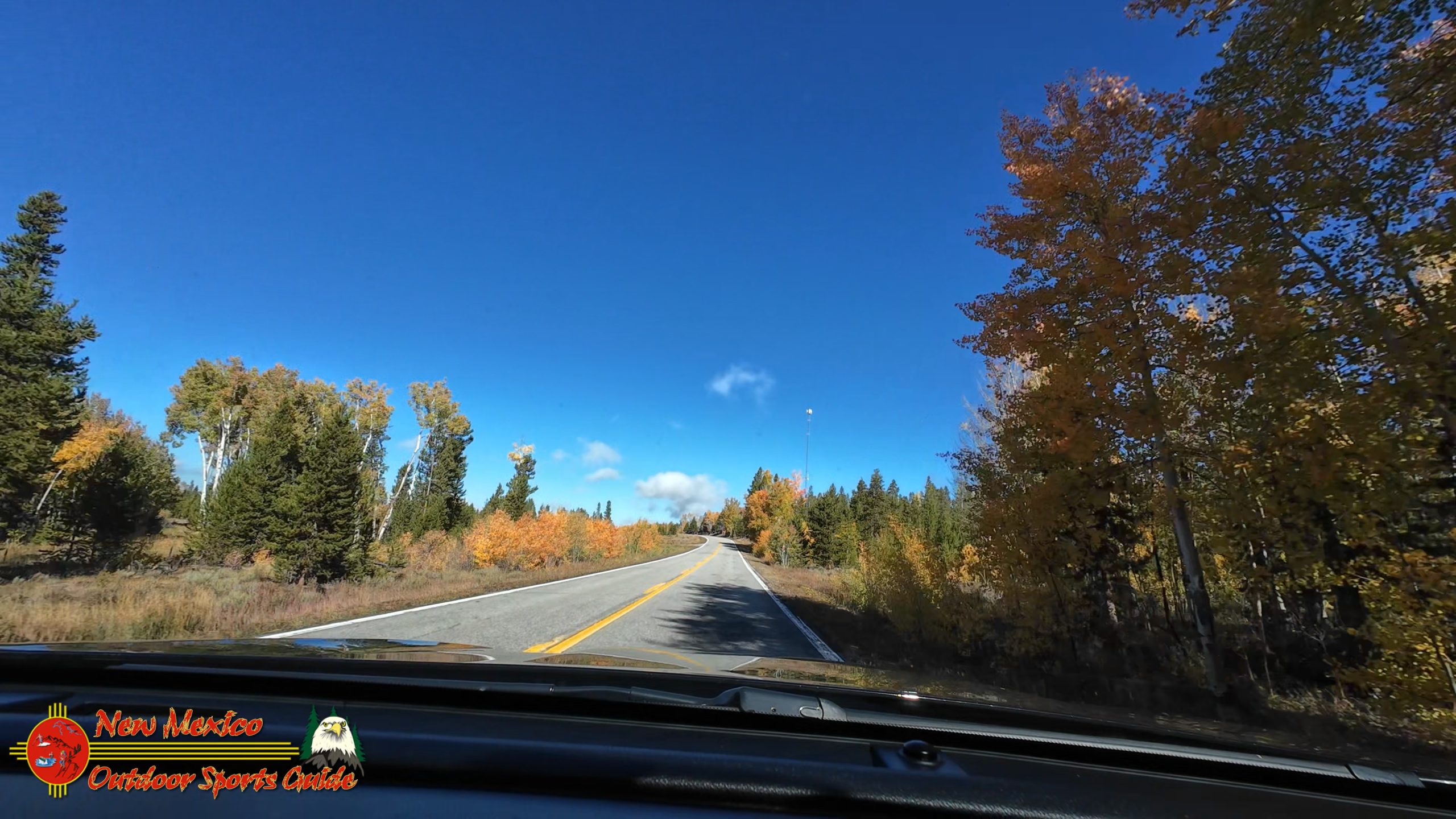
But then, about halfway to Walden, something magical happened—the kind of transformation that reminds you why you keep coming back to these mountains. The clouds began to break apart like ice floes in spring runoff, and suddenly golden autumn light came flooding through in spectacular shafts. The fall colors along the roadway—aspens in brilliant yellow, willows in bronze and crimson, scrub oak in deep burgundy—lit up like Christmas lights strung across the high country. And there, in the distance, the mountain ranges revealed themselves, their peaks freshly dusted with snow, standing proud against a clearing sky.
My fingers, which had been crossed figuratively, tightened on the steering wheel with renewed optimism. Maybe, just maybe, the snow conditions on Long Draw Road would be manageable.
Long Draw Road: A Gamble That Paid Off
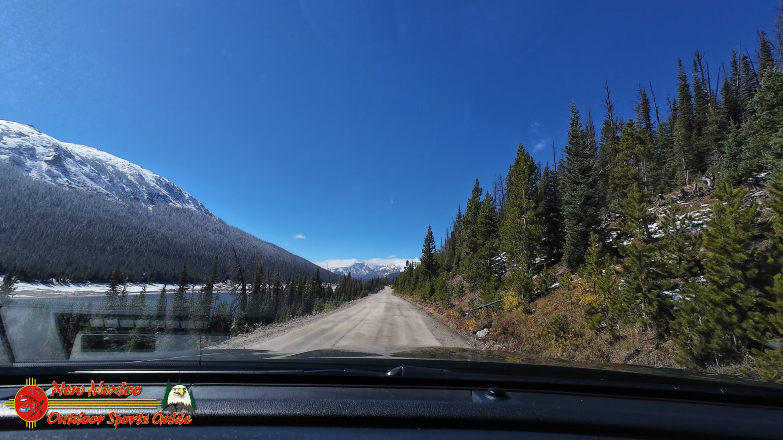
Arriving at the turnoff to Long Draw Road, we caught our break. Just three or four inches of snow covered the unpaved forest road, and fresh tire tracks carved through the white powder indicated we wouldn't be alone in our quest. That was reassuring—both from a safety standpoint and because it meant the road was passable.
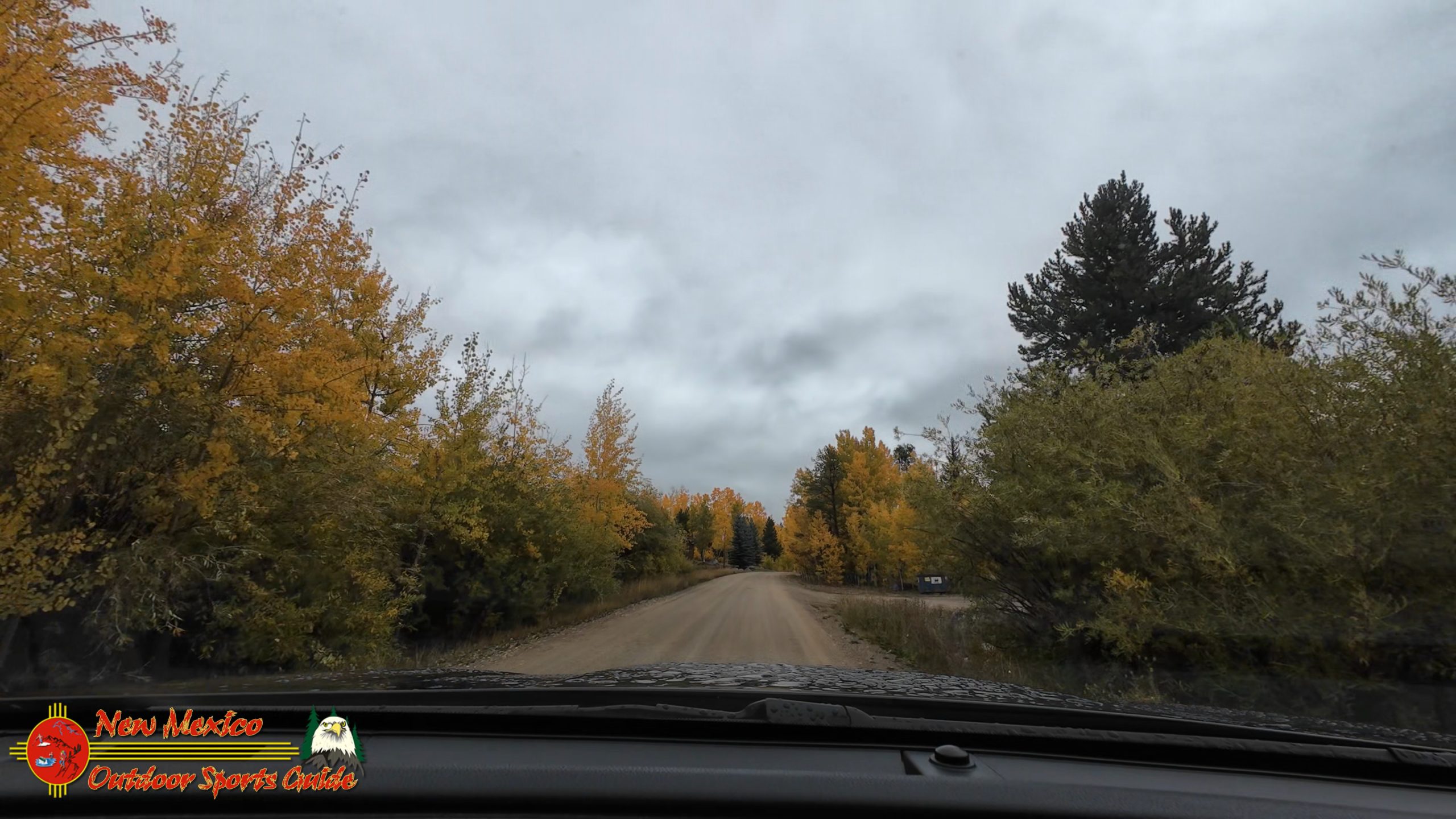
About five miles in, the character of the road changed dramatically. The snow had melted away almost completely, leaving us on reasonably dry dirt and gravel. We weren't sliding through mud, and the Outback's all-wheel drive was handling the conditions beautifully. With each passing mile, I could feel the tension in my shoulders easing. This was actually going to work.
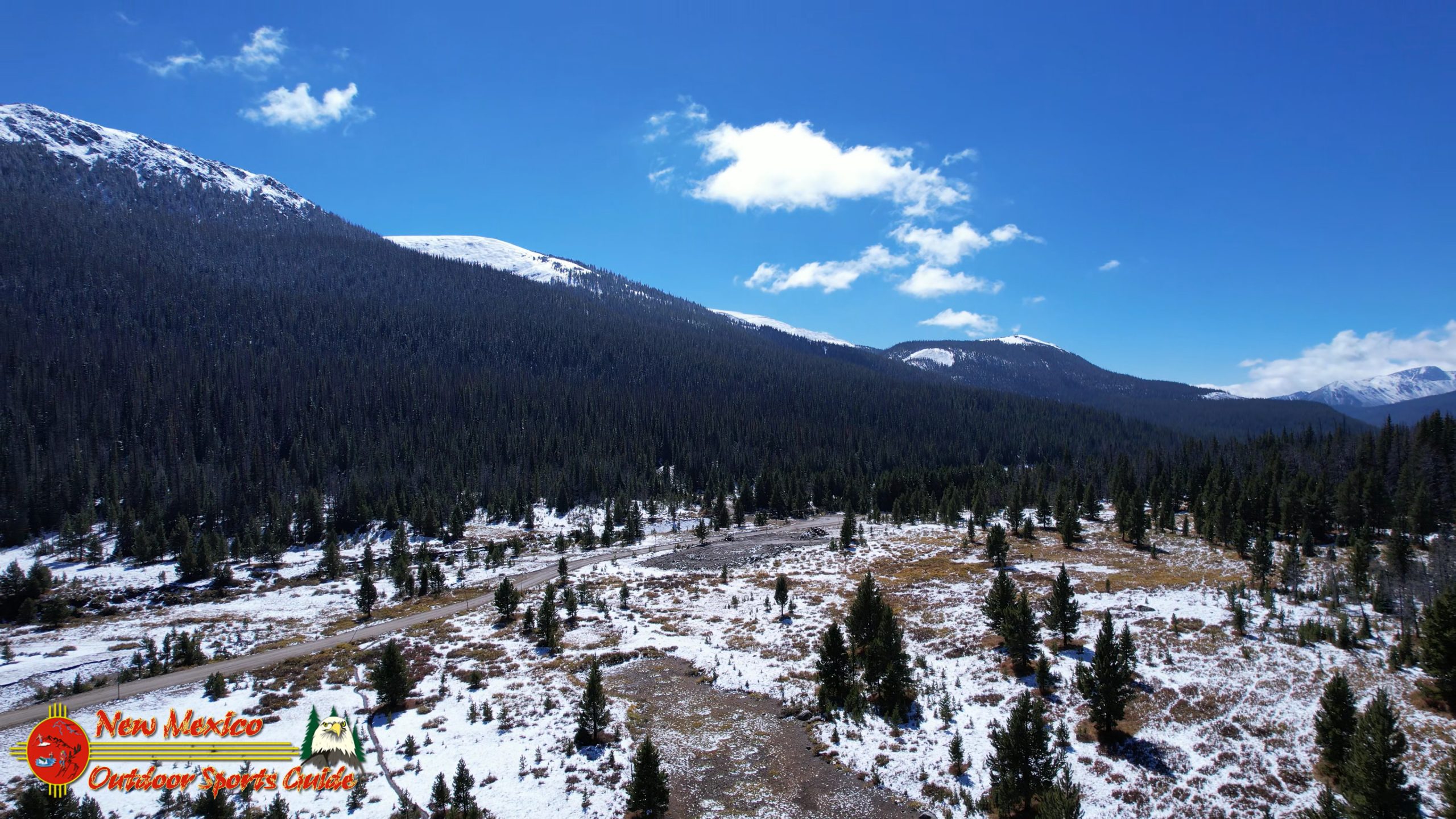
Long Draw Road is one of those spectacular Colorado backroads that seems to exist in a world apart. It winds through the Routt National Forest, climbing steadily through pine and spruce forests, opening up into high alpine meadows, and offering glimpses of the kind of wilderness that drew me to the mountains in the first place. The road gets its name from the "long draw" or valley it follows—a gentle, extended drainage that collects snowmelt from the surrounding peaks.
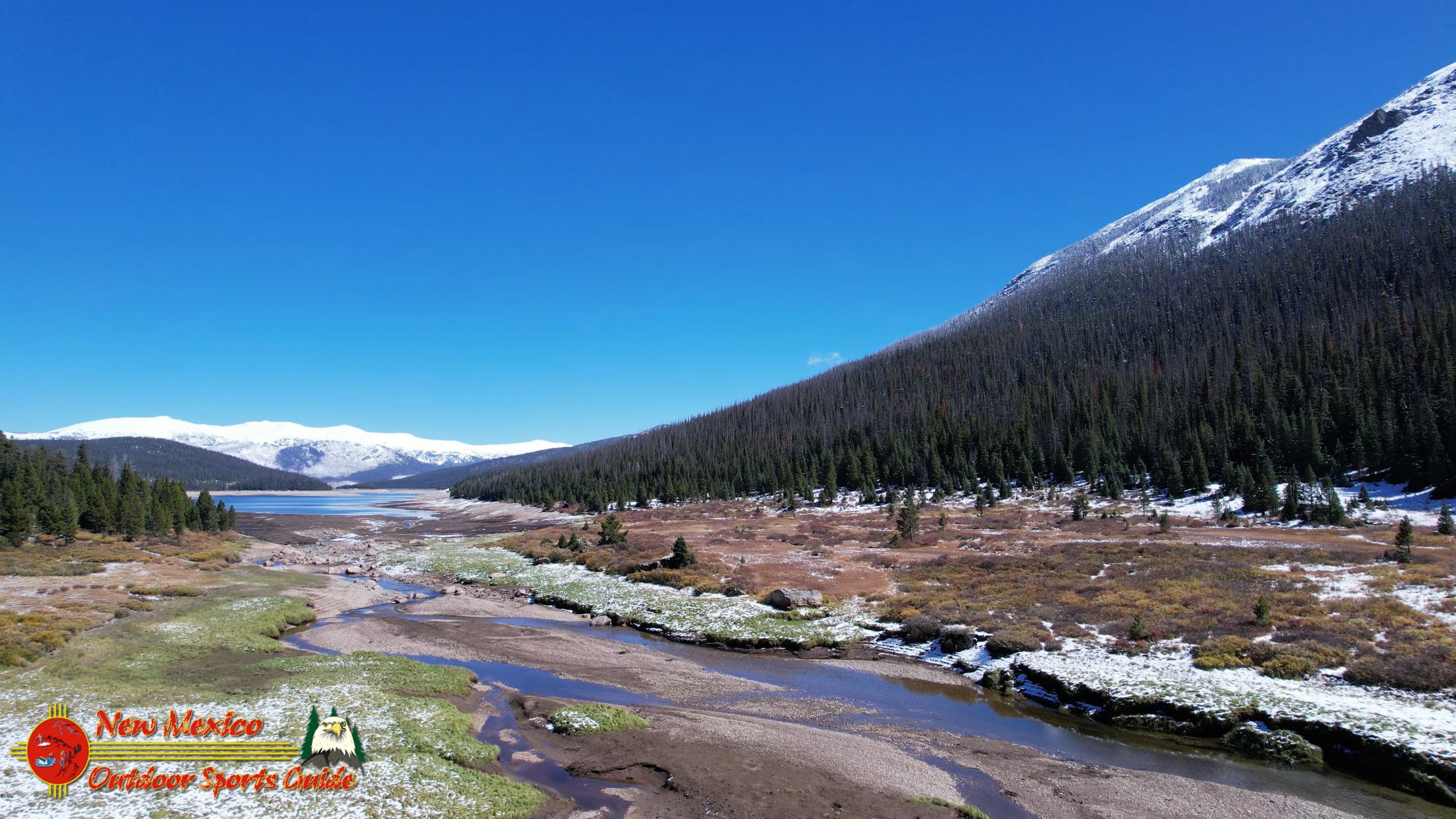
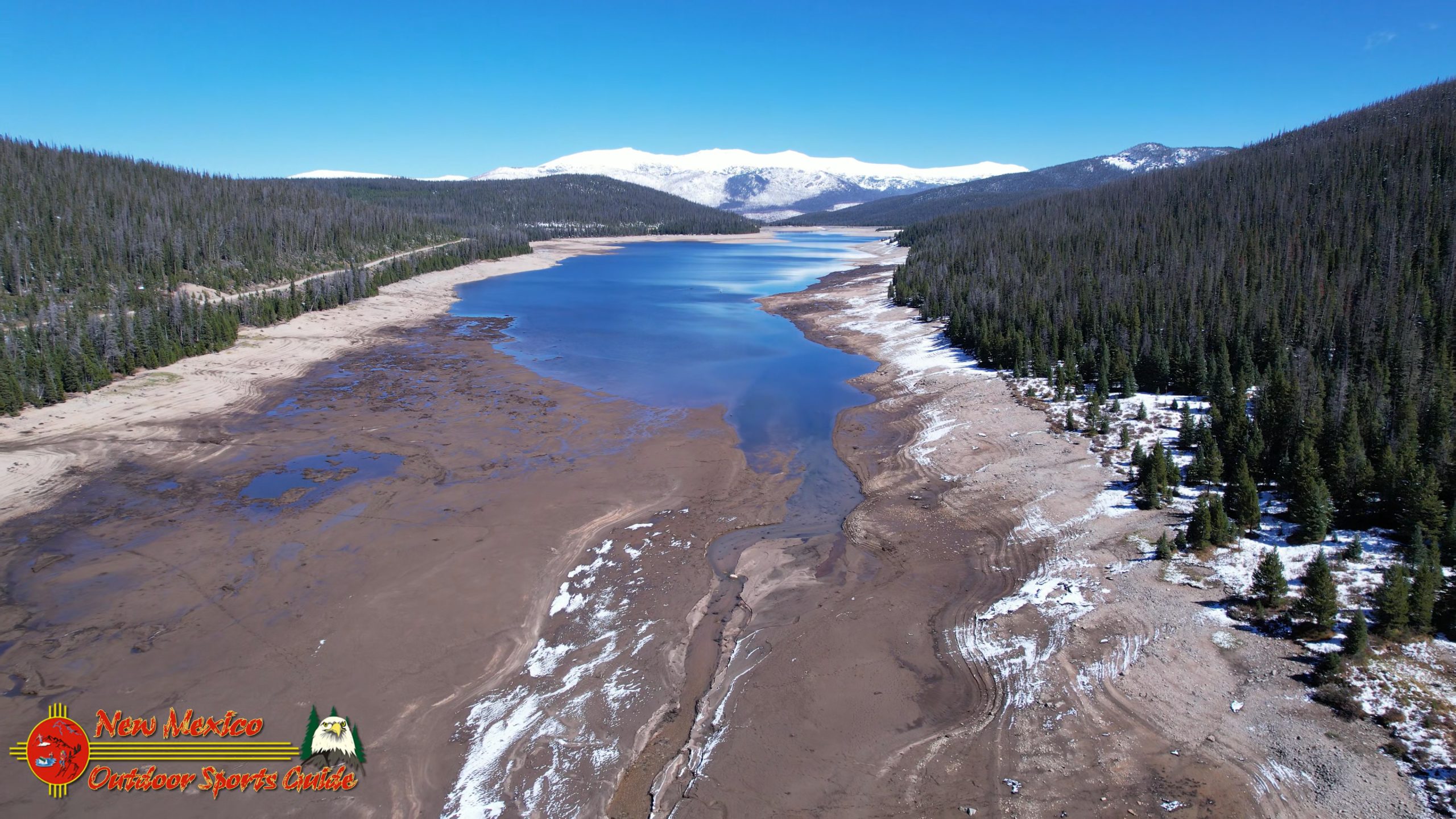
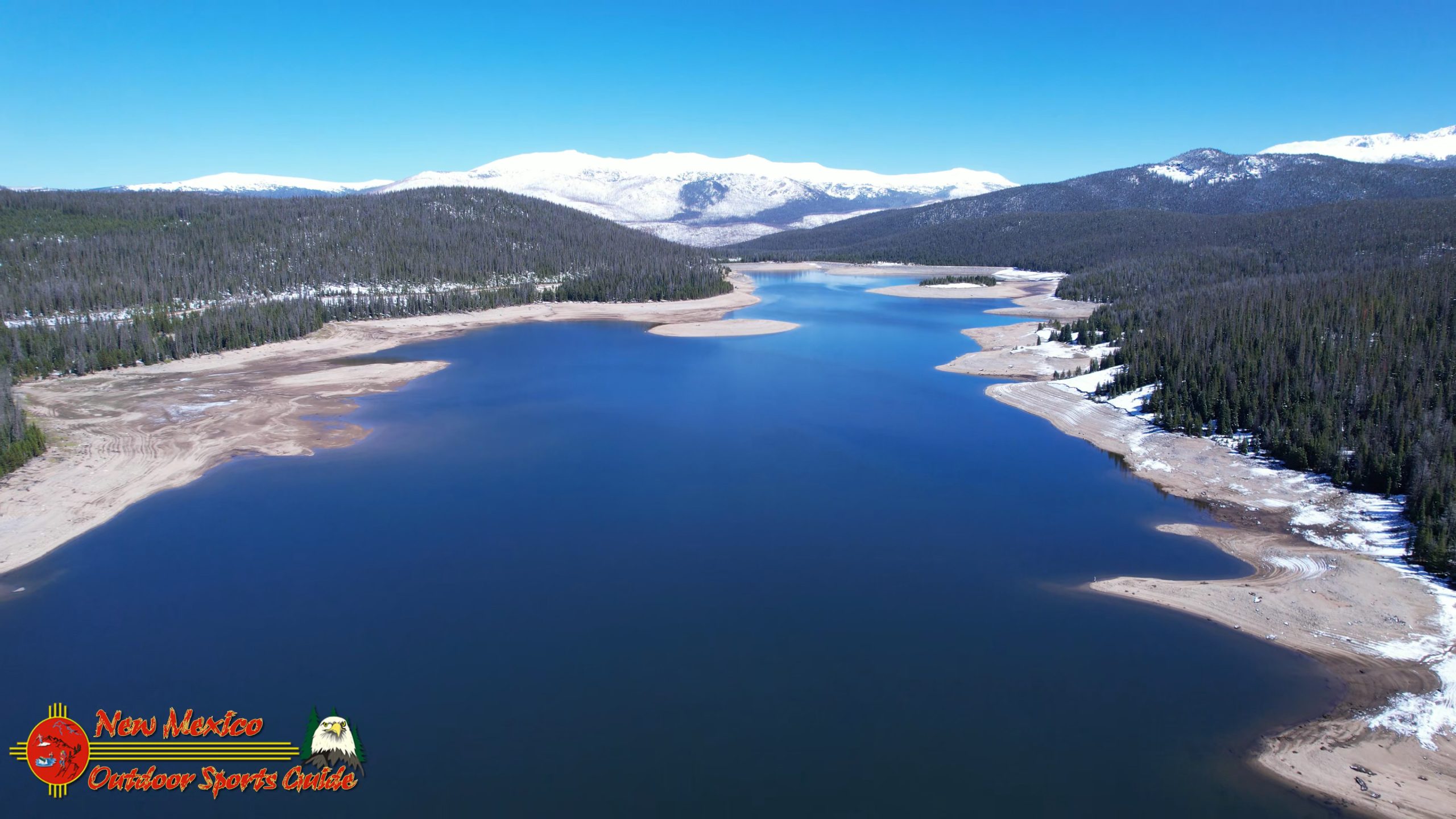
By the time we passed Long Draw Reservoir—a beautiful high-country impoundment that serves as part of the Cache la Poudre River water system—I was relaxed enough to truly absorb the spectacular scenery unfolding around us. The reservoir itself was partially frozen at its edges, its deep blue waters reflecting the now-clearing sky. The surrounding peaks, mantled in fresh snow, created a stunning backdrop that had my photographer's eye constantly searching for the next perfect shot.
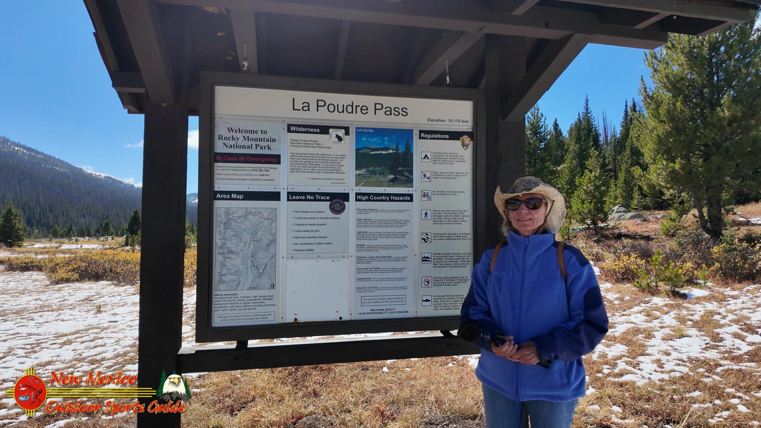
LaPoudre Pass Trailhead: Lunch and Reconnaissance
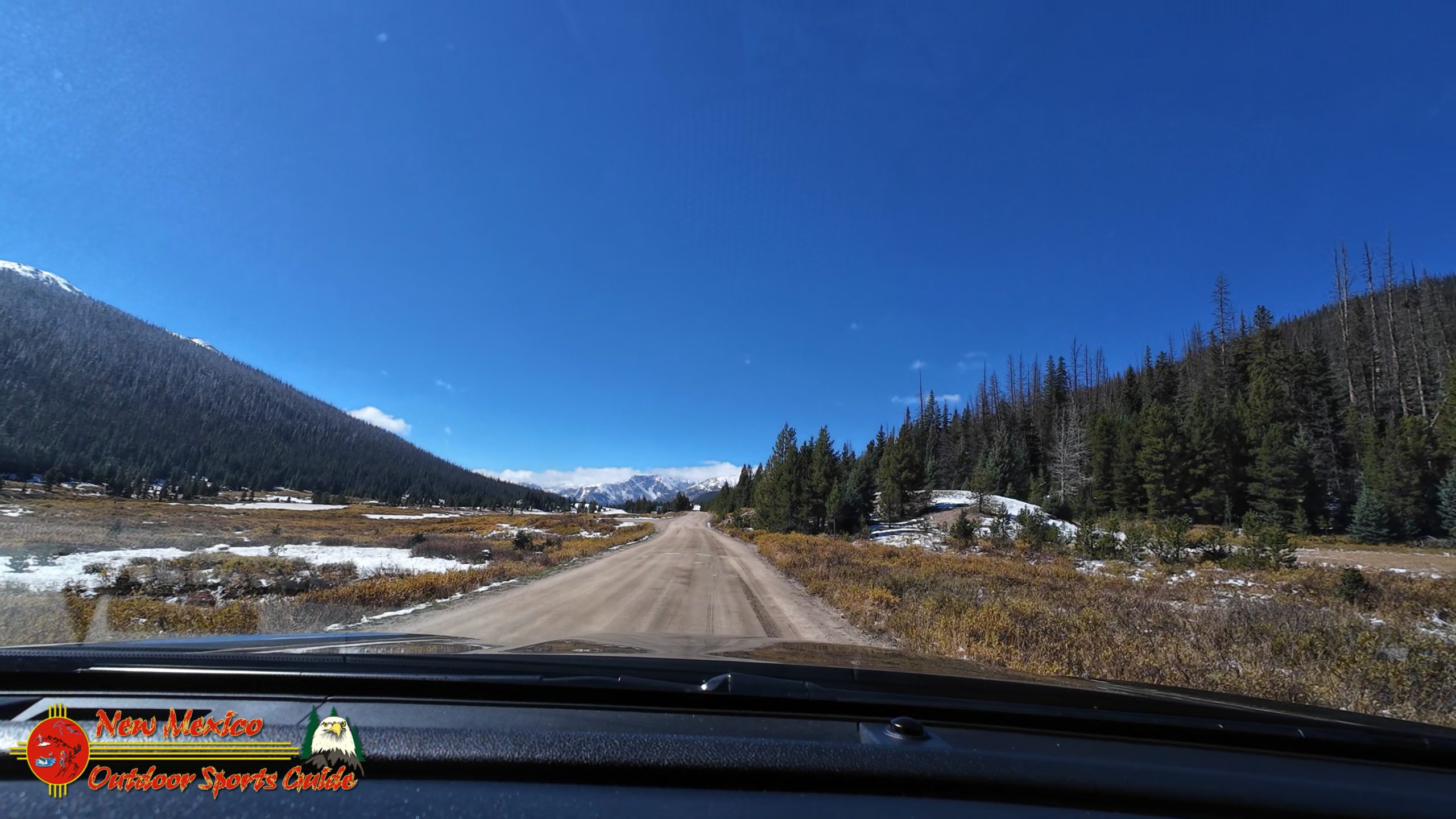
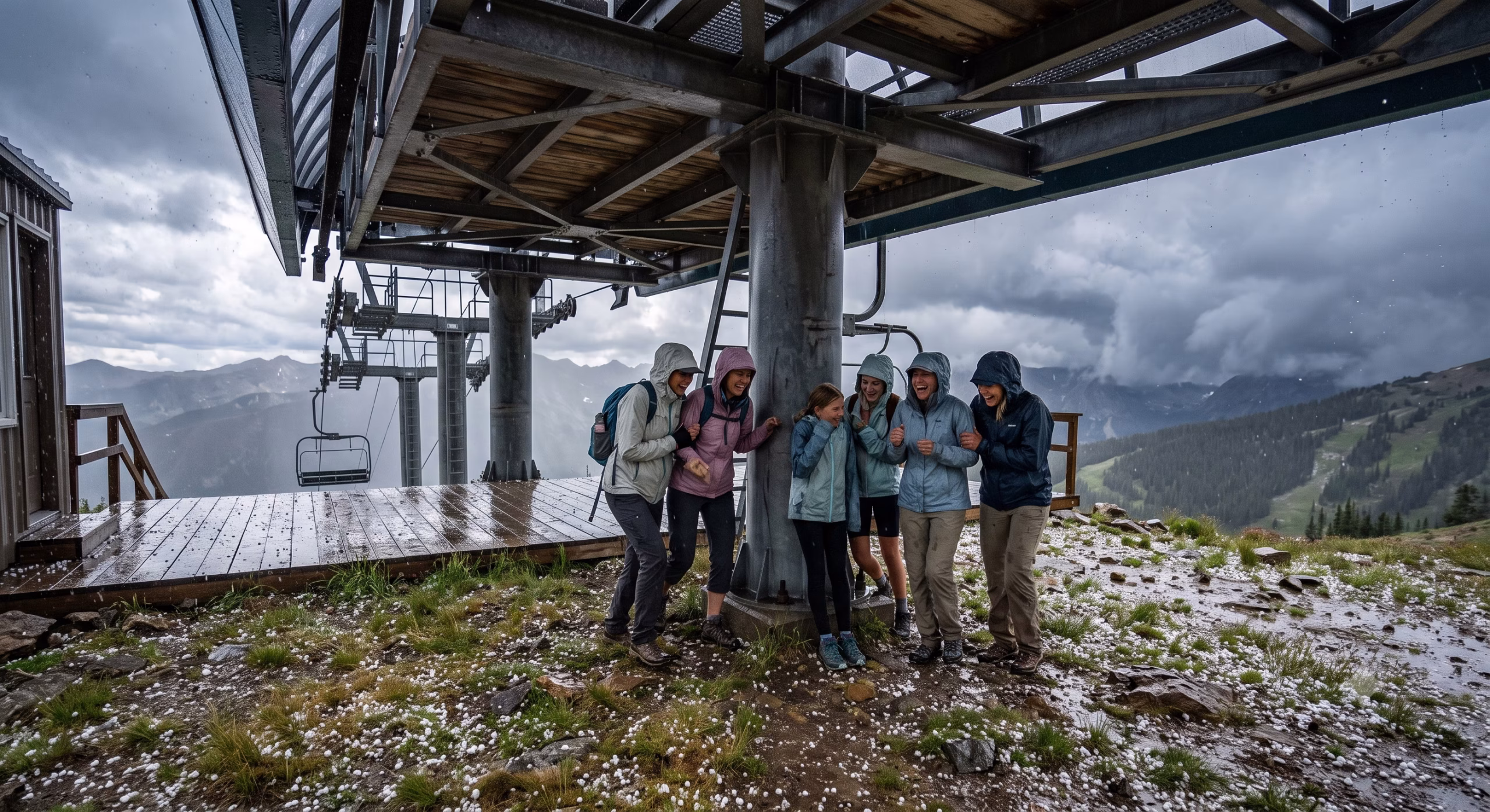
We rolled into the LaPoudre Pass Trailhead near noon, right on schedule. The parking area was empty except for one other vehicle, and the silence of the high country was almost overwhelming—the kind of quiet that seems to press against your ears after the steady hum of highway driving.
After a quick lunch, I unpacked the drone. This was reconnaissance as much as photography. I wanted aerial footage of Long Draw Reservoir, the Poudre River diversion structures, and most importantly, a bird's-eye view of the long headwaters valley that was our ultimate destination. As the drone climbed and the camera panned across the landscape, I was struck by the sheer scale of this alpine watershed. The valley stretched out like a massive collection basin, a natural funnel for winter snowpack that would eventually become the mighty Colorado River.
At the far end of the headwaters valley, I pivoted the drone south and captured something that gave me goosebumps—a long-distance view of the areas where Paulette and I had been hiking just two days earlier along the Colorado River in Rocky Mountain National Park. Seeing the connection between these places from above, understanding the flow and geography in a way that ground-level hiking can never quite reveal, was profoundly satisfying.
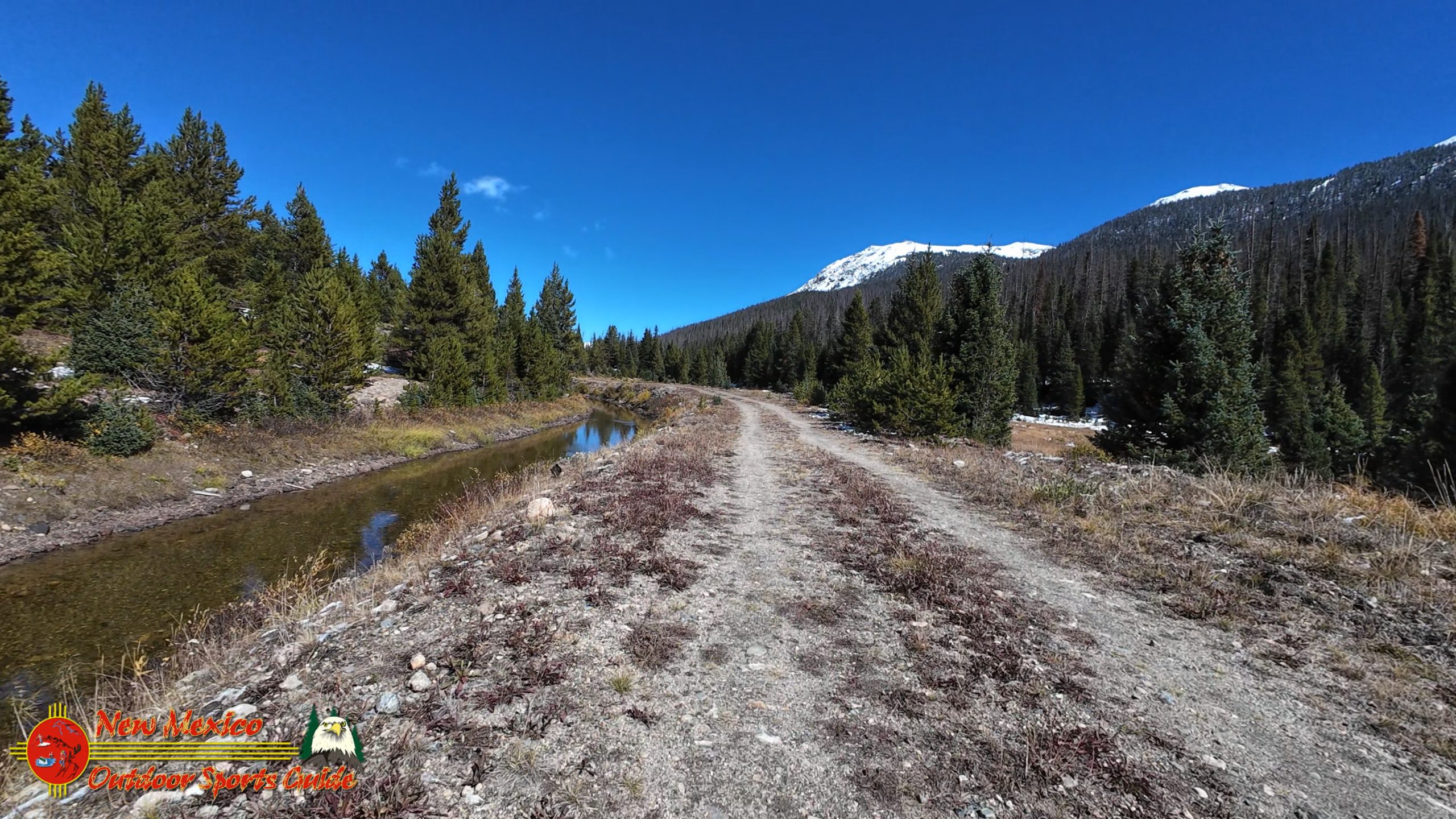
The Trek Begins: Following LaPoudre Creek
After lunch, we shouldered our day packs and started down the trail. The path followed LaPoudre Creek—also known as Cache la Poudre River—downstream for about a mile to where a bridge should cross, leading to the trail toward the Colorado River headwaters. The Cache la Poudre is itself a significant Colorado waterway, flowing east from these mountains through Fort Collins and eventually joining the South Platte River. The name, which translates to "cache of powder" in French, comes from French fur trappers who reportedly buried gunpowder along its banks during a snowstorm.
But when we reached the bridge location, our hearts sank. The bridge was completely washed out—victim to the powerful spring runoff that these mountains produce. Standing there looking at the gap, I felt that familiar tug between disappointment and problem-solving that comes from a lifetime of ranching, construction work, and wilderness adventures. You don't turn back at the first obstacle; you find another way.
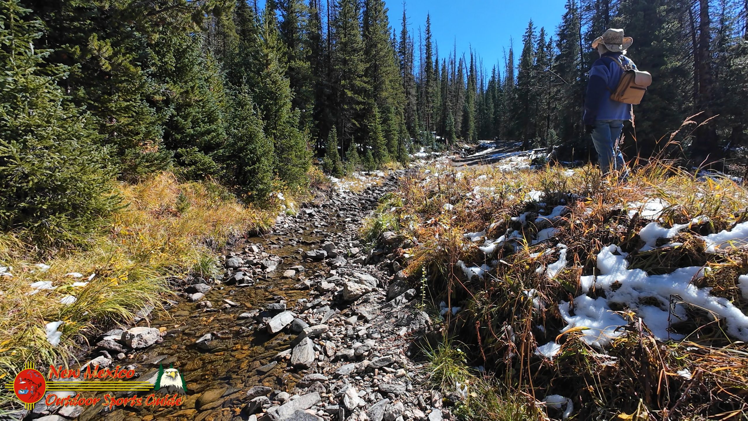
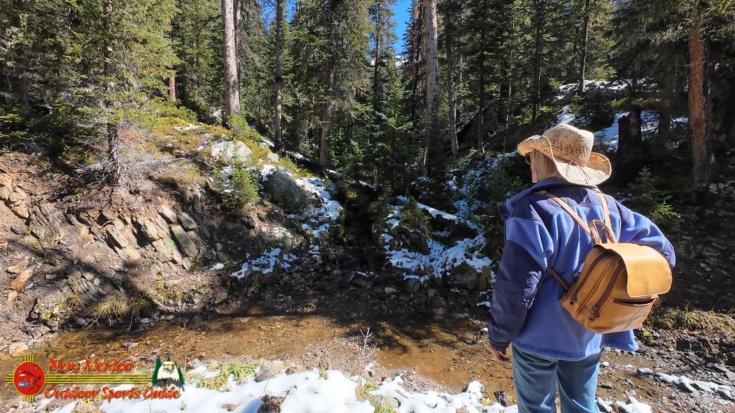
Scanning my GPS map, I spotted another bridge marked about a mile upstream. Fingers crossed again—seems like this entire expedition was a series of small gambles and calculated risks. We trekked on, following the creek upstream through beautiful riparian habitat where willows crowded the banks and the water sang over rounded stones.
The relief when we found the second bridge intact was palpable. This one looked solid, well-maintained, crossing LaPoudre Creek at a point where the water ran clear and fast over a rocky bed. We crossed carefully and began backtracking downstream on the opposite bank, now headed toward our ultimate goal.
Finding the Headwaters: A Test of Navigation and Persistence
Here's where things got interesting. I had only a GPS waypoint marking the location of a sign designating the official Colorado River Headwaters. No detailed trail description, no photographs showing what to look for—just coordinates and faith that we'd recognize it when we saw it.
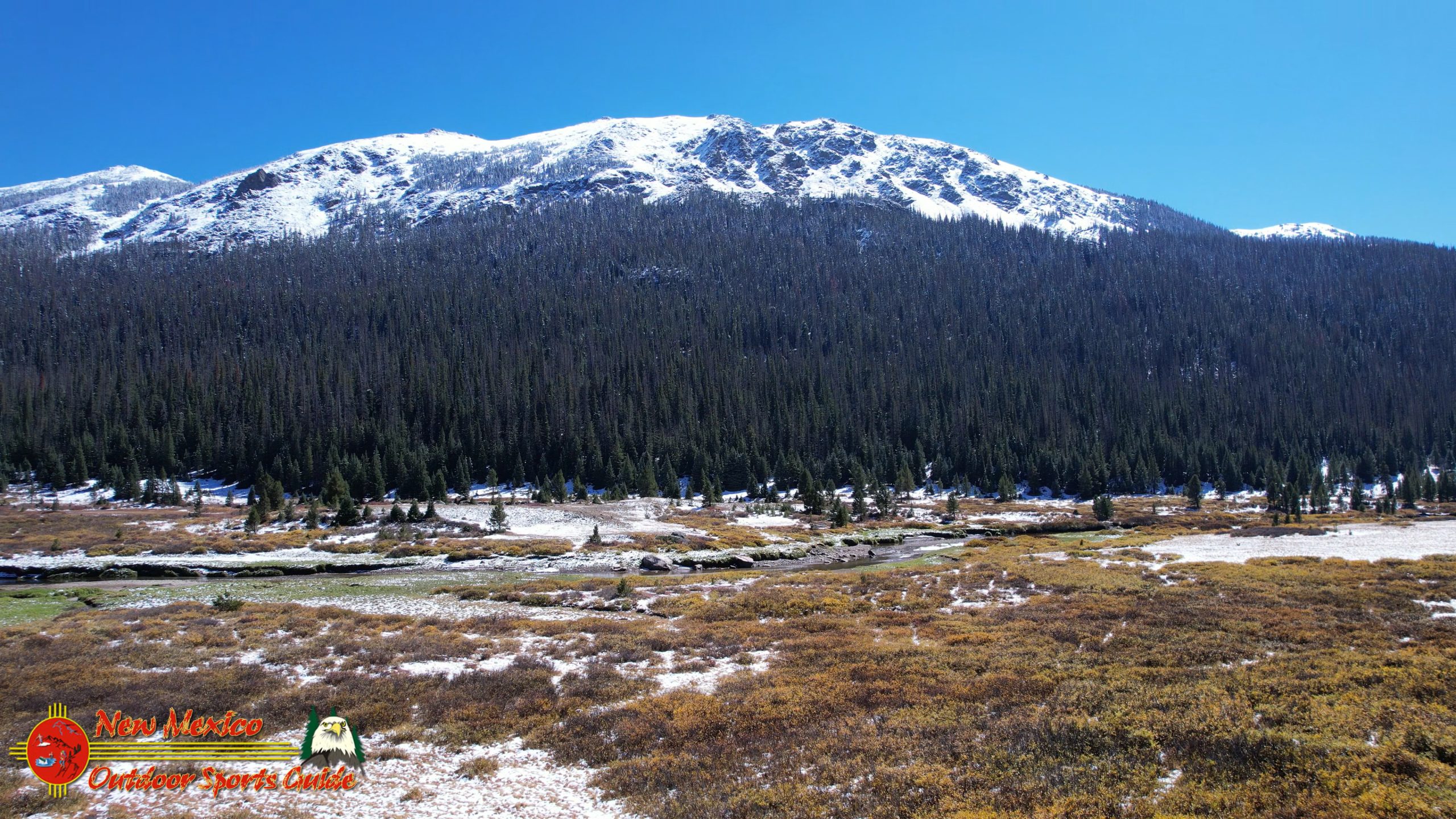
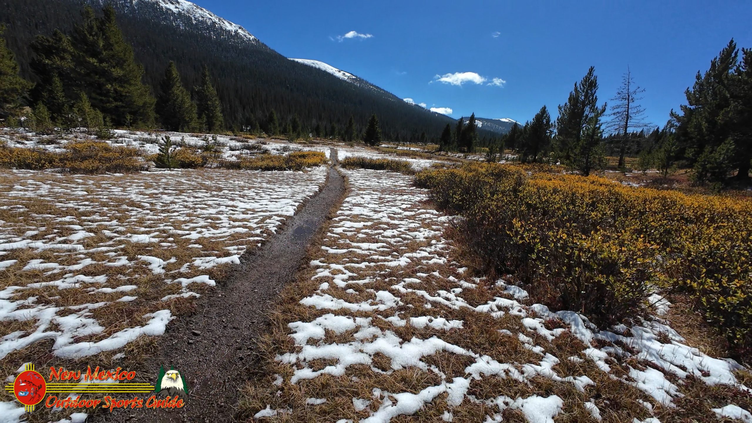
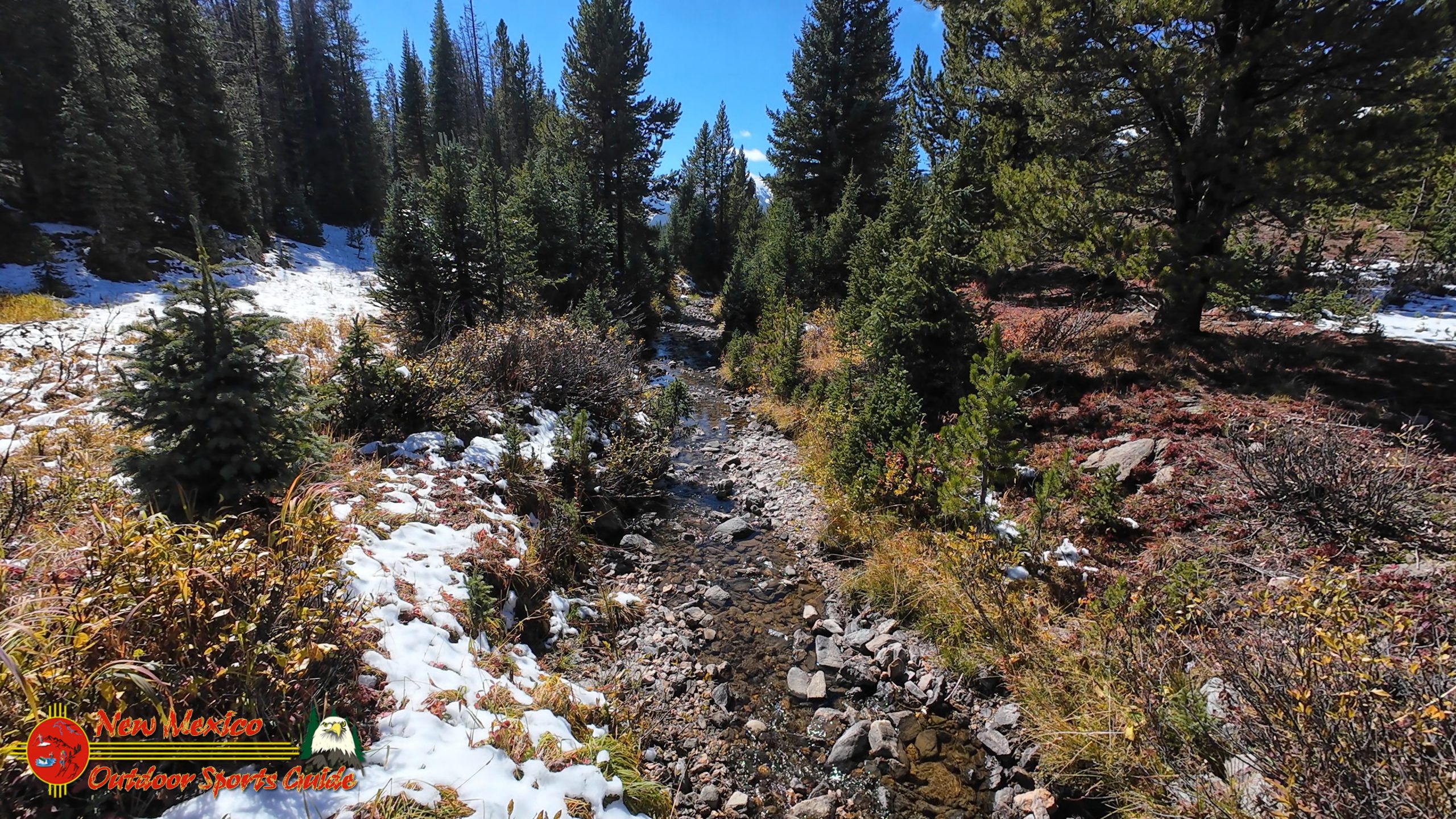
When we arrived back across from the washed-out bridge but on the correct side of LaPoudre Creek, I spotted what appeared to be a trail heading in the direction my GPS indicated. We followed it, pushing through head-high willows and crossing open meadows thick with grasses gone golden in the autumn chill.
Then we found it—or at least we thought we did. A small stream, barely a foot wide, bubbling down through the meadow. According to my GPS, this was the Colorado River. Not the mile-wide torrent that carves through the Grand Canyon. Not even the substantial river we'd been following through Rocky Mountain National Park. This was the Colorado River at its absolute beginning—a modest trickle you could step across without getting your boots wet.
We followed it uphill for another mile or so, climbing through increasingly rugged terrain. The stream grew even smaller, then seemed to disappear completely into the forest, seeping up from springs on the mountainside. But my GPS kept insisting the official headwaters sign was back down the trail. We'd somehow walked right past it.
Back we went, this time with eyes glued to the GPS track rather than the landscape. When we arrived at the waypoint, we stopped and looked around carefully. No sign. Nothing but willows, grasses, and small aspens.
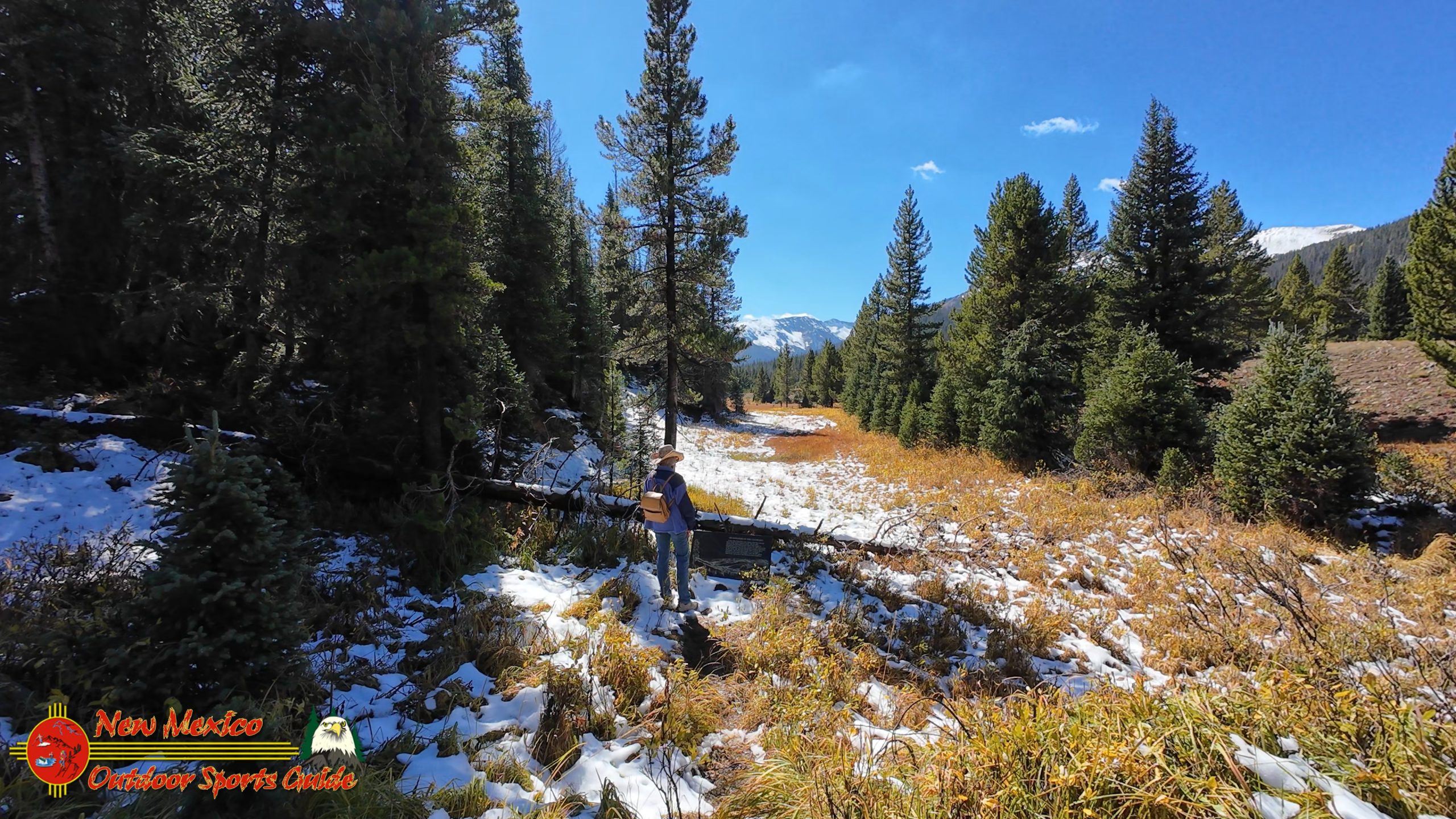
After coming this far—three hours of driving, miles of hiking, years of dreaming about this moment—I wasn't about to give up. We spread out and began searching methodically through the brush along the trail. Twenty minutes passed. My back was starting to complain about all the bending and pushing through vegetation. Then Paulette called out: "Found it!"
Eureka: The Official Colorado River Headwaters
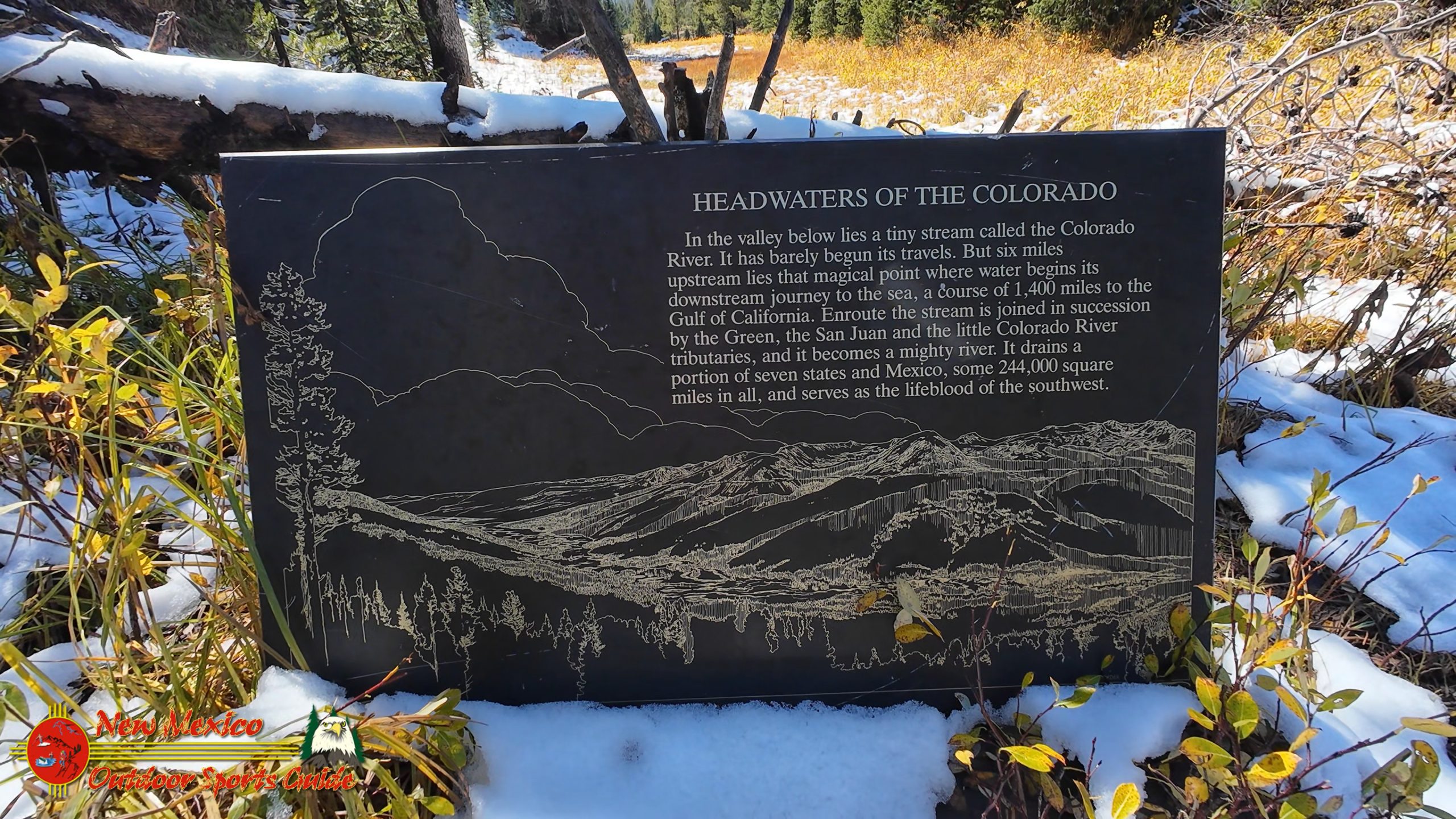
There it was, knocked down and hidden in the bushes along the trail—the official sign marking the Colorado River Headwaters. Someone or something had knocked it over, and the brush had grown up around it, effectively camouflaging it from casual hikers. But it was real, it was official, and we'd found it.
The sign marked a subtle bend in that foot-wide stream where it turned and began its long journey down a magnificent grassy valley. At the far end of the valley, several miles distant, the infant Colorado turns south into Rocky Mountain National Park and begins its more rapid descent in elevation, gathering strength and volume as tributaries feed into it.
Standing there in that high alpine valley, surrounded by snow-capped peaks, I was overwhelmed by a profound sense of awe. The geography makes perfect sense when you see it from this vantage point. This entire valley system acts as a massive collection basin for winter snow. The precipitation that falls here—sometimes measured in the tens of feet over a winter season—has nowhere to go but into the ground and then back out as springs and seeps that feed these nascent streams.
What's remarkable is that this single valley gives birth to two significant river systems. The Colorado River flows south and west, eventually reaching the Gulf of California (or at least it used to, before agricultural and urban demands claimed most of its water). The Cache la Poudre River flows north and east, eventually joining the South Platte and the Missouri, ultimately reaching the Gulf of Mexico. Continental divide dynamics create these split personalities, sending water to opposite sides of the continent from the same patch of high country.
Documenting the Moment
I spent the next thirty minutes documenting everything. Photographs of the sign from multiple angles, proof that we'd made it. Video footage panning across the valley, capturing its scale and beauty. Close-ups of that impossibly small stream that would grow into one of America's most important and contested waterways. The light was perfect now, the clouds completely cleared, the autumn sun casting everything in that magical golden glow that photographers dream about.
As an octogenarian who's been documenting the American Southwest for years, I felt a deep sense of gratitude. How many people get to stand at the birthplace of the Colorado River? How many more years would I have to chase these bucket-list adventures? Every trip into these mountains feels like a gift, a privilege, a race against time to see and photograph and experience as much as possible while the body still cooperates.
Paulette and I sat for a few minutes on a fallen log, just taking it all in. The silence was remarkable—no highway noise, no aircraft, no human sounds except our own breathing. Just wind in the pines, water trickling over stones, and the distant cry of a Clark's nutcracker working through the forest. This is the wilderness experience that drew us from the comfort of our Santa Fe home, that pulls us back to these high places year after year.
The Journey Back: Easier Than Expected
The hike back to the Outback seemed dramatically easier than the outbound trek. Maybe it was the satisfaction of mission accomplished. Maybe it was the familiar trail. Maybe it was just gravity working in our favor on the downhill sections. Whatever the reason, we made good time back to the trailhead, stopping occasionally to photograph scenes we'd missed on the way in.
The drive back toward Grand Lake offered one more objective we'd been nursing throughout the trip: spotting moose. The area around Walden, Colorado, and the willow-choked valleys around Grand Lake and Shadow Mountain Lake represent prime moose habitat. Colorado's moose population is actually a relatively recent success story in wildlife management. Moose were extirpated from Colorado in the 1800s but were successfully reintroduced beginning in 1978. Now several hundred moose roam the high country, particularly favoring exactly the kind of willow-dominated wetlands we were driving through.
We watched every colorful willow patch with anticipation, scanning for those massive dark shapes and distinctive antlers. But luck wasn't with us on this objective. The fall colors, though, made the drive thoroughly enjoyable even without moose. The mountainsides were ablaze with autumn brilliance—entire hillsides of aspen creating golden tapestries, accented by the dark green of conifers and the burgundy of scrub oak.
Tomorrow's Plans: One Last Day
Back at the cabin in Grand Lake as the sun set behind the peaks, Paulette and I discussed plans for our final day. Should we drive back toward Walden for another shot at seeing moose? Or should we focus on Grand Lake and Shadow Mountain Lake, getting better video and photography of these magnificent waters that bookend the west side of Rocky Mountain National Park?
Grand Lake itself holds the distinction of being Colorado's largest natural lake, though Shadow Mountain Lake and Lake Granby—both reservoirs—are significantly larger. Grand Lake sits at 8,369 feet elevation and has been a resort destination since the late 1800s. The little town of Grand Lake on its shores maintains a wonderfully authentic mountain village character, resisting the over-development that has plagued some Colorado resort communities.
Our love for water—a passion forged over decades of bass fishing, boating, and lakeside living—won out. We'd spend the morning photographing and filming Grand Lake and Shadow Mountain Lake, capturing their beauty in morning light. And if the weather looked promising, we'd make one more run up and back on Trail Ridge Road, that spectacular high-altitude highway that crosses Rocky Mountain National Park.
Trail Ridge Road, which reaches 12,183 feet at its highest point, offers some of the most accessible alpine tundra views in North America. It's usually closed by snow from October through May, so we were near the end of the season. One more pass, one more chance to be above treeline, one more opportunity to see this landscape from a perspective that few people ever experience.
Reflections on the Colorado River Headwaters
As I sit here now, reviewing the photographs and video footage from our expedition to the Colorado River Headwaters, I'm struck by how much this journey meant to me personally. Growing up on ranches in the Kansas Flint Hills, I learned early about the importance of water. Every creek, every spring, every pond mattered. Water defined what was possible, where cattle could graze, where life could flourish in an often harsh landscape.
The Colorado River, in many ways, plays that same role on a continental scale. From its modest beginning in that high alpine valley, it grows into a river that supports millions of people, irrigates millions of acres of farmland, generates hydroelectric power, and creates some of the most spectacular landscapes on Earth. The fact that the river is now over-allocated—that more water is claimed than actually flows in an average year—only underscores its importance and the complex challenges we face managing water in the arid West.
Standing at the headwaters, seeing that foot-wide stream, understanding the geographic and hydrologic forces that create it—that's a privilege and a perspective I'll carry with me. It's one more piece of the puzzle that is the American Southwest, one more chapter in the story I've been documenting through photography and video for years.
From our summer home in Santa Fe to our winter retreat at Lake Mohave, Arizona, Paulette and I have been blessed with the opportunity to explore and document this remarkable region. At eighty-plus years, I'm more aware than ever that every trip is precious, every sunrise might be one of the last I'll see from a particular mountain peak, every river might be the last I'll wade in search of that perfect photograph.
But that awareness doesn't make me melancholy. Instead, it sharpens the experience, makes every moment more vivid, every discovery more meaningful. Finding the Colorado River Headwaters wasn't just about checking something off a bucket list. It was about connecting with the landscape in a deep and personal way, understanding where things come from, and appreciating the natural processes that create and sustain the water that is literally life itself in the American West.
Tomorrow we'll photograph Grand Lake and Shadow Mountain Lake. If weather permits, we'll make that final run up Trail Ridge Road. Then it will be time to head back to Santa Fe, back to the life and routines that fill our days. But the memory of standing at the Colorado River Headwaters, in that pristine alpine valley surrounded by peaks and forest and the profound silence of wilderness—that's something I'll carry with me forever.
And who knows? Maybe I'll make it back someday. Maybe when the moose are more cooperative. Maybe when the wildflowers are blooming. Maybe just because these mountains call to me the way they always have, the way I suspect they always will, for however many seasons remain.
0 Comments