

There's a moment on the Lamy Overlook Trail — right when the last juniper gives way to open sky and the Galisteo Basin unfolds before you like a page torn from a geography book — where everything goes quiet inside. The wind might be humming through the piñon pines at your back, and somewhere far below a freight train may be threading its silver needle through Apache Canyon, but inside your chest, things just... settle.
I've felt that stillness before. On top of Wheeler Peak, looking west across the Moreno Valley on a crystalline October morning. At Eagle Nest Lake at dawn, where the trout rise like secrets and the Sangre de Cristos hold their reflection without blinking. I even felt it as a boy on the Kansas Flint Hills, standing on a rise at the edge of my father's ranch with the prairie rolling away in every direction, impossibly vast and impossibly quiet. A man could live a full life chasing that feeling. Lord knows I have.
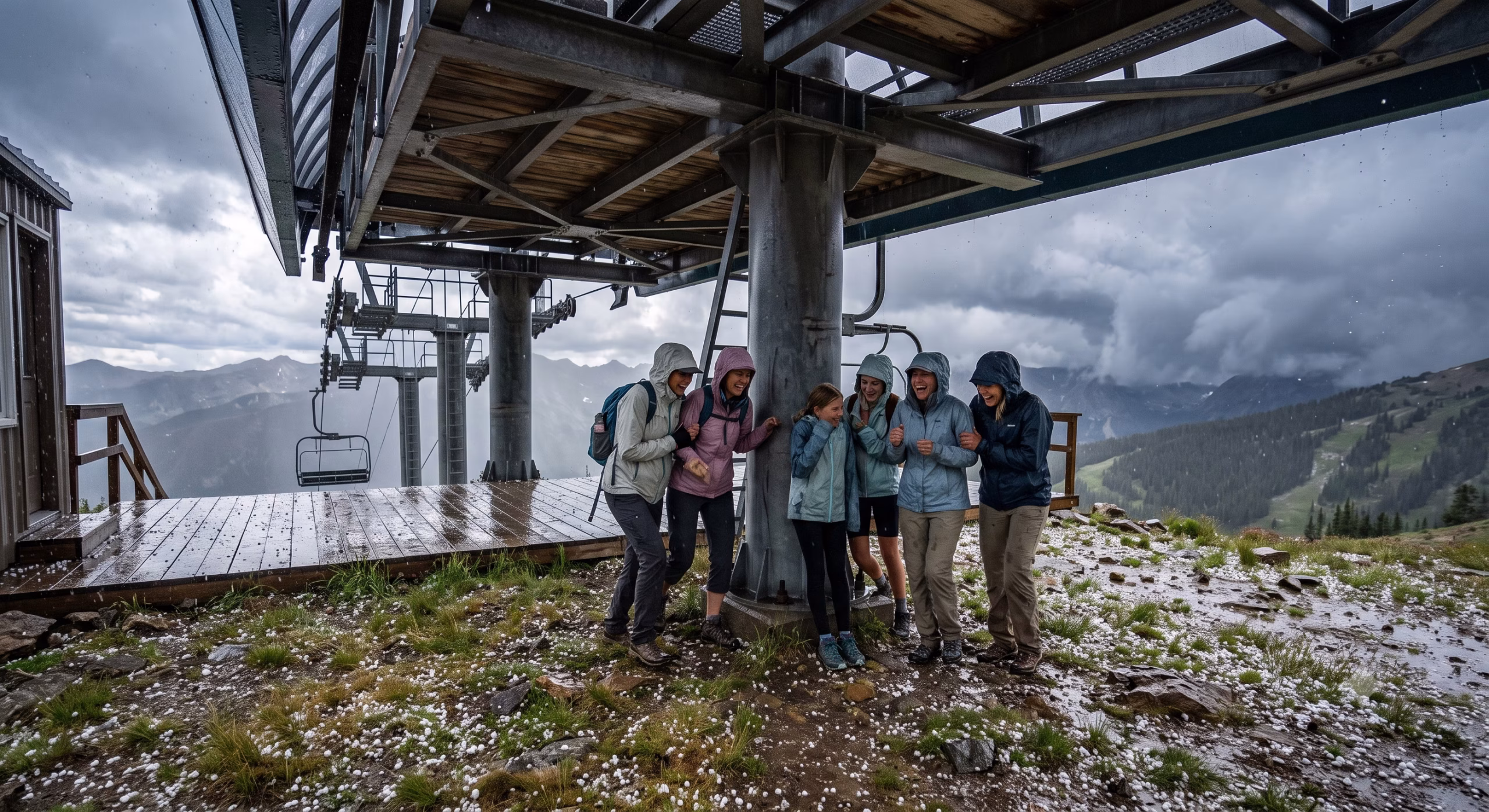
At eighty-something years old, Paulette and I have done our share of chasing. We've lived at 9,500 feet above sea level in a log home we built with our own dreams and a good contractor. We've run center consoles across Lake Mohave in the purple light of early mornings, hunting smallmouth. We've planted ourselves in Santa Fe — the City Different — where the light does things at sunset that would make a painter weep and a photographer forget to breathe. These days, my knees remind me that I'm no longer thirty, but they haven't filed a formal protest loud enough to keep me off the trail. Not yet.
And thank God for that, because the Lamy Overlook is one trail I refuse to give up.
The Eldorado Community Preserve: A Hidden Treasure South of Town
Most people driving south out of Santa Fe on Highway 285 see the turn toward Eldorado at Santa Fe and keep going. That's their loss. Eldorado sits about fourteen miles south of the plaza — a thoughtfully planned community of adobe and territorial-style homes perched on the high desert edge of the Galisteo Basin, where junipers cast long afternoon shadows and the sky is the kind of blue that doesn't exist at sea level.
But it's what lies across the highway from Eldorado that really matters: the Eldorado Community Preserve. This remarkable preserve consists of 4,094 acres of undeveloped land stretching from across Highway 285, continuing across the Galisteo River at Cañoncito and south all the way to Lamy. The Conservation Committee and the ECIA manage it as a day-use area, and as they rightly note, this kind of amenity is simply unrivaled in any other local community.
Four thousand acres. In a world where open land is being carved up and sold off faster than you can say "luxury subdivision," the Eldorado Community Preserve is a genuine miracle. The preserve protects archaeologically and ecologically sensitive areas that visitors can explore by hiking, biking, and horseback riding on designated trails, spanning a diverse and beautiful desert highland landscape. Pink granite canyons, red limestone cliffs, unique rock formations — the geology alone could keep a curious mind occupied for years. Ridges and mesas are wooded with juniper, piñon, cholla, and rabbitbrush at lower elevations, while higher up you'll spot ponderosa pine and gambel oak, with many arroyos crossing through the area.
I've been lucky enough to walk quite a few trails in this preserve, but the Lamy Overlook West Trail is the one that keeps calling me back like an old friend you can't stop visiting.
The Trail: What to Expect When You Lace Up
The Lamy Overlook West Trail is a 4.4-mile round-trip hike rated as moderately difficult — and I'll tell you, that rating is earned. This is not a stroll in the park. The first mile is a genuine uphill climb, the kind that makes you remember you promised yourself you'd use the treadmill more often. The footing requires attention: rocky in places, sandy in others, with the occasional root crossing just to keep things interesting.
But there are rewards along the way, even before you reach the summit. As you make your way up the initial climb, the trail offers occasional overlooks eastward where, on clear days, you can catch glimpses of the Amtrak rail line threading through the canyon below. That's always a fine sight — civilization at a comfortable distance, doing its thing while you do yours.
Wildflowers dot the trail depending on the season. In spring, desert marigolds and penstemon paint the hillsides in yellows and reds. Late summer brings monsoon-fueled blooms that would make a botanist reach for his notebook. Even in the drier months, the silver sage and the delicate purple of desert aster give the landscape a quiet dignity.
The trail is accessible year-round, which matters to those of us who live here rather than just visiting. A January morning hike in the cold, clear air is entirely different from a September afternoon walk after the monsoon season has painted the desert green. Both are worth doing. Bring water regardless of season — this is New Mexico high desert, and the air and sun are both more demanding than they look.
When at last you clear the final rise and the overlook presents itself, prepare yourself. The panorama is nothing short of extraordinary: the Chicago-to-Los Angeles Amtrak Southwest Chief route spread below like a silver thread, Apache Canyon cutting its dramatic notch into the mesa, Galisteo Creek winding through the basin floor, the vast bowl of the Galisteo Basin spreading to the south and west, and — on a clear day, which in New Mexico happens more often than not — the distant blue humps of the Sandia Mountains rising above Albuquerque some fifty miles away.
Paulette and I have developed a tradition. We find a flat rock, we sit down with whatever snacks she's thought to pack (she's always more prepared than I am), and we just... look. We look for a good long time.
The Galisteo Basin: Where History Pooled Like Water
The Galisteo Basin is one of those places that earns the word "ancient" without any exaggeration. Because of its location lying between mountain ranges and connecting the upper Rio Grande Valley with the Great Plains, the Galisteo Basin was used as a trade route by prehistoric and historic indigenous peoples and later by Spanish explorers. The earliest known humans to inhabit the Galisteo Basin were Paleo Indians who arrived as early as 7500 to 6000 B.C., and by 3000 B.C. small groups were living there, with farming practices beginning around 1500 B.C.
The name "Galisteo" is actually a Spanish name derived from "kálistos," a Greek word meaning "very beautiful," bestowed by members of the Rodríguez-Chamuscado Expedition in the fall of 1581. The Spanish had a gift for borrowing names from everywhere but home, apparently, and in this case they weren't wrong. The basin is very beautiful. Achingly so.
But it was the people who lived here long before any Spanish expedition arrived who gave the Galisteo Basin its true depth and character. When I sit at the overlook with Paulette, my mind always wanders to them.
The Galisteo Basin reflects the pace and trajectories of human habitation across more than sixteen thousand years of history. Between 1100 and 1300 A.D., following a prolonged severe drought that emptied the great pueblos at Chaco Canyon and Mesa Verde, Ancestral Pueblo people migrated into northern New Mexico and ultimately established cultures throughout the Galisteo Basin. Several large pueblos were sustained there from the late 1200s until the 1500s and 1600s.
The Tano — also known as the Southern Tewa — were the primary people of this basin. The Tewa name for them translates roughly as "Living Below People," because to the Northern Tewa living near Santa Fe, the Galisteo Basin people were those who lived down in the country to the south. The Tano inhabited this land between the Pecos and Kewa peoples — the verdant Galisteo Basin — from La Ciénega and Cerrillos to Galisteo and Lamy and up to the foothills where Eldorado is now situated.
Archeologists believe the total population of the Galisteo Basin pueblos at their peak was between 10,000 and 15,000 people. Fifteen thousand people, living in multistory adobe villages, farming the basin floor, trading turquoise and pottery, raising children, telling stories around fires. The basin below me, when I squint just right and let my imagination off its leash, reveals the ghost-shapes of all that life.
I imagine the smoke rising from cooking fires on cool autumn mornings, the way it would have drifted across the basin like low clouds. Children chasing dogs through the alleys between pueblo walls. Women carrying water from the Galisteo Creek. Men returning from hunts in the juniper hills, or from trading expeditions that connected this basin to a network stretching from what is now Mexico City to the Great Plains. The Galisteo Basin was a trade route for turquoise, malachite, and lead — materials mined in the Cerrillos Hills nearby. Caravans would have moved through the basin loaded with these materials and returned with shells from the Pacific, feathers from tropical birds, cotton blankets from the south.
For approximately 100 years, beginning around 1400, the Southern Tewa were challenged by Diné-speaking peoples — warriors from Apache and Navajo tribes who raided and deeply stressed the Tewas' resources and sense of security. Despite this, the Southern Tewa persevered in the Galisteo Basin until the 17th century. Then came the Spanish colonizers, and with them the weight of forced labor, forced religion, and forced change. In 1680, tension between the pueblos and the Spanish reached a climax, and a revolt temporarily drove the Spanish from Santa Fe. With the return of the Spanish in 1692, the Southern Tewa were forced to abandon the Galisteo Basin entirely, migrating to other pueblos.
The basin they left behind is still here, still beautiful, still whispering. The ruins of their great villages — San Cristobal, San Lázaro, San Marcos — sleep beneath the desert soil, mostly closed to the public to protect what remains. But from the Lamy Overlook, you can look out over that basin and feel the weight of what happened there. It's one of the most historically layered landscapes I've ever stood above, and I've stood above a fair number.
Lamy: The Little Depot That Could
Looking down from the overlook, you can make out the tiny cluster of buildings that is Lamy, New Mexico — population a couple hundred souls, history outsized by several orders of magnitude. The community was named for Archbishop Jean-Baptiste Lamy and lies within the Bishop John Lamy Spanish Land Grant, previously known as Galisteo Junction because it contained the closest railway stop to Galisteo.
The Santa Fe Railway originally planned to run from Atchison, Kansas, to Santa Fe, and then west to California. But as track-building advanced into New Mexico, civil engineers realized the terrain around Santa Fe made this impossible. The line was built through Lamy instead, with a spur line northward to the capital. This geographical compromise turned tiny Lamy into a significant junction, and for decades it hummed with the activity of one of America's great railroads.
Among the famous passenger trains of the past, the Santa Fe Chief, the Super Chief, and the El Capitan all ran from Chicago, through Lamy, and on to Los Angeles — luxury travel through the high desert, with observation dome cars and well-appointed dining cars and a view of the Galisteo Basin that made eastern travelers reach for their cameras. During World War II, Lamy station was commonly the first stop for Manhattan Project staff and their families arriving in New Mexico on their way to the secret city of Los Alamos.
Today, Lamy is served by Amtrak's Southwest Chief, the route between Chicago and Los Angeles, with the station also serving as the southern terminus for the Sky Railway. Amtrak passengers headed to the state capital still alight at Lamy, where a shuttle transports them the remaining 18 miles. It's a wonderfully old-fashioned arrangement, and I mean that as a compliment. There's something right about a train station where the pace slows down enough to let you actually see where you are.
From the overlook, when the timing is right, you can watch the Southwest Chief make its appearance — a silver streak threading through Apache Canyon, emerging into the basin, pulling toward that small Mission Revival depot with its red-tile roof and stucco walls. There's something hypnotic about a train seen from a great height, moving with that unhurried certainty across the landscape. It connects the present moment to all those decades of trains making this same passage, and to the trade caravans before that, and to the Tano traders before that. The Galisteo Basin has always been a corridor for human movement.
The City Different: Santa Fe as Home Base
People ask me sometimes why, after seventeen years in a log cabin at 9,500 feet overlooking the Moreno Valley — with Wheeler Peak out the west window and Eagle Nest Lake gleaming in the valley below — we chose Santa Fe as our permanent home. I give them the short answer: the light. But the longer answer includes things like the depth of the culture, the quality of the art, the green chile, the trails, the architecture that looks like it grew out of the earth rather than being imposed on it.
Santa Fe earns its nickname of "The City Different" every single day. It's a city where you can walk from a world-class museum to a centuries-old church to a gallery showing contemporary Native American art in about four minutes flat. Where the farmers market on Saturday morning feels like a community reunion. Where the opera sits on a hillside under the stars and the acoustics are a gift from the gods of geography.
And for those of us who love the outdoors, Santa Fe is outrageously well-positioned. The Jemez Mountains to the west, the Sangre de Cristos to the east and north, the high desert stretching south toward the Galisteo Basin — within an hour you can be at 13,000 feet or at 4,000, in forest or desert, on a world-class trout stream or walking a trail where Pueblo people walked eight centuries ago.
The Lamy Overlook Trail is perhaps the finest example of what I mean. Less than fourteen miles from the Santa Fe plaza, you're standing on the edge of a landscape that holds ten thousand years of human history and a panoramic view that would make your heart ache with gratitude. That's not nothing. That's everything, actually.
A Few Practical Notes for Fellow Travelers
The Lamy Overlook West Trail begins in the Eldorado Community Preserve, which is managed for the use of Eldorado residents and their guests. If you live in Eldorado or have a friend who does, this trail is yours to explore. The preserve's Conservation Committee does excellent stewardship work, maintaining trails and protecting the sensitive archaeological and ecological resources of these 4,094 acres.
The trail is rated moderately difficult and clocks in at 4.4 miles round trip. Count on two to three hours depending on your pace and how long you linger at the overlook — and you will linger, trust me. Wear sturdy footwear; the terrain is uneven enough to demand it. Bring more water than you think you need. New Mexico sun has a way of reminding you that you're at altitude and the air is dry in ways that the thermometer doesn't fully capture.
The trail is open year-round. Each season offers something different: wildflowers in spring and late summer after the monsoons, golden cottonwoods along the arroyos in fall, crystalline views in winter when the air has been scrubbed clean by cold fronts sweeping down from Colorado. I've hiked it in all four seasons and found reasons to love each one.
Bring binoculars if you have them. The bird life in the Galisteo Basin is excellent — raptors riding thermals above the mesa, ravens performing their acrobatic shows in the updrafts, the occasional roadrunner below on the basin floor looking like a cartoon character who doesn't realize it's supposed to be fictional. A camera is, of course, non-negotiable in my book. The light on the Galisteo Basin in the late afternoon takes on a quality that photographers call "golden hour" and I simply call a gift.
The Stillness at the Top
Paulette and I will be back at the Lamy Overlook this spring, sooner rather than later. We'll park, start up the trail, greet the junipers and the piñons like old acquaintances, catch our breath on the uphill grade, and eventually emerge onto that rocky lip above the basin. We'll sit on our rock — we've sort of claimed it through years of return visits, though the rock probably doesn't know that — and we'll look out over the Galisteo Basin.
I'll think about the Tano people who called this basin home for five centuries: their villages and their fires, their trade routes and their ceremonies, their extraordinary endurance in the face of drought and raiders and finally the overwhelming force of Spanish colonialism. Their descendants live on in the Pueblo communities of New Mexico today, carriers of a culture that absorbed everything the centuries threw at it and kept its core intact.
I'll think about the railroad that brought the modern era through Apache Canyon and opened this corner of the Southwest to the rest of the country — imperfectly, controversially, but undeniably. About the scientists who passed through Lamy depot on their way to build the bomb, and the tourists who passed through on their way to see a part of America that looks like no other part.
And I'll think about how lucky I am to be here, an old rancher's boy from the Kansas Flint Hills, sitting above one of the most historically layered landscapes in North America, next to the woman I've shared more than forty years of living with, watching the afternoon light do what it does to the Galisteo Basin.
Some things in this life are worth the uphill climb.


0 Comments